






About
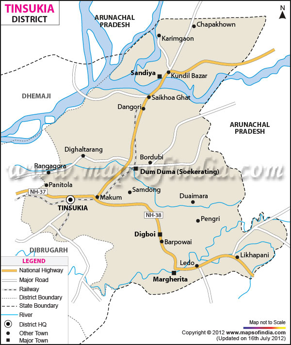
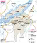
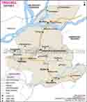
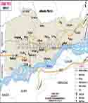
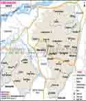
Tinsukia is a district in the northeast of Assam. It is near the border with Arunachal Pradesh and also is one of the key districts of Upper Assam. Tinsukia town is the district headquarter.
Tinsukia is a home to many communities. In different parts of the district you will find Moran, Matak, Adivasi, Tai Ahom, Sonowal Kachari, Nepali, Singpho, Bengali, Marwari and Bihari communities.
The district is home to tea gardens, oil fields, coal mining and also natural places. In Tinsukia tourism includes national parks, old temples, railway heritage sites, museums and historic places.
History & Culture
Tinsukia’s history goes back many centuries. In the medieval period the area was that of the Chutia Kingdom. Then the Ahoms took over the region. Post the Moamoria Rebellion the Matak Kingdom came to dominate in that part of Assam.
The present day Tinsukia was known as Bengmara in the past. It was part of the Matak Kingdom. King Sarbananda Singha established his capital at Rangagarh which is near the Guijan River. In 1791 he shifted the capital to Bengmara. The city was developed with the help of his minister Gopinath Barbaruah also known as Godha.
During the Matak period many ponds were constructed. In Tinsukia Na-Pukhuri is the most known historic water body. Also at that time old roads were built. Today these roads and ponds are a part of Tinsukia’s history.
In the old days Tinsukia was associated with Tinikunia Pukhuri, a triangular pond in the Bengmara area. A railway station was later developed near that pond. The station was named Tinsukia which in turn gave the name to the city which grew around it.
Teas which had a great impact on the history of Tinsukia and the greater Upper Assam area. In 1823 the British first took notice of tea at Sadiya. The first tea plantation in the region was at Chabua which is near Tinsukia. The name Chabua is associated with tea planting.
Railways also brought in great transformation. In the 1880s the Dibru-Sadiya Railway came into operation. Tinsukia grew to be a key railway center which in turn promoted trade and movement of people and goods. The rail network also played a great role in the local economy.
Economy
Tinsukia’s economy is made up of a number of key sectors. Tea, agriculture, oil, coal, trade, transport and services are the main supports for many families in the district. Also an important player in tea growth and processing is Tinsukia which is a part of Assam. Oil and coal also had a large role to play in the economic history of Tinsukia district.
Agriculture is still a mainstay in Tinsukia’s rural economy. Rice is the leading crop. Also grown are vegetables and fruits and other crops. In horticulture we see oranges, bananas, pineapples, ginger, turmeric, black pepper, areca nut, Assam lemons and a variety of other products.
Tinsukia is home to a large scale of mining and petroleum activity. In Digboi you can see the old oil industry which has been there for a while, at Margherita and Ledo there are coal mines. North Eastern Coalfields of Coal India Limited is the operator in the coal producing area.
Government Sector
In Tinsukia the government is a large component of the economy. District administration offices, health centers, schools, colleges, police stations and other government agencies provide employment and public services.
Tinsukia Medical College and Hospital is a key health care facility in the district. Also in the district they have Tinsukia Civil Hospital and other health centers.
Government programs that support agriculture, food production, rural employment and also local industries. In Tinsukia they have the National Food Security Mission which has been put into practice with a focus on pulses.
Digital government services which have grown in accessibility through district administration portals. We see in Sewa Setu, Mission Basundhara, online grievance redressal and online building permit services.
Public Sector
In Tinsukia the public sector is very much a part of the economy. You can also see large public enterprises in oil, coal, rail and other sectors which for many years have been the backbone of job creation and business activity.
Digboi was at the center of India’s early petroleum industry. At the Digboi Centenary Museum you will find the past of the oil industry in the area. There are in that museum old machinery and other items related to petroleum production.
Railways in Tinsukia are very prominent. New Tinsukia and Makum are key railway junctions. The rail network in Tinsukia goes to many parts of Assam and also other Indian states.
Railway Heritage Park in Tinsukia is a display of the past of railway growth in the area. You can find in it the Dibru-Sadiya Railway and Assam Bengal Railway. The park has old railway equipment, locomotives, a museum gallery and other rail related items.
Services Sector
In Tinsukia the services sector is a very important component. They have shops, hotels, restaurants, transport companies, banks, schools, hospitals, repair shops and other businesses which are what you may term as the backbone of the local economy.
Education and health care has seen growth in the services sector in Tinsukia. They have colleges, schools, medical facilities and training centers that serve people from all over the district.
Tourism
Tourism in Tinsukia is a mix of natural and man made attractions which also include historical and industrial sites. Many visitors from within Assam and other parts of India are drawn to these places.
Dibru-Saikhowa National Park is a major tourist destination near Tinsukia. The park is in Tinsukia and Dibrugarh districts. It is about 12 km from Tinsukia town. The park has forests, grasslands, wetlands and rivers.
The park is a home to a great diversity of birds and animals. White winged wood duck is one of its main species. Also you will see wild water buffalo, capped langurs and other wildlife there.
Dibru-Saikhowa also is a Biosphere Reserve. In that area bird watching and nature trips are very popular.
Dehing Patkai National Park is also a large natural point of interest which is related to Tinsukia district. The park’s forest area has great bio diversity. Visitors to the park report to see species like hoolock gibbon, elephant, tiger, clouded leopard and also many species of birds.
The forest is a key element in wildlife conservation and nature tourism. During trips guests must follow forest rules.
The Digboi Centenary Museum which tells the story of the oil industry in Digboi. It opened at the time of the celebration of India’s first oil well. They have old machinery and other items which introduce guests to the early petroleum industry.
Na Pukhuri is a set of nine historic ponds in Tinsukia town. The main one is the centerpiece. These ponds came into existence during the Matak period under King Sarbananda Singha. While it has historical value it is also a great spot for recreation.
Demographics
Tinsukia district reports a population of 13.3 lakh as per the data from the district’s website. Also the district website reports a literacy rate of 70.9%.
In the 2011 Census Tinsukia district was home to a population of 13,27,929. That year the district saw 6,80,231 males and 6,47,698 females in the population. Also at that time almost 19.9 per cent of the population lived in urban areas. The 2011 Census reported a sex ratio of 952 females for every 1000 males.
In many areas of Tinsukia you will see a home to many communities. That district is home to Moran, Matak, Adivasi, Tai Ahom, Sonowal Kachari, Nepali, Singpho, Bengali, Marwari and Bihari communities.
Tinsukia’s population includes farmers, tea workers, traders, miners, government employees, transport workers, health care professionals, educators and other fields.
Administration
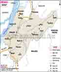
Sadiya, Doomdooma, Margherita, Digboi and Makum which are in fact four revenue circles that also include seven development blocks.
The four revenue divisions are Tinsukia Sadar, Doomdooma, Margherita and Sadiya. Also in the case of development blocks they have Kakopathar, Guijan, Hapjan, Itakhuli, Saikhowa, Margherita and Sadiya.
Tinsukia reports to have 86 panchayats and 253 revenue villages as of the present district profile. Also in the district they have six municipal boards in Digboi, Makum, Doomdooma, Margherita and Chapakhowa.
Tinsukia has a total of 6 Legislative Assembly districts which are Sadiya, Doomdooma, Margherita, Digboi, Makum and Tinsukia.
| Official Name | Tinsukia District |
| Location | Assam |
| Capital | Dispur |
| Area | 3790 sq. km |
| Population | 13.3 lakh |
| Religion | Hinduism, Islam, Christianity and other religions |
| Language | Assamese, Bengali, Hindi and other local languages |
FAQs
Q.1: In what areas is coal mining prominent in Tinsukia?
Margherita and Ledo are key areas related to coal mining in Tinsukia district.
Q.2: What is the role of Tinsukia in railway history?
Tinsukia developed into a key railway center during the construction of the Dibru-Sadiya Railway. Also rail connection which came later played a role in trade and movement in Upper Assam.
Q.3: What is Tilinga Mandir famous for?
Tilinga Mandir is a well known Shiva temple in Bordubi. There one sees devotees present bells at the temple after their wishes are fulfilled.
Q.4: Why is Tinsukia important in Assam?
Tinsukia is a key area because of its tea gardens, coal and oil production, railway network, farming, trade and natural attractions. Also its location near Arunachal Pradesh which in turn gives it importance for regional transport and trade.
Q.5: What did Tinsukia used to be called?
Tinsukia’s former name was Bengmara. Also it was associated with the name of Changmai Pathar.
Q.6: Which national park is near Tinsukia?
Dibru-Saikhowa National Park is near Tinsukia town. It is a great spot for wildlife and bird watching.
Last Updated on : October 15, 2026
