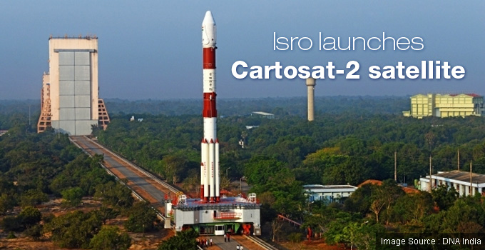
The Indian Space Research Organisation (ISRO) is continuing to write success stories. It successfully launched the PSLV-C38 rocket carrying Cartosat-2 and other satellites on Friday Morning, 23 June, 2017.
The rocket set off on its course as per the scheduled time at 9.29 am from the first launch pad of the Satish Dhawan Space Centre in Sriharikota. This was a 28-hour countdown operation. The launch procedure began on Thursday, 22 June, 2017, at 05:29 hours IST, after the mission readiness review committee and launch authorisation board cleared the countdown on Wednesday.
Cartosat-2 Satellite
The Cartosat-2 Satellite is a remote sensing satellite and can be best described as the eye-in-the-sky. Just to give the readers a perspective on its functioning, the famed surgical strikes by the Indian Army in Pakistan-occupied-Kashmir in 2016 was possible because of this satellite.
- The ISRO is strengthening the capability of Cartosat-2 Satellite to monitor from the sky.
- The objective is to provide high-resolution, scene-specific spot imagery.
- The satellite, the seventh in the Cartosat series, is capable of along-track and across-track steering, up to 26 degree nominally. This will work towards streaming the images in continuous imaging mode.
- The satellite will help in the preparation of high-resolution maps using pictures from the panchromatic camera loaded on it.
- Equipped with a high-resolution, multi-spectral instrument, the satellite will help in high-resolution land observation and cartography, as the multi-spectral instrument will work in tandem with the Panchromatic camera.
- The pictures and videos will be helpful in a wide range of activities, including military and civil planning.
- In civil planning the images will help towards utility management like road network monitoring, urban & rural applications, water distribution, coastal land use & regulation, creation of land use maps, change detection to bring out geographical and man-made features, etc.
- The satellite weighs 700 Kg.
PSLV-XL
- The PSLV in the ‘XL’ configuration, with the use of solid strap-on motors, is in its 40th flight.
- PSLV (Polar Satellite Launch Vehicle) is the workhorse of the ISRO and apart from the 712-Kg Cartosat-2 series satellite for earth observation it is also carrying 30 co-passenger satellites, together weighing about 243 Kg at lift-off.
- It is on its way to place the satellites into a 505-Km Polar Sun Synchronous Orbit.
- The co-passenger satellites comprise 30 nano satellites. Apart from India, there are also satellites from other countries United Kingdom, the United States of America, Germany, Italy, Japan, Austria, Belgium, Chile, Czech Republic, Finland, France, Latvia, Lithuania, and Slovakia. These satellites are being launched as part of the commercial arm of ISRO, Antrix Corporation Limited (Antrix).
- The entire project has been allocated Rs 160 crore.
The Future
ISRO envisages that even in the future it will continue to launch the thematic series of satellites that include the Resourcesat, Cartosat, Oceansat, RISAT, and INSAT series for land, water, ocean, and meteorological satellites. It also expects to place geo-imaging satellite in geostationary orbit to enable near real-time imaging. Placing these satellites will help to maintain the continuity of services provided by the respective satellites complete with the enhancement in the technological capabilities with respect to the sensors and payloads to meet operational applications. The ISRO plans to design, develop and launch the Cartosat-3 and Oceansat-3 and more satellites from the INSAT series for meteorological applications.
ISRO with yet another successful launch of the PSLV with the payload of some very important satellites has proved that India is all set to be self-reliant in this arena which will also help in reducing the cost of getting such images from external sources.


