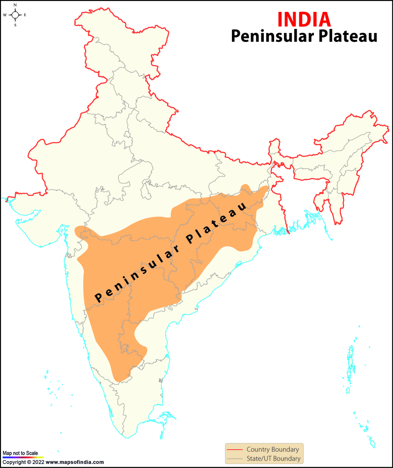
- In the Peninsular plateau, there is an uneven triangular landform that rises from 150 m above the river lowlands to 600 m or 900 m above sea level.
- The Peninsular plateau's outside limits are defined by the Delhi ridge in the northwest (an extension of the Aravalis), the Cardamom hills in the south, the Gir range in the west, and the Rajmahal hills in the east.
- Furthermore, Shillong and the Karbi-Anglong plateau provide a continuation of this in the northeast. Peninsular India comprises a variety of plateaus, including the Palamu plateau, Hazaribagh plateau, the Malwa plateau, the Coimbatore plateau, the Ranchi plateau, and the Karnataka plateau, among others.
- This is one of India's oldest and most stable landmasses. The general slope of the plateau is from west to east, as seen by the direction of river flow.
- Bare rocky formations, Tors, rift basins, spurs, block peaks, wall-like quartzite dykes, and a succession of hummocky hills are some of the prominent physiographic characteristics of this region. The plateau's western and northern flanks are dominated by black soil.
- Several uplifts and submersions have occurred on the Peninsular plateau, as well as crustal faulting and cracking.
- These significant differences have contributed to the diversity of the Peninsular plateau's relief. The plateau's northern region features a complicated terrain with ravines and gorges. Some well-known examples include the ravines of Chambal, Bhind, and Morena.
Let's discuss some of the important landforms of the region:
Deccan Plateau
- This is bounded on the west by the Western Ghats, on the east by the Eastern Ghats, and on the north by the Maikal range, Satpura, and Mahadeo hills.
The Malwa Plateau
- The Malwa plateau is bounded to the west by the Vindhya Range.
- This mostly comprises Deccan traps.
- The region has black soil
Plateau of Telangana
- There are two units in this area.
- Telangana
- Rayalaseema
- Telangana is a peneplain formed by gneiss rock and has a Semi-arid setting
- Rayalaseema is a Karnataka plateau extension with Cuddapah rocks.
Plateau of Karnataka
- The mineral-rich belt is found in the Dharwad and Cuddapah rocks.
- Basalt lava covers the northern section.
- The tallest mountain is Mulangiri, followed by Kudremukh.
- The northern uplands consist of monotonous plateaus, whereas the southern uplands consist of a succession of undulating plateaus.