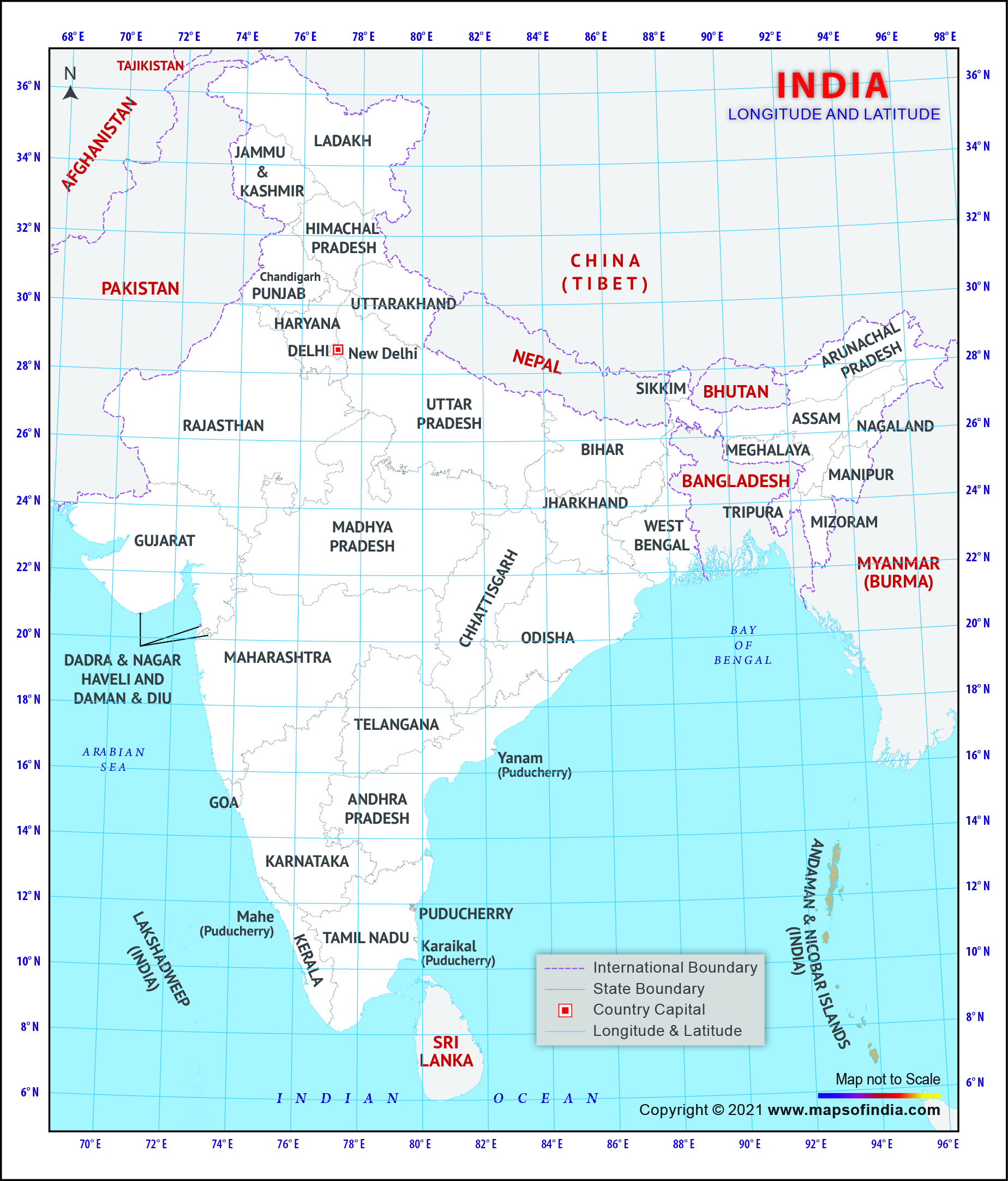
If you are a geography student, you might be interested to know about the latitude and longitude of Indian states. The latitude and longitude of a particular place helps you know the exact situation of that place on the Earth. The latitude and longitude of India are 20' North and 77' East respectively.
India is the seventh largest country in the world and also ranks second in population. Surrounded by Bangladesh, Burma, Bhutan, China, Nepal and Pakistan, India covers an area of 3,287,590 sq km.
Bordered by Bay of Bengal, Arabian Sea and Indian Ocean it also has a coastline of more than 7,000 kms. It has 28 states and 8 Union Territories.
Most popular metropolitan cities in India are Mumbai, Kolkata,
Delhi, Chennai and Bangalore.
Indian economy is also flourishing because of its Information Technology, Bio Technology, Pharmaceuticals, Business Management, Travel and Tourism, Financial Consultancy, Real Estate, Consultancies, Educational Institutes, and Construction sector.
Last Updated on: November 13, 2025
