The importance of maps in our life is often underestimated. Can you imagine how the world will seem in their absence? Will we be able to be familiar with the World Geography the way we are now? The answer is obviously no.
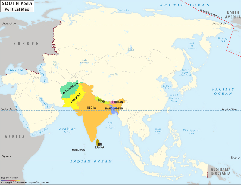
Realizing the importance of this vital tool in our lives, mapsofindia brings you maps of South Asia from its plethora of maps. The first thing that will strike you about the map is that India is the largest country in the South Asia. India is surrounded by Pakistan to the North West and Myanmar to the East. Nepal and Bhutan are the neighboring countries to India. Around one fifth of the total World population resides in the South East Asia. The popular tourist destinations like Malaysia and Singapore are also situated in the South Asia. The Indian Ocean also lies to the south of Asia.
For More Details Explore: Asia Map
Last Updated on November 13, 2025
South Asia Political Map |
| |||||||
 | |||||||
|
|
*The South Asia Political Map showing the Countries in South Asia.
Disclaimer: All efforts have been made to make this image accurate. However Mapping Digiworld Pvt Ltd and its directors do not own any responsibility for the correctness or authenticity of the same.
Disclaimer: All efforts have been made to make this image accurate. However Mapping Digiworld Pvt Ltd and its directors do not own any responsibility for the correctness or authenticity of the same.