





About
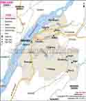
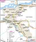
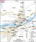
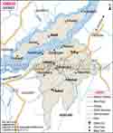
In the very south of Assam, to the west of the state capital lies the district of Bongaigaon, which is the administrative seat of the district after which it was named. Bongaigaon has gone from being a small railway outpost to becoming one of the main economic and industrial towns of Lower Assam. The origins of the name are said to be a combination of indigenous Assamese and Bodo languages tied to the native life of the earliest settlements in the locality, with various versions of the story being circulated locally among residents. Bongaigaon town itself is a centre of movement on the map of Assam, being a railway junction of the NEFR zone, and one of the most frequented stations in the state. This again is a gift of sorts for the entire district in attracting trade and transit between Guwahati and the rest of north-east India and even the neighboring West Bengal. The heart of the local economy revolves around the Bongaigaon Refinery, a facility managed by Indian Oil Corporation.
History & Culture
The area that is today Bongaigaon belonged to the Kamatapur kingdom that was a part of the history, and local culture says that Bongaigaon was the last capital of the kingdom. Traces of the Koch kingdom which for many centuries ruled big parts of western Assam as well as northern Bengal are still there in the many temples and old settlements of the local area. Remains of archaeological sites at Jogighopa for example the caves carved in the rocks, the sculptures, and the stone edicts indicate that the area was occupied by Buddhists long before Bongaigaon evolved into a railway station on the road used mainly for carrying loads from one market to another and also being a pilgrim route. Until India gained independence in 1947 and for a long time thereafter the area which is now Bongaigaon was part of the much larger traditional Goalpara district. As the government of Assam began to re-organise its administrative districts in the post-independence period, Goalpara was subdivided into several new districts, including Bongaigaon which was created to enable administration and public services to be delivered more effectively to the local population. Cultural life in Bongaigaon epitomises the mixed population of the district. Public life is generally Assamese in character, in particular for the Bihu festival, when the entire district engages in song, dance and in hosting community feasts three times a year to celebrate the agricultural cycle. Durga Puja is another major celebration, with the historic Bageshwari Temple acting as the focus of festivities; dedicated as it is to the goddess, it has long been one of the region's older Shakti Peeths and attracts pilgrims from throughout Lower Assam. The communities of Bodo and Koch-Rajbongshi lists the harvest festival and their traditional dance form of the community beyond the existing festivals of Assamese communities. Beyond this, the community of Bodo and Koch-Rajbongshi have what comes next existing institutions: Ngahr as a Vaishnavite prayer hall in line with the presentation of Srimanta Sankardev which still finds its place in the village only in a few of the villages in the district for prayer and gathering of locals. Traditional weaving of Assamese silk and cotton cloth is still found in the pockets of the village and is a family activity through multiple generations of local weavers.
Economy
Government Sector
Among the formal sectors, government offices, health agencies and educational institutions constitute the largest sources of formal employment in the district of Bongaigaon. The district administration for Bongaigaon is done through the Deputy Commissioners office. The functions of the administration are carried out via the office of Deputy Commissioner. It comprises administration of five different administrative units called revenue circles like Bongaigaon, Boitamari Bijni, Dangtol and Srijangram. With these, there are development blocks that are the responsible arms for execution of various rural scheme programs and welfare measures at the grassroots level, mainly in the remote and isolated villages.
Public Sector
The biggest public sector footprint in the district is Bongaigaon Refinery, the Indian Oil Corporation Limited's installation in the region. Established in the 1970s, the refinery transforms crude oil into crude fuel, diesel and other products, but is also one of the largest direct employers as well as a major source of revenue in western Assam. Within the district besides the refinery, the Northeast Frontier Railway also has a large significant institutional population in the district including the Bongaigaon railway station and service research and colonies with a significant population as well as a large number of support businesses.
Services Sector
Trade and small business are an increasing part of the economy of the district, and Bongaigaon's geographic position makes it an ideal transshipment point between Guwahati and the towns and districts of farther west such as Dhubri and Kokrajhar and neighbouring West Bengal. Small markets at Bongaigaon town and Abhayapuri sell produce, textiles and everyday items. The banking, transport and small industries sector has developed and an increasingly large workforce is employed in the railway and refinery.
Tourism
Manas National Park mainly located in adjacent districts of Barpeta and Chirang, the northern part of Manas National Park is just one of Bongaigaon's attractions. Manas is considered a place of international tourism. The Reserve was recognized as a UNESCO World Heritage Site and has been declared a Tiger Reserve and also an Elephant Reserve. Bongaigaon is the major center for accessing the park and is considered the base for most wildlife enthusiasts visiting Manas. With its beautiful wilderness, Manas is quite a hot spot for both naturalists and wildlife lovers. The Reserve was declared both a World Heritage Site by UNESCO and also a Tiger Reserve and an Elephant Reserve. Its impressive fauna consists of not only tigers and elephants but also pygmy hogs and the golden langur. The scenery of the park consists mainly of the Manas River as well as the Himalayan foothills. The place offers excellent access to Manas, making it a popular stopover for people planning their visit to the park.
Kakoijana Wildlife Sanctuary only 14 to 15 kilometers from the town of Bongaigaon on the banks of the Air River, is a small forest reserve, home to the golden langur, a rare and protected primate species. The sanctuary offers an ideal alternative to Manas for visitors who want to watch wildlife without the inconvenience of very long journeys. Bageshwari Temple is considered one of the oldest sites of religious significance in the district, the Bageshwari Temple is located some five kilometers away from Bongaigaon town. Nakkati Hills: Nakkati Hills, famous for a local hiking trail, has visitors, comparing it a bit to the hiking trails found in other mountainous areas, quite naturally making an association. Yet, the trail is only a short one and offers views at the surrounding countryside, making it a very popular attraction of Bongaigaon for casual hikes and local trips. The trek is short but it gives great views of nature and landscape which make it popular among locals as well as occasional hikers who are not in a hurry to complete the trek. Koyakujia Beel bird lovers flock here in winter, when the lake is visited by a large number of migratory birds. Koyakujia Beel's wetlands also host a great diversity of local plant and animal life besides the waterfowl, making it an interesting point for natural enthusiasts to visit. During the winter months, it is the migratory birds that add to the charm of the place. Many birds can be seen including herons, cranes, storks, etc. These are the birds that can be seen in large numbers during the migratory season. Among the migratory birds the highlight is the Siberian Crane and the Black-necked Crane. In recent times though conservation efforts have seen the population of some of these birds going up. Jogighopa Rock-Cut Caves: Jogighopa located in Assam is known far and wide for the rock-cut caves and the historical importance attached to it. These rock-cut caves situated close to the river Brahmaputra were used as shelter by the Buddhist monks during the time they were engaged in their spiritual practices at Jogighopa. The site is of great relevance for the historical scholars researching the history of Buddhist and later the Hindu culture in the Brahmaputra valley.
Some of the carvings in these caves have survived for over a millennium and a half. These carvings are an indication of great craftsmanship. There are also paintings left on the walls of the caves. Other Sites: Tamranga Beel is a very famous bird watching site and attracts a great number of visitors. Nigamghola rural tourism site attracts a great number of locals as it gives a chance for them to explore their heritage through the local traditions and culture. The places of interest include Bhairav Hill, Mahadev Hill as well as the Temple dedicated to the god Ganesha at Lalmati.
Demographics
As per the 2011 Census of India, Bongaigaon district was reported to have a total population of 738,804 persons with 375,818 males and 362,986 females. Such distribution results in a sex ratio of 966 females per 1,000 males slightly more than the average of Assam state. Approximately 15 percent of the people in the district reside in urban places, mostly around Bongaigaon town, with the rest in rural zones of the district. Scheduled Castes form around 11 percent while Scheduled Tribes form around 2. 5 percent of the total populace as per the 2011 census figures. Assamese is the mother tongue of most of the residents in the district and it is also an official language used in the government, along with English. Besides this, there are other people's languages like Bodo, Rajbongshi, and Bengali which are frequently spoken by the inhabitants. This linguistic mix of the district also results in a situation where Hindi is used by very few people, mainly in and around the railway and the commercial trading areas of Bongaigaon town. There are other local languages also which are spoken by some minority speakers.
Administration
Bongaigaon town is the headquarters of the Bongaigaon district. It has five revenue circles, viz. Bongaigaon, Boitamari, Bijni Dangtol, and Srijangram. About development, rural development in the district has been divided into five blocks, each managed by a Development Officer working through local gram panchayats. Bongaigaon has 535 villages and five towns as per the 2011 census. Local governance in the rural areas has been done by 65 panchayats. Panchayats in Bongaigaon town itself fall under the municipal administration while Abhayapuri, this town being the other prominent urban hub of the district, is administered through a municipal board.
| Official Name | Bongaigaon |
| Location | Assam |
| Area | 1093 sq. km |
| Population | 7,38,804 |
| Language | Assamese, Bengali, Bodo, Rajbongshi |
FAQs
Q1. How many villages are there in Bongaigaon district?
Bongaigaon district has 535 villages, as recorded in the 2011 Census of India.
Q2. What is the population of Bongaigaon district?
As per the 2011 Census, Bongaigaon district has a population of 738,804 people.
Q3. What is Bongaigaon district famous for?
Bongaigaon is known for the Bongaigaon Refinery, its major railway junction, Manas National Park, and the golden langur found in Kakoijana Wildlife Sanctuary.
Q4. Which languages are spoken in Bongaigaon district?
Assamese is the main language, alongside Bodo, Rajbongshi, and Bengali, spoken widely across different communities in the district.
Q5. How many sub-divisions does Bongaigaon district have?
Bongaigaon district is divided into four sub-divisions: Bongaigaon (Sadar), Bijni, North Salmara, and Manikpur.
Q6. What is the total area of Bongaigaon district?
Bongaigaon district covers a total area of about 1,093 square kilometres.
Last Updated on : October 15, 2026
