






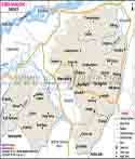
About
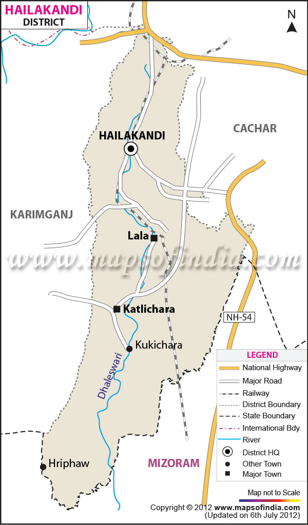
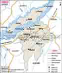
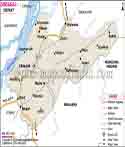
Hailakandi District, located at the southernmost point of Assam in the Barak Valley region of Northeast India. There are also two popular stories behind the name 'Hailakandi'. One states that the name is a hybrid of the Kukci words Halam (small state) and Kundia (a piece of land for fallow cultivation). The other narration states that the district was originally known as 'Sailkandi' (one who cultivates sali paddy) and that this was changed to the present name. Some rivers of the district are Katakhal, Dhaleswari Pala and Jita, besides which the agricultural and rural life of people are shaped. With its sprawling tea estates, tranquil countryside and large number of Bengalis, Manipuris, Kukis and other communities, Hailakandi is one of the lesser known truths of Assam. Topographically the district is situated at an altitude of about 21 metre from the sea level in the vicinity of the town, from the wider area of the district some places are located at higher elevations towards the hilly tracts bordering Mizoram. More than half of the land area of the district is under reserve forest area which is a key factor for the natural flourishing of the natural environment of the district as it contains a large portion of landscape under jungles and forests and is spared from the enormous construction or industrialisation process. The district has a predominance of river plains, patches of forests and tea garden slopes; this lends a more rural image to Hailakandi against the towns of upper Assam.
History & Culture
Hailakandi civil sub-division was created on 1 June 1869. As such it was one of the oldest civil subdivisions of Assam. It continued as the civil sub-division till 1989. It was, in fact, upgraded to the district status via notification from the state government in 1989. This region holds a special recognition in the entire history of the nationalist movement of India. During the Sepoy Mutiny in 1857, some local leaders opposed to British forces fought in and around "Ron Tila" of Mohanpur where many soldiers lost their lives for the 'national cause'. Still their sacrifice is recorded to be celebrated in the hearts of the local people, whose names are remembered as 'National Leaders' of the district. During the later days of the Civil Disobedience Movement of Mahatma Gandhi and the Quit India Movement, young people of this district were actively involved. Since then many names are remembered in the hearts of the local people as 'National Heroes', namely Sanat Das Gupta, Upendra Dhar, Abdul Matlib Mazumdar, Sunil Chakraborty and so on. Even before the joining of the Freedom Movement, many visits by national leaders, such as Netaji Subhash Chandra Bose and Jawaharlal Nehru, are recorded to have taken place in this district. Much of the district's contemporary development can also be attributed to the colonial period during which the first tea gardens were established in the district and a railway track was constructed for the transportation of raw material. Before the British administration, on which the economy, polity and administration of the district was still largely dependent, the river system was the main transport route, and the colonial rulers constructed bridges, roads and railway links that brought the district out of its pre colonial remoteness few institutions may be remnants of the period, Chalmers Higher secondary school Katlicherra and Graham M.V. Hailakandi town is named after British officers and gardens managers in the area during the colonial era. Hertbertganj bazar, part of Hailakandi is named after a colonial sub divisional officer of Hailakandi. Besides changing place names on long established buildings and market-places, the land itself preserves fragments of this history. Documents record that during the time period a number of leading native families presented land to establish schools and many of those institutions are still regarded as a part of the educational heritage of the district. During the time of the partition of 194647 Shri U.C. Roy, ACS was the sub-divisional officer of Hailakandi during one of the most tumultuous periods in the history of the region.
Culture and Traditions
The culture of Hailakandi shows the identity of the broader Barak Valley, where the Bengali language and its local dialect Sylheti are the main languages of communication. Though, besides this, the languages spoken are Manipuri (Meitei and Bishnupriya Manipuri), Dimasa Hindi, and Khasi, adding yet another dimension to the local social fabric. Religiously, the population is quite diverse; the Muslim and Hindu communities form the major portion. Festivals of both religions - Durga Puja Eid Bihu, and Manipuri cultural festivals - are celebrated together with community spirit all through the year. The life in Hailakandi's countryside has been influenced largely by tea plantation industries for generations; the district is still mainly a village where its residents live their lives around farms, rivers, and small-town routines instead of heavy industries or urban sprawl. Eating in the district is heavily shaped by the Bengali and Barak Valley cuisines - rice, fish, and farm-fresh vegetables are staples of most homes every day.
Economy
Government Sector
The Hailakandi district is acknowledged by the Government of India as one of the aspirational districts in its development programme which results in increased focus and funding directed at the region to improve the area's health, education, and infrastructure indicators. Government schemes including rural roads, housing, sanitation, and agricultural subsidies are reaching village communities through the district's four revenue circles while gradually reducing the gap with the more developed parts of Assam.
Public Sector
Alongside contributing to the local industry of paper and pulp the Hindustan Paper Corporation's mill at Panchgram has been, for quite some time, one of the big employers in the region providing employment to a lot of people. Alongside the mill public sector banks, postal services, and state-owned transport companies are also present throughout the district which makes it convenient and efficient for people in both rural and urban areas to be supported with their needs and services. Although the prosperity of the paper mill has changed from time to time and was dependent mainly on the industrial demand and availability of the production capacity, it is still a well-known place locally and is an important influencing factor in employment for people living in and around Panchgram.
Services Sector
Local Hailakandi businesses of small trades, transport services, education facilities, and retail outlets together form the major part of the services industry. District headquarters and sub-division towns are filled with small local markets, shops, and roadside vendors who provide daily necessities while schools, colleges, and private coaching centers further augment the service sector. Educational facilities in the form of 2 colleges and many other schools including primary, middle, and high schools cover all the educational needs of this district of the town. Beyond the two colleges, local families can choose from a government school (Kendriya Vidyalaya) and a Navodaya School (Jawahar Navodaya Vidyalaya).
Tourism
Hailakandi is not a commercial tourist circuit busy with attractions, which makes it attractive for visitors who like travelling to calm and green environments. A day of visit is enough to see the main attractions, though the slow pace of the district makes visitors stay longer because of its calm atmosphere. Serispore Tea Estate: The tea estate of Serispore is one of the most renowned gardens of the district. The estate displays the ascending plantation as well as the traditional life connected to tea cultivation. Siddyashar Bari (Sibmandir): A Shiva temple, one of the famous religious places in the district, attracting numbers of pilgrims from Hailakandi town and the surrounding areas in particular during festivals. Pach Pir Mukam: A sacred place of worship for the Muslim community, it is a significant site for the Muslim community and one of the most respected religious sites in the district. Rivers and nature: The Dhaleswari and Katakhal rivers and the bamboo forests and wooded patches in the district (more than half the district area is reserve forest including the Inner Line and Katakhal reserve forests) provide opportunities for gentle outdoor experiences and walks in nature. The tourism experienced by visitors to Hailakandi is a more relaxed and rural one rather than back to back sightseeing. A visit to the district makes an ideal extension to visits to the tea estates, temples and shrines and time spent around the Dhaleswari and Katakhal rivers. Visiting the town itself, there are fairly limited but adequate facilities for short visits and most tourists tend to combine a visit to Hailakandi with a broader trip covering Silchar and elsewhere in the Barak Valley. Heavy rains can be experienced during the months of the monsoon, June to September and travel plans between these months should take the possibility of wet roads and limited visibility through forested areas into account.
Demographics
Being situated in the north-eastern Himalayan state of Assam India Hailakandi is a district. The Census 2011 records the total population of Hailakandi district as 6,59,296, thereby contributing a lot to the population of Assam. Such a figure at the district level either meets or goes over the national average. This statistic basically gives an insight into the gender ratio and societal conditions of the area. Clearly the people of this area have moved from one age group of one census to another census over time as demographic change has been a gradual process that cannot be achieved quickly. The administration of the district continues to see education as one of its main priorities. Hailakandi district is divided into 4 talukas which form an administrative unit for governance and collection of data.
Administration
Hailakandi is divided into one sub-division named Hailakandi where the administration of the entire district is performed. For revenue purposes, the district is split into four revenue circles: Hailakandi, Algapur, Katlicherra, and Lala. The district has 3 urban centres and around 331-393 villages, as mentioned in different sources and the years they were prepared, covering all 4 revenue circles of the area.
| Official Name | Hailakandi |
| Location | Assam |
| Area | 1327 sq. km |
| Population | 6,59,296 |
| Language | Bengali |
FAQs
Q1. How many villages are there in Hailakandi district?
Hailakandi district has around 330 villages.
Q2. What is the population of Hailakandi district?
As per the 2011 Census, Hailakandi district had a population of 6,59,296.
Q3. What is Hailakandi famous for?
Hailakandi is known for its large tea gardens and the Siddyashar Bari temple.
Q4. When was Hailakandi declared a separate district?
Hailakandi was declared a district on 1 October 1989, after functioning earlier as a sub-division of Assam since 1869.
Q5. What is the main language spoken in Hailakandi?
Bengali, mostly in its local Sylheti form, is the principal language, spoken by close to 85% of the district's residents.
Q6. Which river flows through Hailakandi town?
The Dhaleswari River flows through Hailakandi town, with the Katakhal River also running through other parts of the district.
Last Updated on : October 15, 2026
