





About
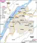
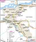
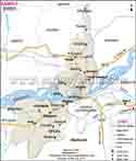
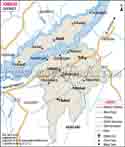
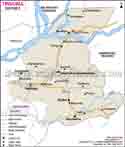
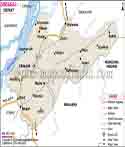
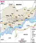
Nalbari is an Assam district. It is in the lower Brahmaputra Valley which also includes the district town of Nalbari. To the north is Baksa, to the west is Barpeta, to the east and south is Kamrup. The Brahmaputra forms the southern boundary. Many rivers pass through the district. Nona, Buradia, Pagaldia, Borolia and Tihu are reported to be the main rivers in Nalbari. They support farming and other rural activities.
Nalbari is for the most part flat. In the north clay and loam are the type of soil present, in the middle which is the main area that is loam and sand. In the south it is sandy soil which is the main type. Nalbari has a sub tropical climate which is characterized by very hot summers and relatively cool winters.
Nalbari in Assam also has a large number of religious and cultural sites. In Nalbari you can find the Hari Mandir, Billeswar Temple, Ballilecha Kali Devalaya and Gangadhar Pond which are very popular.
History & Culture
The history of Nalbari is rich and tied into that of the Brahmaputra Valley. Which at one time was a part of ancient Kamrupa and over the years came into the hands of many rulers and kingdoms. The district’s history reports the influence of the Varmans, Salastambhas, Palas, Bhuyans, Koch rulers, Tai-Ahoms and Mughals in the larger region.
Nalbari which is associated with reeds. In 1890-91 the British railway engineers gave it that name. Also in connection with the area are Satra, Govindapur and Khata.
Nalbari in 1967 came under the undivided Kamrup district. In 1985 August 14 it became a separate district. Shri V.K. Pipersenia, IAS, was the first Deputy Commissioner of the new district.
Nalbari is a district that has gained a reputation for its Sanskrit education. Also associated with the name "Nabadeep" which is what this district is also known for because of its renowned Sanskrit learning centers. In terms of formal education in Nalbari we are looking at a past which stretches back many years. The first middle school in the area was put up in 1887 which later on became Nalbari High School.
Festivals are a big part of the culture in Nalbari. In the town of Nalbari is the Hari Mandir which hosts the annual Ras festival in November. Since 1946 the festival has been run at the temple which also sees great attendance.
Hand weaved fabrics is an aspect of their local culture. In many rural areas weaving is a source of income. The Handloom and Textile Department operates training centers, production units and also runs weaver based programs in the district.
Economy
The mainstay of Nalbari economy is agriculture and rural based industries. They grow mostly rice which is the primary crop. Also they cultivate vegetables, pulses, mustard, jute, potato, ginger, turmeric, and chilli.
The district also reports fish farming, animal husbandry, sericulture, handloom industry and small scale industries. Many families there run into multiple income sources. A farm family may also have livestock, be into weaving or run a small shop.
In Nalbari’s One District One Product initiative, rice and rice based products have been put forward. The program supports growth in rice production, also including products like rice flour, puffed rice, flaked rice, pitha and other food items.
Government Sector
In Nalbari, the government is a key player. At district level you can see that which is related to revenue, agriculture, education, health, rural development, social welfare, water resources, disaster management, and other issues is provided by the government.
The Nalbari district administration has various departments which take care of public works and district level administration.
Nalbari is hit by floods at times of heavy rain. Government agencies play a role in flood control, relief and disaster response. Also the district administration runs public services during emergencies.
Public Sector
The public economy is supported by way of government entities, public utilities, banks, education and health care as well as other services.
Agriculture related government offices support farmers. Irrigation programs which they have put in place are to see that farmers have better access to water for crop production. At the District level the Agricultural Office has been into pump installation, irrigation and also other farm related issues.
The fishery department is also involved with those that are in the fishing and aquaculture fields. In Nalbari they have seen the introduction of integrated fish farming, pond development, input for fish farmers, wetland fish stock enhancement and support for the fishers.
Hand weavers are supported by handloom departments in Nalbari. Weaving societies, handloom training centers and production units are present. They offer training to people that wish to better their weaving skills and earn through handloom work.
Services Sector
In Nalbari and in the surrounding district the services sector has grown. You can see shops, banks, schools, hospitals, hotels, restaurants, transport services and small offices which support the local economy.
Nalbari is a key center of trade and daily services. From nearby villages people come in for shopping, education, medical care, banking and other needs.
Hotels and restaurants which support the local economy. The district disaster management report includes that they have small scale businesses, hotels and restaurants in town areas.
They have schools, colleges, Sanskrit schools and training institutions which see a great deal of local enrollment. Also in the health sector they have employment for doctors, nurses, technicians, support staff and other health care personnel.
Tourism brings in additional service sector revenue. Passengers require transport, food, accommodation and local shops. Also during religious festivals you can see an increase in business for small scale traders and service providers.
Tourism
Hari Mandir is a well known tourist destination in Nalbari town. The temple is devoted to Lord Krishna. In 1965 construction of the temple which was built on land given by Rambahadur Pratap Narayan Choudhury began. The new Math was developed between 1976 and 1985.
Each year at the end of November the Ras festival at Hari Mandir takes place which is a big draw. The festival brings in devotees, local people, traders and visitors. It is the primary cultural event related to Nalbari tourism.
Billeswar Temple is one of the old Shiva temples which is very near to Belsor. It is said that the temple is about 500 years old. Also in local folklore it is told that a cow used to give milk at a certain spot. Later a Shiva Linga was found at the site which led to the building of the temple.
The temple is at a distance of 10 km from Nalbari town. All through the year devotees visit the temple.
Ballilecha Kali Devalaya also is an ancient religious site in Nalbari district. The temple is thought to have been built during the reign of Ahom King Siba Singha which was between 1718 and 1744. It is situated near the Pagaldia River, at a distance of seven kilometers south east of Nalbari town.
The temple has an Asta Dhatu Kali Idol. Also present is a Kali Pukhuri. The site is a draw for devotees and those with an interest in the history of Nalbari.
Gangadhar Pond which is in Barkuriha village of Upper Barbhag at a distance of 7 km from Nalbari town. Also a part of local history the pond sees visits of migratory birds at certain times of the year.
Demographics
According to the District Administration the 2011 Census reported a population of 7,71,639 for Nalbari. Also that of the district’s population was 78.63% literate.
In over 97% of the district’s area the population is rural as per the old district reports. Agriculture thus remains very much a part of the daily life for large elements of that population.
Nalbari is home to many ethnic and religious groups. In Assamese, Bodo, Bengali, Nepali and Hindustani communities you will find large numbers of people. Also present are Hindu, Muslim, Christian, Jain and tribal religious communities.
In the rural areas farming and related work is very primary. Rice farming, fishing, livestock, weaving and small business are the sources of income for many families.
Administration
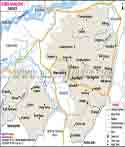
Nalbari is in the Central Assam division. Nalbari town is the district headquarter. Also it is reported that the district has four sub divisions, seven revenue circles and seven development blocks. Also they report 456 revenue villages and 65 panchayats.
The district reports that it has many revenue circles which have had long administrative histories. In 1886 Nalbari Revenue Circle was established, and in 1898 Tihu Revenue Circle came into existence. Paschim Nalbari Revenue Circle was founded in 1981 and in 1985 the Ghograpar Revenue Circle was created.
The District Administrator is the head of the district administration. At present Shri Nibedan Das Patowary, the Assistant Collector and Revenue Superintendent, holds this post. The administration is in charge of public services, revenue related work, development projects, disaster response and also the coordination between various departments.
Nalbari is home to departments which include agriculture, fisheries, handloom and textiles, health, social welfare, power, water resources, public works, animal husbandry, sports and disaster management.
The district administration works in association with Zilla Parishad, panchayats and local bodies for rural development. These bodies play a role in the administration of local needs and government programs.
| Official Name | Nalbari District |
| Location | Assam |
| Capital | Dispur |
| Area | 1052 sq. km |
| Population | 771,639 (2011 Census) |
| Religion | Hinduism, Islam, Christianity, Jainism and other faiths |
| Language | Assamese, Bodo, Bengali, Nepali and other local languages |
FAQs
Q.1: What is Hari Mandir famous for?
Hari Mandir is a temple of Lord Krishna which also hosts the annual Ras festival in November.
Q.2: What languages are spoken in Nalbari?
In Nalbari, Assamese is the main language which is spoken. Also Bodo, Bengali, Nepali and other languages are used by various communities.
Q.3: What industries are found in Nalbari?
Nalbari is a home to small and rural industries. Handloom, rice processing, handicrafts, fisheries and also other small scale businesses contribute to the local economy.
Q.4: What makes Nalbari important in Assam?
Nalbari is a key area for agriculture, education, religious tourism, handloom and local trade. Also being located near Kamrup and Barpeta which in turn puts it in good standing with the rest of Assam.
Q.5: Why do people refer to Nalbari as a center of Sanskrit education?
Nalbari is home to many Sanskrit learning centers and is also seen in this district as a tradition of Sanskrit education. Also associated with the name “Nabadeep of Assam.
Last Updated on : October 15, 2026
