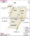

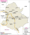
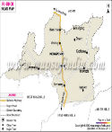
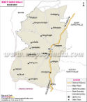
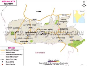
 Meghalaya, one of the north-eastern state's of India is a hilly region out of which one third of the state is forested. With a huge number of small villages and towns in remote areas, road is the one and only chief means of transport within Meghalaya. The state has only 5 main National Highway transitory i.e. National Highway number 40, 51, 62, 44 and 44E with a distance of approximately 461 Km. Roads are the only means of transport, thus putting trade and commerce in a reserved situation.
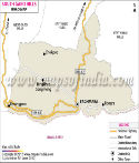
Investment is been made by the government in connecting all towns and villages by road. For nearly all roads are metalled but give way during the continuous rains in the region. Shillong is well connected by a network of roads, connecting all important towns in Meghalaya and the neighboring states with major cities throughout the country. However, the roads within the state need proper maintenance for smooth traffic movement, also a considerable portion of the roads are still unpaved.
Meghalaya is easily reachable by road from Assam. The National Highway number 40 connects main cities in India to Meghalaya. Travelers can easily travel by buses and cabs. The capital city has a big fleet of taxis, shared taxis and mini buses which run on fixed point to point basis and charge reasonable rates. A few routes are covered by the state transport corporation while the Shillong City Bus Syndicate provides regular bus services linking important places in the state.
Last Updated on : June 24, 2026