

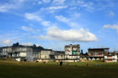
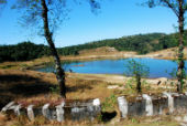
The temperate hill climate and the natural beauty of the country side have made Shillong into an attractive tourist destination of the state and the city offers all the facilities for tourists such as hotels and accommodation. It is one of the few urban centers in the state.
Roads are the most important link of the city and it is connected by motorable roads to neighboring states and the country. There is no airport in the city, nor is it connected by rail. The closest air and rail link is in Guwahati in Assam. Shillong is connected by National highway 40 and National highway 44. NH 40, runs entirely within the state of Meghalaya and connects Shillong to Jorabat and Jowai. NH 44 connects Shillong with Agartala, the capital of Tripura, passing through the state of Assam at Karimganj.
The total population of the city is 223366 with the majority of the populations belonging to the Khasi tribe. Christianity is the dominant religion and Shillong has a number of churches. It also has a very high literacy rate of 87%.
Localities in the City
Shillong is divided into various geographical localities having schools, churches, hospitals etc. The localities are Langkryding, Pynthorumkhrah, Shyriap, Laitumkhrah, Happy Valley, Dernthring, Nongthymmai, Moti nagar, Lamwabah, Upper Mawprem, and Lower Mawprem. Laitumkhrah has one of the oldest hospitals in Shillong, The Nazareth Hospital. The Laitumkhrah Catholic Cemetery is also located here. The church of Saint Peters and Paul is located in Pynthorumkhrah.
Important Landmarks in the City
- The headquarters of the Northern Eastern Council is also located here.
- The Shillong Golf Course, one of the oldest in the country, is in the center of the city.
- The Pasteur Institute
- The Power Grid Corporation of India has its regional headquarters for the north eastern region located at Shillong.
- Don Bosco Museum, one of the top cultural and academic institutions of the state, has a research and publication division, apart from galleries displaying northeastern artifacts and paintings.


Last Updated on : June 24, 2026
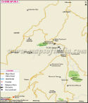
| Shillong Maps |
| Find Distance from Shillong to other Indian Cities | |||