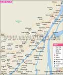
Known as the 'Lake District of India', Nainital is the largest town in Kumaon, Uttarakhand. Deriving its name from the Naini Lake, which is one of the 64 Shakti Peethas of the Hindus, Nainital is blessed with biodiversity and idyllic location. It is located at about 80°14' and 78°80' east longitude and 29°00' and 29°05' north latitude. The Nainital district covers an area of 4,251 sq km.
The town has been a part of several ancient legends and myths and is known to be one of the most popular tourist destinations in North India. This is why tourism plays a significant role in contributing to the economy of the city. There are many places of visit for the tourists in Nainital:
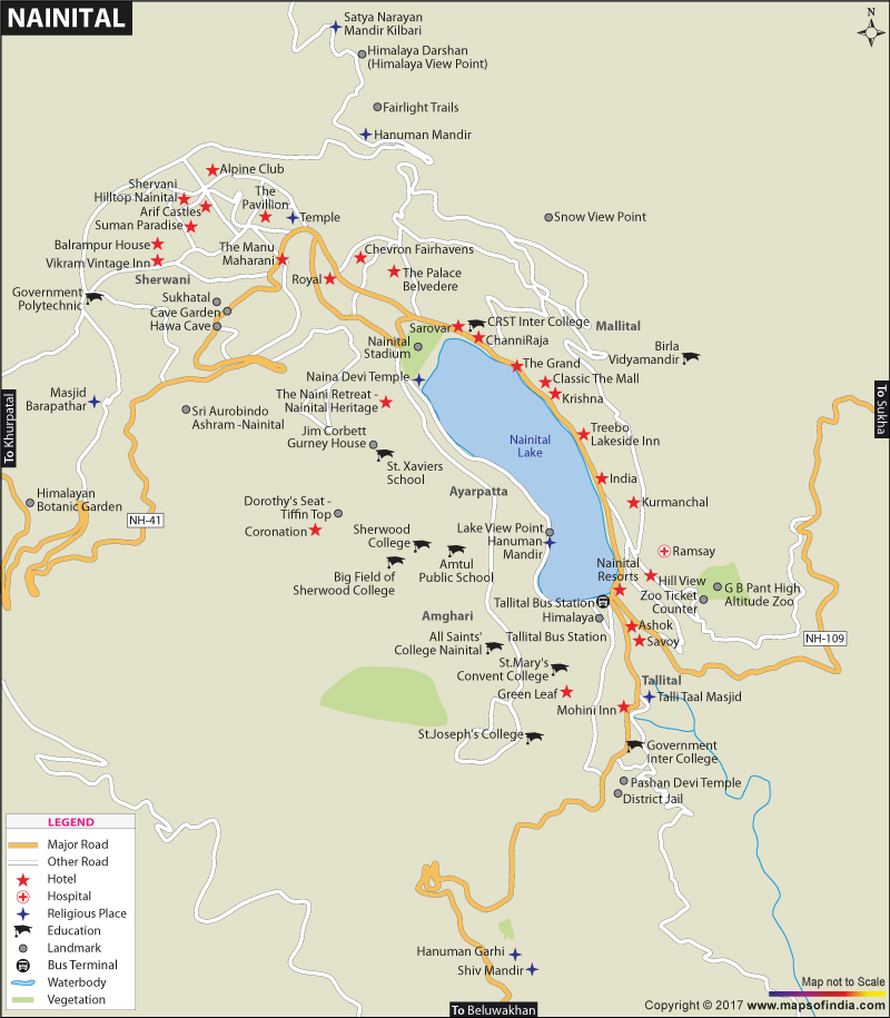
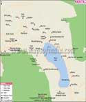
Nainital Lake:
It is the most popular tourist place in the city as it is after this lake that the city earned its name. The northern portion of the Lake is known as Mallital and the southern portion is called Tallital. It is a beautiful place where you can stroll and savour the scenic beauty of the lake and the lush green surrounding. You can also go for boating. Hire a paddleboat, rowboat or yacht and indulge amidst the tranquillity and quietude of the environs.Naina Devi Temple:
Devoted to Maa Naina Devi, this temple is one of the 64 Shakti Peethas. Situated on the northern shore of the Naini Lake, it is one of the sacred pilgrim places for Hindus. It is believed that when Lord Shiva was doing the Tandava, the ethereal dance of destruction, carrying the body of Goddess Sati, Vishnu with his Sudarshana Chakra cut through Goddess Sati's corpse and due to that, several parts of her body fell throughout the Indian subcontinent and thus formed the Shakti Peethas. Goddess Sati's eyes fell in the Naina Devi temple and that's how the place got its name.Tiffin Top (Dorothy's Seat):
Located on the Ayarpatta hill, this terraced top is built as a memorial to Dorothy Kellet, the wife of a British Army Officer, after she passed away in a plane crash. This place has now become a popular picnic spot as the views here are simply awe-inspiring. Locally, it is known as Tiffin Top and has beautiful green neighbourhood.Naini Peak:
Also known as Naina Peak or China Peak, it is the highest peak in the city. From this peak, you can have a panoramic view of the town. Tourists have to trek 6 km or take a pony from Mallital or Snow View Point to reach to the top.Nainital Zoo:
Also known as Bharat Ratna Pt. Govind Ballabh Pant High Altitude Zoo, this zoo is home to more than 50 free-ranging bird species such as babblers, tits, magpies, jays, barbets, woodpeckers, thrushes, Kalij pheasant, hill partridge, Himalayan griffon and lammergeier vulture, thus proving to be a heaven for bird watchers. Other than that, you can also catch a glimpse of leopards, rose-ringed parakeets, hill foxes, Tibetan wolf, sambar, leopard cat, Himalayan bear and more.Jim Corbett National Park:
The oldest national park in the country, Jim Corbett National Park is a part of the larger Corbett Tiger Reserve. It has hills, marshy natural depression, riverine belts, grasslands and a large lake. For birdwatchers, the park is a heaven as it is a home to more than 650 species of residents and migratory birds.Some other places of interest in Nainital are as follows:
- St. John in the Wilderness
- Snow View
- Governor's House
- Eco Cave Gardens
- Gurney House
- Mall Road
Some more places of interest around the city are as follows:
- Bhimtal
- Sattal
- Kasauli
- Naukuchiatal
- Ghorakhal
- Hanumangarhi
Being a tourist attraction, Nainital is filled with ample accommodation facilities. From affable low budget to luxurious five star hotels, it has plenty of options available for tourists. There are also many eating joints where people can savour delicious food and spend some time relaxing with family and friends.
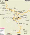
Pantnagar Airport is the nearest airport to the city; however, commercial flights are not operational from this airport. Indira Gandhi International Airport in New Delhi is the second nearest airport that connects it to the other cities in India. Kathgodam is the nearest railway station with connectivity to cities like Delhi and Lucknow. It is well-connected to other cities via road. It is a seven-hour drive from Delhi to Nainital. It is linked to NH-87, which connects it to Rampur and Rudrapur. Regular buses ply to and from Nainital to many neighbouring cities that make travelling to the city quite easy and comfortable.
WBST040515
WBVDA
Last Updated on : May 08, 2026
| Buy this Map |