






 |
 |
 |
 |
||||
| Assam Location Map | Assam District Map | Assam Tehsil Map | Assam Cities Map | ||||
 |
 |
 |
 |
||||
| Assam Road Network Map | Assam Rail Network Map | Assam Physical Map | Assam Travel Map |
Assam is a prominent state in Northeast India, known for its distinctive geographical setting, mighty rivers, lush forests, tea gardens and rich cultural heritage. Situated between the eastern Himalayas and the hill ranges of Northeast India, Assam shares its boundaries with Arunachal Pradesh, Nagaland, Manipur, Mizoram, Tripura, Meghalaya and West Bengal, besides having international borders with Bhutan and Bangladesh. The Brahmaputra and Barak river valleys form the principal geographical regions of the state and have played an important role in shaping its landscape, agriculture, settlements and economy.
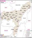
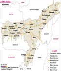
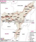
The Assam Map provides a detailed view of the state's location, boundaries, districts, major cities, rivers, physical features, transportation networks and important places. Dispur, the state capital, lies within the Guwahati urban area, while Guwahati serves as the region's major commercial, transportation and communication hub. From the wildlife-rich landscapes of Kaziranga and Manas to the historic sites of Sivasagar, the island of Majuli and the tea-growing areas of Upper Assam, the map helps provide geographical context to the state's diverse natural, historical, cultural and economic features.
Assam Map: Physical Features
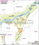
The Physiography of Assam can be divided into: the Brahmaputra Valley, the Central Assam Hills comprising the Karbi Anglong and Dima Hasao hill areas, and the Barak Valley. The state has an impressive forest cover of 28,313.55 sq km, accounting for about 36.10 per cent of its geographical area according to the India State of Forest Report (ISFR) 2023. The Assam map also highlights these major physical divisions of the state.
Assam is famous for producing rice, maize, pulses, potato, wheat, etc. The chief cash crops are tea, jute, oilseeds, sugarcane, cotton, and tobacco. The elongated valley of the River Brahmaputra occupies its northern part. This is also Assam's most populated area. The Brahmaputra becomes a braided river on entering Assam; its width varies considerably along its course, with its tributaries creating a massive floodplain. It is called the 'Life-line of Assam'.
Assam is famous for its biodiversity worldwide. It has several wildlife sanctuaries as well as National Parks that include Manas, along with Kaziranga National Park, a UNESCO World Heritage Site. Kaziranga National Park is famous for the Indian one-horned rhinoceros. Assam is also home to other important protected areas, including Orang National Park, Nameri National Park, Dibru-Saikhowa National Park and Dehing Patkai National Park. The state's forests, wetlands, grasslands and river systems support a remarkable variety of flora and fauna.
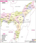
Assam Districts Map
The Assam District Map shows the administrative divisions of the state and helps users locate all 35 districts across the Brahmaputra Valley, Barak Valley and hill regions. The districts vary considerably in their geographical features, population, culture, economy and natural resources. Major districts and administrative areas include Kamrup Metropolitan, Kamrup, Dibrugarh, Jorhat, Nagaon, Sonitpur, Cachar, Tinsukia, Golaghat, Sivasagar, Kokrajhar, Karbi Anglong and Dima Hasao. The district map provides a convenient way to identify the location and distribution of Assam's districts and understand their relationship with neighbouring states and major cities.
As of 2026, Assam has 35 districts, including Bajali, Baksa, Barpeta, Biswanath, Bongaigaon, Cachar, Charaideo, Chirang, Darrang, Dhemaji, Dhubri, Dibrugarh, Dima Hasao, Goalpara, Golaghat, Hailakandi, Hojai, Jorhat, Kamrup, Kamrup Metropolitan, Karbi Anglong, Karimganj, Kokrajhar, Lakhimpur, Majuli, Morigaon, Nagaon, Nalbari, Sivasagar, Sonitpur, South Salmara-Mankachar, Tamulpur, Tinsukia, Udalguri and West Karbi Anglong.
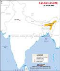
Assam Location Map
Assam occupies a strategic location in Northeast India. It is a significant corridor connecting the northeastern states with the rest of the country, and shares inter-state borders with Arunachal Pradesh, Nagaland, Manipur, Mizoram, Tripura, Meghalaya and West Bengal. It also shares international boundaries with Bhutan and Bangladesh. An Assam location map helps users understand the state's position in relation to neighbouring Indian states and countries.
Assam Rivers Map
The Brahmaputra is the most important river of Assam and plays a major role in the state's geography, agriculture, transportation, ecology and economy. The Barak is the principal river system of southern Assam. Other important rivers and tributaries include the Subansiri, Manas, Dhansiri, Jia-Bharali, Kopili and Sonai. These rivers support fertile agricultural plains but also contribute to the recurring floods that affect several parts of the state. An Assam rivers map helps identify the major rivers, tributaries and river valleys of the state.
History of Assam
Reference to ancient Assam, known as Pragjyotisha, is found in the epics of Ramayana and Mahabharata. The Ahom dynasty ruled much of the region for more than six centuries and played a significant role in shaping Assam's political and cultural history. The Ahoms successfully resisted several attempts by the Mughal Empire to establish control over their kingdom. The Ahom kingdom played a major role in the political and cultural history of Assam, with its rule beginning in the 13th century. The British entered Assam following the Treaty of Yandabo in 1826, after which British political control expanded in the region. Tea cultivation subsequently became one of the most important commercial activities under British rule. The Assam map provides useful geographical context for understanding this historical region.
Society and Culture
Assam is a multi-ethnic and culturally diverse state, home to Assamese-speaking people and communities such as Bodo, Kachari, Karbi, Miri, Mishimi and Rabha. Each community has its own languages, traditions, dress, festivals and cultural practices. Assam's cultural landscape also reflects Assamese Vaishnavism, tribal traditions and the influence of communities that have settled in the region over different periods.
Bihu is the principal and most widely celebrated festival of Assam, with three major forms: Rongali or Bohag Bihu, Kongali or Kati Bihu, and Bhogali or Magh Bihu. Assam is also renowned for its traditional Muga, Eri and Pat silk, handloom weaving, jaapi, bamboo and cane products, bell-metal work and pottery. Hinduism, Islam, Christianity, Buddhism and various indigenous faith traditions are practised across the state.
Economy
Agriculture is an important occupation in Assam, with rice, pulses, jute, tea, cotton, oilseeds and areca nuts among the major crops. Tea is one of the state's most important commercial crops, while silk production, handloom and handicrafts also contribute to the economy.
Assam is a significant producer of crude oil and natural gas. Forestry, tourism, real estate and the service sector are other important contributors. Guwahati is the state's major commercial centre and an important economic and transport hub for Northeast India.
Transport
Road transport is an important means of connectivity in Assam, linking towns, villages, commercial centres and neighbouring states. The Assam State Transport Corporation (ASTC) provides bus services within Assam and adjoining states.
Assam falls under the Northeast Frontier Railway (NFR) zone, headquartered at Maligaon, Guwahati. Major civilian airports include Lokpriya Gopinath Bordoloi International Airport in Guwahati, Dibrugarh, Jorhat, Silchar, Tezpur, Lilabari and Rupsi. Guwahati's airport is the principal international aviation gateway to Assam and an important air-connectivity hub for Northeast India.
Forests and Wildlife of Assam
The forests of Assam include tropical evergreen and semi-evergreen forests, moist deciduous forests, grasslands and riverine forests. As per the India State of Forest Report 2023, Assam has 28,313.55 sq km of forest cover, representing approximately 36.10% of its geographical area.
The State has a special role in wildlife conservation. Kaziranga National Park is famous for its greater one-horned rhinoceros, and Manas National Park is famous for its rich biodiversity and its location along the Bhutan border. The Assam map provides a geographical overview of the state's forests, national parks and protected areas.
Tourism in Assam
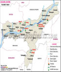
Tourism is one of the vital economic and cultural activities of Assam. The state has many attractions like Kaziranga National Park, Manas National Park, Majuli, Kamakhya Temple, Sivasagar, Umananda Island, Pobitora Wildlife Sanctuary and the tea gardens of Upper Assam.
Assam is a popular tourist destination because of its wildlife, river scenery, tea plantations, temples, monasteries, festivals and traditional crafts. Tourists can use the Assam map to locate important destinations across the state.
Assam's Importance in Northeast India
The central location and the connectivity in terms of roads, rails and airways make Assam the gateway to Northeast India. The commercial, educational, transport and communication centre in the region is Guwahati. Additionally, the state's strategic location is important due to its border with Bhutan and Bangladesh. The Assam map is useful for understanding the state's role as the gateway to Northeast India and its connections with neighbouring regions.
Assam / Asom State Information | |
|---|---|
| Capital | Dispur |
| Date of formation | Statehood in independent India | 26 January 1950 |
| Governor | Lakshman Acharya |
| Chief Minister | Himanta Biswa Sarma |
| Tourist attractions | Kamakhya temple, Umananda (Peacock Island), Navagraha (temple of nine planets), Basistha Ashram, Dolgobinda, Kaziranga National Park, Manas National Park, Majuli and Sivasagar |
| Festivals | Bihu, Sivaratri Mela, Baishagu |
| Major dance and music forms | Bihu, Sattriya and traditional folk forms |
| Arts and crafts | Jappi (traditional hat), toys made of clay, cork, wood and bamboo. Satras or monasteries to preserve art and culture. Muga, Eri and Pat silk weaving, cane and bamboo crafts and bell-metal work are also important. |
| Languages | Assamese, Bodo, Karbi, Bengali, and several other regional and tribal languages |
| Size | 78,438 km2 (30,285 sq mi) |
| Population (Census 2011) | 31,205,576 (Census 2011) |
| Rivers | Brahmaputra, Manas, Subansiri, Sonai, Barak, Dhansiri, Jia-Bharali and Kopili |
| Forests and wildlife sanctuaries | Kaziranga NP, Manas NP, Orang NP, Nameri NP, Dibru-Saikhowa NP and Dehing Patkai NP |
| State animal | Indian one-horned rhinoceros |
| State bird | White winged wood duck |
| State flower | Rhynchostylis retusa |
| State tree | Hollong (Dipterocarpus macrocarpus) |
| Major crops | Rice, jute, tea |
| Factoids | A traditional mythological account associates the name Tezpur with a legendary battle described in regional traditions. |
| No. of District | 35 |
FAQs
Q1: What does the Assam Map show?
The Assam Map shows the state’s location in Northeast India along with its districts, major cities, rivers, roads, neighbouring states, international boundaries and important geographical features.
Q2: Where is Assam located in India?
Assam is located in Northeast India, south of the eastern Himalayas. It shares boundaries with Arunachal Pradesh, Nagaland, Manipur, Mizoram, Tripura, Meghalaya and West Bengal, and also shares international boundaries with Bhutan and Bangladesh.
Q3: How many districts are there in Assam?
Assam has 35 districts. These districts are distributed across the Brahmaputra Valley, Barak Valley and the hill regions of the state.
Q4: What is the capital of Assam?
Dispur is the capital of Assam. It is located within Guwahati in the Kamrup Metropolitan area and serves as the state's administrative capital.
Q5: Which is the main river shown on the Assam Map?
The Brahmaputra River is the most prominent river on the Assam Map. It flows across the state and plays an important role in its geography, agriculture, transportation and ecology. The Barak River is the principal river of southern Assam.
Q6: Which states and countries share borders with Assam?
Assam shares interstate boundaries with Arunachal Pradesh, Nagaland, Manipur, Mizoram, Tripura, Meghalaya and West Bengal. It also shares international boundaries with Bhutan and Bangladesh.
Q7: Why is Assam important geographically?
Assam is strategically important because it serves as a gateway to Northeast India and connects the northeastern states with the rest of the country. Its Brahmaputra and Barak river valleys, eastern Himalayan foothills, forests, tea-growing regions and international borders also make it geographically significant.
Maps in Other Regional Languages
Last Updated on : September 08, 2026