Nizam of Hyderabad |
|
||||||||
 | ||||||||
|
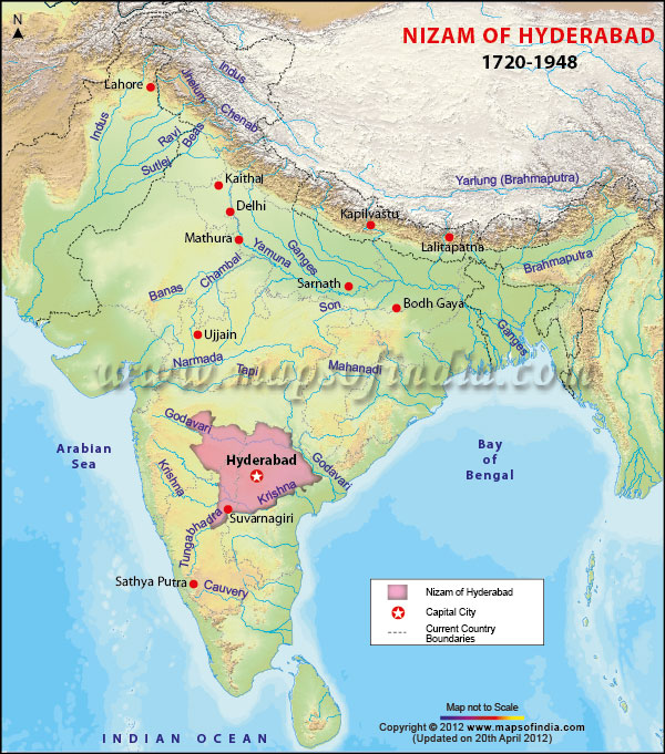
*Map showing capital city and boundaries where Nizams of Hyderabad ruled for two centuries between 1720 and 1948.
Disclaimer: All efforts have been made to make this image accurate. However Mapping Digiworld Pvt Ltd and its directors do not own any responsibility for the correctness or authencity of the same.
Disclaimer: All efforts have been made to make this image accurate. However Mapping Digiworld Pvt Ltd and its directors do not own any responsibility for the correctness or authencity of the same.
Last Updated on : November 13, 2025
|
|
