| Click on the map for Bigger map |
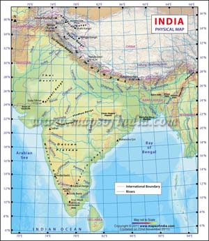 |
India is the seventh largest country in the world and also ranks second in population. It can be divided into six zones: North Zone, South Zone, East Zone, West Zone, Central Zone, North East Zone and has 29 states and 7 Union Territories. Most popular metropolitan cities in India are Mumbai, Kolkata, Delhi, Chennai and Bangalore.
Indian economy is also flourishing because of its Information Technology, Bio Technology, Pharmaceuticals, Business Management, Travel and Tourism, Financial Consultancy, Real Estate, Consultancies, Educational Institutes, and Construction sector.
Last Updated April 02, 2026