






Where is Jammu and Kashmir Located?
Jammu and Kashmir is a Union Territory of India in the northernmost part of India, surrounded by the Himalayan Mountain ranges. It has borders with the states of Himachal Pradesh in the north and west, and Punjab in the south. Its southern border is with Punjab, and its northern and western borders are with the bigger Kashmir area. The UT has two administrative divisions, Jammu Division and Kashmir Division, with 20 districts. Srinagar is the summer capital, while Jammu is the winter capital.
Renowned for its snow-covered mountains, picturesque valleys, pristine lakes, and sacred pilgrimage sites, Jammu and Kashmir is one of India's most popular tourist destinations. In addition to its beauty, the area has tremendous geopolitical, cultural and military value. The map of Jammu and Kashmir is useful to students, tourists and researchers for identifying the districts of Jammu and Kashmir, major cities, the transportation network, rivers, mountain ranges and the important tourist sites of the region.
Jammu and Kashmir Map
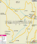
The Jammu and Kashmir map is a comprehensive map of all the administrative and physical features of the Union Territory. It displays district boundaries, major towns, national highways, rivers, mountain ranges, lakes and neighbouring states, which can be helpful for educational, administrative and travel purposes.
The present map has been updated as per administrative reorganization which is effective from 31 October 2019, when erstwhile Jammu and Kashmir became two Union Territories, namely, Jammu and Kashmir and Ladakh. Jammu and Kashmir today is in the possession of 20 districts in the Jammu and Kashmir divisions. The map also includes the administrative boundaries, along with some natural features like the Greater Himalayas, Pir Panjal Range, Jhelum River, Chenab River, Dal Lake, and Wular Lake.
Geographical Diversity
Jammu and Kashmir is one of the most geologically varied states of India. From the fertile plains and foothills of Jammu to the lush valleys, alpine meadows, glaciers and snow-covered peaks in Kashmir. The landscape is dominated by the Greater Himalayas as well as the Pir Panjal Range, and rivers like Jhelum, Chenab and Tawi provide not only food and water for the locals, but also electricity.
The climate is varied because of high variations in altitudes. The climate of the Kashmir Valley is pleasant, while the summer months are warm and the winter months are snowy in Jammu; the climate in the Kashmir Valley is moderate. The region is also rich in wildlife, including the Hangul and Himalayan black bear, and is also home to dense forests and high-altitude lakes.
History
Jammu and Kashmir boasts a long history of thousands of years. One of the earliest historical accounts of the region and its rulers is given in ancient texts like the Rajatarangini written by Kalhana. The territory of Jammu and Kashmir has witnessed the reign of various dynasties over the centuries, such as the Mauryas, Kushans, Karkotas and Mughals, who all have made their mark on the culture and architecture of the state.
After the Treaty of Amritsar (1846), Maharaja Gulab Singh formed the Dogra-style princely state of Jammu and Kashmir. The Partition of British India in 1947 was a pivotal moment in the modern history of the region, when the Maharaja of Kashmir, Hari Singh, signed the Instrument of Accession to India. The former state was divided into the Union territories of Jammu and Kashmir and Ladakh in 2019. Jammu and Kashmir is still a vital administrative, cultural and tourist centre in northern India today.
Administration and Districts
The state of Jammu and Kashmir is controlled by the Lieutenant Governor of the state appointed by the President of India as a Union Territory. It also has a Legislative Assembly elected and a Council of Ministers (CoM) led by the Chief Minister. There are 20 districts in the Union Territory, which are divided into two divisions, namely Jammu Division and Kashmir Division. These districts are governed by local authorities, and they have key roles in governance, infrastructure construction, tourism, agriculture, public services, etc. The administrative system is able to manage the region efficiently, without losing its distinctive cultural and geographical characteristics.
Major Cities
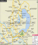
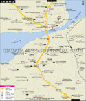
Srinagar and Jammu are the two main cities of the Union Territory and are considered the seasonal capitals of the UT. Srinagar is the summer capital and is known for Dal Lake, Mughal Gardens, houseboats and colourful local markets. It is also the cultural and administrative centre of the Kashmir Valley. Jammu is the winter capital and is also popularly dubbed the ‘City of Temples', and is also a significant commercial, educational and transportation hub. It is the gateway to many important pilgrimage sites such as the holy shrine of Shri Mata Vaishno Devi.
Cultural Heritage and Traditions
Jammu and Kashmir is famous for its rich cultural heritage, which has been influenced by centuries of the Hindu, Buddhist, Islamic and Sikh communities. This diversity can be seen in its architecture, languages, festivals, music, literature, handicrafts and cuisine. Kashmiri, Dogri, Hindi, Urdu and English are widely used across the region, and the folk music and dance traditions are still a big part of the region's celebrations.
Handicrafts like Pashmina Shawls, Hand Knotted Carpets, Walnut wood carvings, Papier-mâché products and delicate embroidery are internationally recognized and are the speciality of the region. The festivals are celebrated with great enthusiasm, and the region has a rich cultural fabric of festivals like Eid, Diwali, Baisakhi, Lohri, Shivratri and Navratri. Other traditional dishes like rogan Josh, ghushtaba, dum aloo, yakhni, kahwa and kaladi also exemplify the culinary culture of Jammu and Kashmir.
Popular Pilgrimage and Tourist Destinations
Tourism is one of the best sectors of Jammu and Kashmir's economy. The Union Territory is blessed with amazing mountains, lakes, forests and valleys, and every year millions of people visit this territory.
Srinagar is known for Dal Lake, Nigeen Lake, Mughal gardens and houseboats, whereas Gulmarg is one of the best skiing destinations in India and is the location of one of the world's highest cable cars. While Amarnath Yatra is the annual trek from Pahalgam, which is surrounded by pine forests and rivers, Sonmarg is home to glaciers, alpine meadows and trekking routes.
The holy shrine of Shri Mata Vaishno Devi is located in Jammu and is among the most famous pilgrimage sites of India. The region is also home to other attractions, including Patnitop, Dachigam National Park, Betaab Valley, Aru Valley, Doodhpathri, and Wular Lake, making it a popular destination for nature enthusiasts and adventurers alike. It is also a popular destination for trekking, skiing, camping, river rafting, mountain biking and wildlife tourism.
Economy and Connectivity
Tourism, agriculture, horticulture, handicrafts and small-scale industries form the backbone of the economy of Jammu and Kashmir. It is also famous for the production of various fruits such as apple, cherry, walnut, almond and saffron and is termed as “Fruit Bowl of India”. Handicrafts like Pashmina Shawls, Kashmiri carpets, Silk, Walnut wood, etc. are internationally recognized and are a source of livelihood for thousands of artisans.
In the past decade, Jammu and Kashmir has seen great progress in connectivity. The Union Territory has airports at Srinagar and Jammu, an expanding railway network and a National Highway 44 which connects it to major cities of India. Access via year-round modern tunnels, bridges and road infrastructure has improved, leading to increased tourism, trade and economic development.
Quick Facts
| Particular | Details |
|---|---|
| Official Name | Union Territory of Jammu and Kashmir |
| Formation as Union Territory | 31 October 2019 |
| Summer Capital | Srinagar |
| Winter Capital | Jammu |
| Total Area | 42,241 sq km |
| Administrative Divisions | 2 (Jammu Division and Kashmir Division) |
| Number of Districts | 20 |
| Largest City | Srinagar |
| Official Languages | Kashmiri, Dogri, Hindi, Urdu, English |
| Major Rivers | Jhelum, Chenab, Tawi |
| Major Mountain Ranges | Greater Himalayas, Pir Panjal Range |
| Major Tourist Destinations | Srinagar, Gulmarg, Pahalgam, Sonmarg, Patnitop |
FAQs
Q1: Where is Jammu and Kashmir located?
Jammu and Kashmir is a Union Territory in northern India, located in the Himalayas. It shares boundaries with Punjab and Himachal Pradesh to the south and forms part of the larger Kashmir region.
Q2: Is Jammu and Kashmir a state or a Union Territory?
Jammu and Kashmir is a Union Territory of India. It was reorganised from a state into a Union Territory on 31 October 2019 under the Jammu and Kashmir Reorganisation Act, 2019.
Q3: How many districts does Jammu and Kashmir have?
Jammu and Kashmir has 20 districts, divided into two administrative divisions—Jammu Division and Kashmir Division.
Q4: What are the two capitals of Jammu and Kashmir?
Jammu and Kashmir has two seasonal capitals: Srinagar serves as the summer capital, while Jammu is the winter capital.
Q5: Is Ladakh part of Jammu and Kashmir?
No. Since 31 October 2019, Ladakh has been a separate Union Territory. It is no longer part of the Union Territory of Jammu and Kashmir.
Q6: What is the total area of Jammu and Kashmir?
The Union Territory of Jammu and Kashmir covers an area of approximately 42,241 square kilometres.
Last Updated on: July 13, 2026
