Chhattisgarh is a newly formed state in India, formed on November 1, 2000 and is said to be the tenth biggest state in India. It was made by dividing 16 districts which came under Madhya Pradesh. The capital of this state is Naya Raipur. Chhattisgarh is also well known for its steel production and electric power generation. Almost 15% of the country's steel comes from Chhattisgarh.
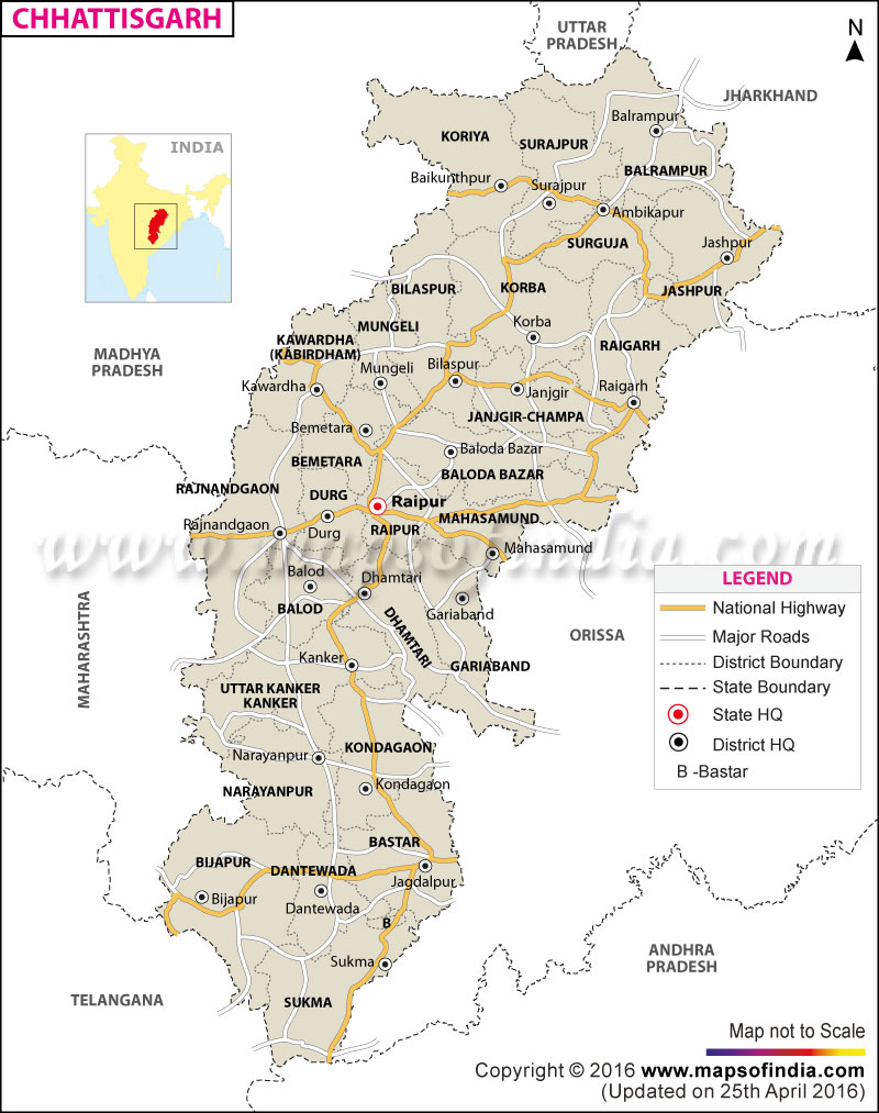
This state is surrounded by Madhya Pradesh in the northwest, Maharashtra in the west, Andhra Pradesh in the south, Orissa in the east, Jharkhand in the northeast and Uttar Pradesh in the north. The road infrastructure is slowly developing in this state. Chhattisgarh's total length of road is around 35,388.54 kilometres. Out of this, about 1,827.30 kilometres result in the national highways. Moreover, net road length of 3,611 kilometres is taken by state highways. Another 2,118 kilometres are for district roads; from where one can visit state's every nook and corners. The remaining 27,566 kilometres are served as village roads, which is bigger and lengthier than the regular roads.
The Chhattisgarh roadway comes under Chhattisgarh Transport Department's jurisdiction. Shri Rajesh Munat is the Transport Minister of the state. The state has 11 National Highways, which is about 2,225 kilometres. The National Highway 6, which connects Mumbai to Kolkata, goes through Chhattisgarh. This state has National Highway 43 that begins from Raipur to Visakhapatnam. Another National Highway 16, which is begins from Hyderabad, ends in Dantewada district at Bhopalpatnam. National Highway 78 connects from Katni in Madhya Pradesh to Gumla at Jharkhand. It passes through Jashpur district, Koria, Sarguja and Surajpur.
The national highways connect all the major district headquarters in Chhattisgarh. The national highways connect Chhattisgarh to all major and important cities such as Mumbai, Howrah, Kolkata, Hyderabad and Visakhapatnam. Due to this, it becomes easy for the state for perform activities required for business like transporting steel to various metros and commercial capital.
Last Updated on : July 15, 2025