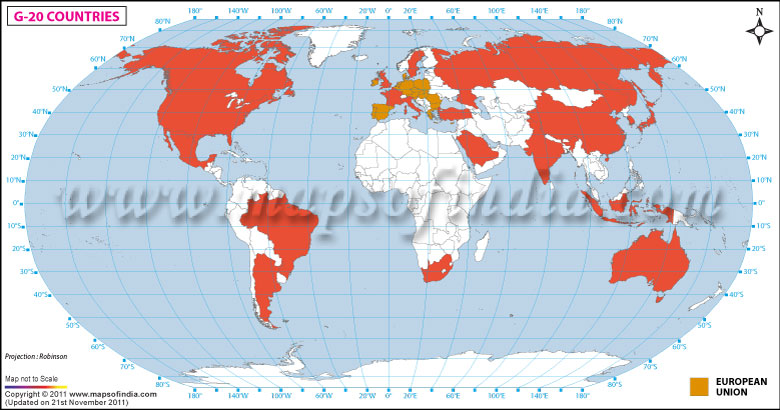
The map here displays all the G 20 countries highlighted in the colour red. The G 20 in brief is a group of finance ministers and central bank governors from 20 major economies- 19 countries plus the Europen Union, which is represented by the President of the European Council and by the European Central Bank.
List of G 20 countries are
:
- Argentina
- Australia
- Brazil
- Canada
- China
- France
- Germany
- India
- Indonesia
- Italy
- Japan
- Mexico
- Russia
- Saudi Arabia
- South Africa
- South Korea
- Turkey
- United Kingdom
- United States of America
- European Union
Apart from the G 20 countries, this map displays all the continents of the world such as North America, South America, Africa, Europe, Asia, Australia and Antartica. The map also contains all the major oceans of the world, namely the North Pacific Ocean, South Pacific Ocean, Southern Ocean, North Atlantic Ocean, South Atlantic Ocean, Artic Ocean and the Indian Ocean. The latitude and longitude, including a compass pointing north have also been provided in this map. This map is a very useful tool for school students wishing to learn more about world geography and the G 20 countries in particular, teachers and parents will also benefit from this map.
Last Updated on : January 14, 2026
