|
|||||||||||
 | |||||||||||
|
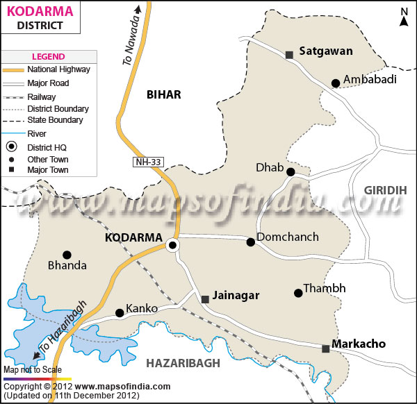
| *Koderma District Map highlights the National Highways, Major Roads, District Headquarter, etc. | Disclaimer |
| KODARMA DISTRICT PROFILE | |
|---|---|
| COUNTRY | INDIA |
| STATE | JHARKHAND |
| AREA | 1,680 sq km |
| DISTRICT HEADQUARTERS | Koderma |
| ASSEMBLY SEATS | 1 |
| POPULATION | |
| Total | 717169 |
| Male | 367952 |
| Females | 349217 |
| Density/km2 | 427 |
| Sex Ratio | 949 |
| LITERACY RATE (% age) | |
| Male | 81.25 |
| Females | 54.77 |
Last Updated on : November 13, 2025
|
|