Places to See
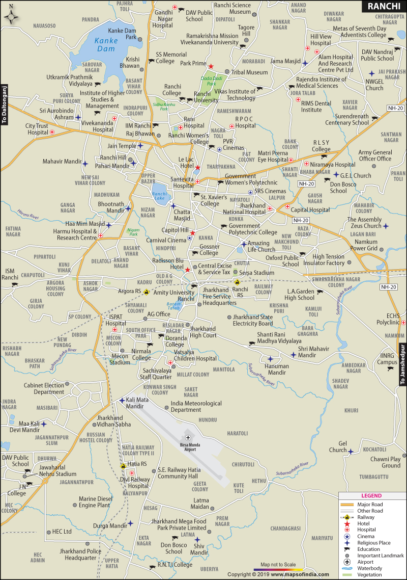
Ranchi has many places of interests for the tourists and the local visitors. Some of these are: Gonda Hill and Rock Garden: Situated on the Kanke Road, the garden is carved out of the rocks of Gonda Hills. It is an artificial garden and has waterfalls and sculptures which attract many tourists. Resembling the design of the rock garden in Jaipur, its appearance strikes a balance between the modern and the ancient creativity.
Tagore Hill: Also known as Morhabadi Hill, it is situated on Ekka Chowk in Ranchi. The hill has close connections with the Tagore family and Jyotirindranath Tagore, the elder brother of Rabindranath Tagore, even built a house on the hill.
Hundru Falls and Jonha Falls: The Hundru Falls is about 45 km away from Ranchi. It falls from a height of 320 feet. The Jonha Falls is about 40km away from the city and there is a rest house near the fall which has a Buddha Temple.
Nakshatra Van: Built by the Jharkhand Forest Department, Nakshatra Van is divided into several sections. It has numerous attractions such as Children Park, flower garden, artificial waterfall, medicinal plants, library and many more.
Jagannathpur Temple: The temple is similar in architecture and design to the Jagannath Puri Temple. Every year a similar yath ratra is organised from this temple. Located at a distance of about 10 km, it was built in 1691.
War Cemetery:It is a small cemetery located on the Ranchi-Hazaribagh road and has a total of 708 burials including those of the Indian army soldiers.
GEL Church, Sun Temple, Angrabari (Amreshwar Dham), Pahari Mandir, Sita Falls and McCluskiegunj are some of the other places of interest in the city.
How to Reach?
Ranchi has an airport from where regular flights ply to other major cities. It is also connected to other cities by railway. Ranchi Junction, Ranchi Road, Hatia, Namkon and Ray are the railway stations in the city that connect it to other parts of the country. Regular buses also ply from Ranchi to other cities and vice-versa.
WBST100715
Last Updated on: February 19, 2026
| Find Distance from Ranchi to other Indian Cities | |||
