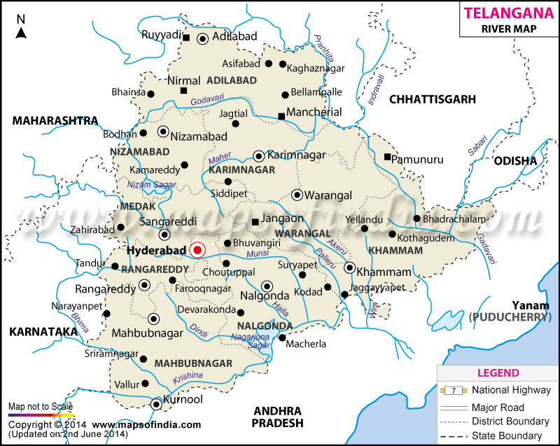
Situated at a high altitude, Telangana has prominent perennial rivers such as Godavari in the north and the Krishna in the south. Other rivers such as Bhima, Manair, Penganga, Akeru, Dindi, Manjeera, Paleru, and Pedda Vagu also irrigate the state.
Telangana is separated from Andhra Pradesh by the Krishna River, which acts as a geographical divider between the two. The Krishna River is the third-longest river of the country, originating in the Satara District of Maharashtra in the Western Ghats. This rivers flows across the state of Karnataka before reaching Telangana and Andhra Pradesh. Bhima is one of the prominent tributaries of Krishna River in Telangana.
River Godavari, the other most important river of Telangana, is the second-longest river of the country. This river originates in the Nashik district of Maharashtra and runs across the Deccan Plateau, before crossing Telangana and entering the Bay of Bengal. The river Manjeera is one of its major tributaries.
| River | Length (km) | Length (miles) | Drainage area (km�) | Outflow | Districts of Telangana |
|---|---|---|---|---|---|
| Godavari River | 1465 | 910 | 312812 | Bay of Bengal | Nizamabad, Adilabad, Karimnagar, Warrangal, Khammam |
| Krishna River | 1400 | 870 | 258948 | Bay of Bengal | Nalgonda, Khammam |
| Bhima River | 861 | 535 | 70614 | Krishna River | Mahaboobnagar |
| Manjira River | 724 | 450 | 30844 | Godavari River | Nizamabad, Medak |
| Musi River | 256 | 159 | NA | Krishna River | Nalgonda, Ranga Reddy |
| Paleru River | 112 | 70 | NA | Krishna River | Khammam |
Last Updated on : June 3, 2014
River Map of Telangana

