|
|||||||||||

| |||||||||||
|
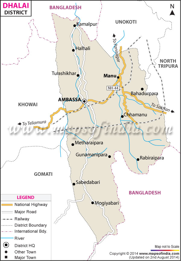
| *Dhalai District Map highlights the National Highways, Major Roads, District Headquarter, etc in Dhalai. | Disclaimer |
The youngest District of Tripura, Dhalai was formed only in the year 1995. The topography of Dhalai district is distinctly hilly and these hills, which covers more than 70 per cent of the total area of the Dhalai district, are wrapped in green forests. The sight of these lush green mountains are really pleasant.
Ambassa is the District headquarter of Dhalai and it is located at a distance of around 90 Kilometers from the state capital of Agartala. Connected by the National Highway number 44, Ambassa is just 3 hours away from Agartala. New railway tracks and stations are being constructed in the Dhalai district. The District of Dhalai has been further sub divided into 4 regions for the convenience of administration, they are:
There are a number of attractive tourists spots in the Dhalai Districts, these include:
Last Updated on : February 19, 2026
Ambassa is the District headquarter of Dhalai and it is located at a distance of around 90 Kilometers from the state capital of Agartala. Connected by the National Highway number 44, Ambassa is just 3 hours away from Agartala. New railway tracks and stations are being constructed in the Dhalai district. The District of Dhalai has been further sub divided into 4 regions for the convenience of administration, they are:
- Kamalpur
- Longtharai Valley
- Ambassa
- Gandacherra
There are a number of attractive tourists spots in the Dhalai Districts, these include:
- Kamaleswari Mandir: Situated in the Kamalpur town of the Dhalai District, this Temple is located in the center of the town and a major pilgrimage spot.
- Longtharai Mandir: Situated in the Longtharai range, this temple is also one of the most popular tourist spot of the Dhalai District.
- Rash Fair of Manipuri community
- Lebang Bumani
- Dhamail of Bengali community
- Hajagiri
Last Updated on : February 19, 2026
District Map of Tripura