

History
Itanagar has a rich history that goes down to the ancient, classical and modern experiences of the eastern Himalayas and it is the influence of indigenous tribal culture coupled with the administrative developments and changes. Even before the development of an urban center as Itanagar, the region was populated by numerous tribes speaking the Tibeto-Burman languages and especially the Nyishi tribe who formed their own social structures, traditional laws and cultures. These societies were in close consonance with the natural environment, based on shifting cultivation, hunting and forest products, and highly developed clan-tribal political structure.
Archaeological data indicate that there was a strategic value in the area of modern Itanagar in the early period of history. The greatest historical monument is the Ita Fort after which the city is named. The fort, which was constructed in the period between 14th and 15th centuries, was built using huge bricks, and is thought to have been linked to the Chutiya kingdom of Assam or other local powers extending their influence to the foothills of the Himalayas. The huge constructions of the walls of the fort and its design show that there was organized political power and defense interests in the medieval age. The fort is a reminder of early state formation as well as the interaction of the region although its actual constructors are disputed among historians.
The territory was mostly beyond the direct control of the British force because it was very rugged with strong tribal conflict during the colonial period. The British rule followed a policy of limited intervention, as it defined the region as a British North-East Frontier Tracts. Their key agenda was frontier security as opposed to introducing any administrative or economic changes at large scale. Consequently, the local governance was still governed by native institutions and customary laws and the foreign intervention was minimal as compared to other areas of India.
The strategic importance of the area went up after the year 1947 when India gained independence, especially after the Sino-Indian War of 1962. The reorganization of the area was caused by the necessity to have a more powerful administrative control and infrastructure development. In 1965, the North-East Frontier Agency (NEFA) was transferred to the Ministry of Home Affairs, as a step to greater integration with the Indian Union. Itanagar was built as an administrative centre to help in administration and development of the region.
Arunachal Pradesh became Union Territory in 1972 and Itanagar was made capital of the territory. When full statehood was established in 1987, the political significance of Itanagar in the country further intensified as it became the seat of the state government, legislature, and key institutions..
Culture
Itanagar is a melting pot of the culture of many indigenous tribes that are intrinsically intertwined with the social and spiritual life of Arunachal Pradesh.The major communities found in the city and in the surrounding areas include the Nyishi, Galo, Apatani, Adi, Tagin, and Monpa tribes each with its own tradition, language, and forms of art.
Cultural life at Itanagar is based on the tribal social organization. Majority of the communities operate within customary norms based on clan systems similar to the operation of customary laws and councils that govern the social behavior, conflict management and utilization of resources. Older traditions accentuate that people are close to nature, which is manifested in rites related to agriculture, seasons, and family spirits. Although locals still act according to indigenous faith like Donyi-Polo, which promotes the Sun and Moon as the universe forces, both Christianity and Buddhism are practiced in the area, which underscores the large degree of religious pluralism in the region.
Festivals are essential to the culture and bringing communities together. Such ceremonies as the Nyokum Yullo of the Nyishi, Solung of the Adi, Mopin of the Galo, and Losar of the Monpa are characterized by great ritual, folk-dances, music, and community feasts. These ceremonies are closely associated with harvest and growth and prosperity, which adds to the social cohesiveness and group identity. Such festivals are highly practised in Itanagar and are usually on an inter tribal and larger scale where different communities are in a position to exchange their cultures.
The cultural identity of traditional clothing and craftsmanship is still significant in many aspects. Both aesthetics and practicality are represented in handwoven fabrics, bamboo/cane, wood carvings, and beads decorations. Striking patterns, colors and headgear mean tribal belonging and social standing. Itanagar’s Local markets are where these traditional products are traded with the modern goods.
Music and dancing form part of the cultural life, with folk songs telling the legends, heroic acts and daily lives. The communal affiliations and passing of the oral traditions between generations are established through group dances which are performed at festivals.
Language
Itanagar is characterized by spectacular ethnic and cultural diversity; this fact is manifested in the linguistic landscape of Itanagar. Indigenous languages that can be found in and around Itanagar are mostly of the Tibeto-Burmans family and these languages are linked to various tribes like the Nyishi, Galo, Adi, Apatani, Tagin and Monpa. The languages are featured in oral traditions, customary laws, folklores, and in ritual practices as these are high indicators of tribal identity.
Nyishi is the most used local language spoken in Itanagar simply because of the number of Nyishi that are present in the area. But a majority of the residents are multilingual, usually of their indigenous tribal language as well as one or more other languages. This multilingualism allows for the exchange of information between communities, as well as it facilitates social interaction within a culturally diverse urban world.
The language plays an important role in Itanagar where Hindi serves as the primary lingua franca. Its popularity may be explained by administrative operations, education, and movement and inter-regional communication. Hindi is widely used in markets, in offices and in informal social settings, which makes it a significant tool of communication among people having varying lingual backgrounds in their everyday life communication. Its practical business use has grown tremendously in urban settings.
The English language has a leading role in the formal sectors. English is the main language of government, education, official records, and business interaction that has been introduced in the post-independence era as a result of modern education and governmental apparatus. In Itanagar, most of the schools, colleges and government establishments run on English, which has led to the high degree of proficiency among the students and the professionals. The English language also helps to create more national and global connectivity.
Geography
The physical environment of the city is defined by the geography of Itanagar, as the location on the foothills of the Eastern Himalayas gives the city a unique physical environment that is characterized by hills, forests, and valleys of rivers. Itanagar is located in the Papum Pare district of the state of Arunachal Pradesh, with an average elevation of 320-440m above sea level. This transition it has created between the highlands of Himalaya and the plains of Assam has shaped its climate and ecology to a big extent as well as its settlement patterns.
The city has small rivers and streams the most significant of which is the Papum river, which is a tributary of the Brahmaputra. These water bodies are very crucial to the local drainage, agriculture and ecology. The heavy rainfall experienced in the monsoon season frequently causes the rivers to overflow hence soil erosion and the risk of floods in the low lands.
Itanagar has a humid subtropical climate, which is defined by the monsoonal winds. The summers are hot and moist whereas the winters are cold and moderately dry. May and September experience high rainfall resulting in dense forest cover as well as other agricultural activities in the city though they lead to some problems like landslides and road blockages. Thick humidity and rains also make the environment full of green all year round.
The vegetation surrounding the Itanagar area is primarily subtropical evergreen and semi evergreen. These forests shelter very diverse species of plants and animals and are considered to be part of the livelihood of the people. The hardwood trees, cane, bamboo are widespread and they are utilized to build structures as well as crafts and daily necessities.
| Particular | Details |
|---|---|
| Town | Itanagar |
| State | Arunachal Pradesh |
| Country | India |
| Area | 51.69 km² |
| Population | 59,490 |
| Official Language | English |
FAQs
Q.1:Are Inner Line Permits (ILP) necessary?
Indeed, Indian tourists need Inner Line Permit (ILP) to explore Arunachal Pradesh, including the city of Itanagar. Protected Area Permit (PAP) is required by the foreign tourists.
Q.2:Can the tourists feel safe in Itanagar?
Generally, Itanagar is safe for tourists. The people of this region are friendly and the crime rate is not so high. There should be basic travel precautions particularly at evening time and remote areas.
Places to See
The archaeological sites and historical places highlight the socio-cultural significance of Itanagar hence making it a perfect tourist destination in the north east. Some of the places of tourist attraction in the city are:
Ita Fort: It is one of the most prominent historical sites in the state. The name means "Fort of Bricks". The city derives it name from this fort. Situated in the heart of the city, the fort is irregular in shape and is built with bricks that date back to 14th -15th century.
Geykar Sinyik: Located at a distance of six kilometres from Itanagar, it is a beautiful picnic spot. A natural lake, Geykar is surrounded with landmass of hard rocks, tall trees and tree ferns. Boating facilities and swimming pools are also available here.
Gompa Buddhist Temple: The Buddhist temple consecrated by Dalai Lama is a beautiful yellow roofed shrine located in Itanagar. The temple has an extensive Tibetan influence and it offers a great view of the city and the surrounding countryside.
Jawaharlal Nehru Museum: The museum showcases the tribal culture of the state and has a rich collection of textiles, handicrafts, household articles and weaponry associated with the culture and heritage of Arunachal Pradesh.
Craft Centre and Emporium: The craft centre and emporium is the best place to shop for traditional stuff such as wall paintings, dye yarns, utility items from cane and bamboo.
Some other places to see in the city are Bomdila, Malinithan, Parshuram Kund and many others. The accommodation facilities are available in the city in different ranges such as budget hotels, guest houses and home stays. People can take up any accommodation as per their budget. There are also many restaurants that offer traditional, Indian, Chinese and Continental cuisines.
How to Reach?
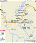
There are regular helicopter services from Guwahati to Naharlagun in Itanagar. The nearest domestic airport is either in Lilabari, Rowriah or Dimapur in Assam. The nearest railway stations are Harmuti and Gohpur in Assam. However, there is a train every week that plies between Naharlagun and Delhi. Itanagar is connected through NH-52A to Assam and other cities of India. The city has a good road network and is connected to Guwahati. Regular buses ply between the two cities. Arunachal State Transport Corporation also runs regular buses from Itanagar to other north eastern states.
WBST080715
Last Updated on : June 24, 2026