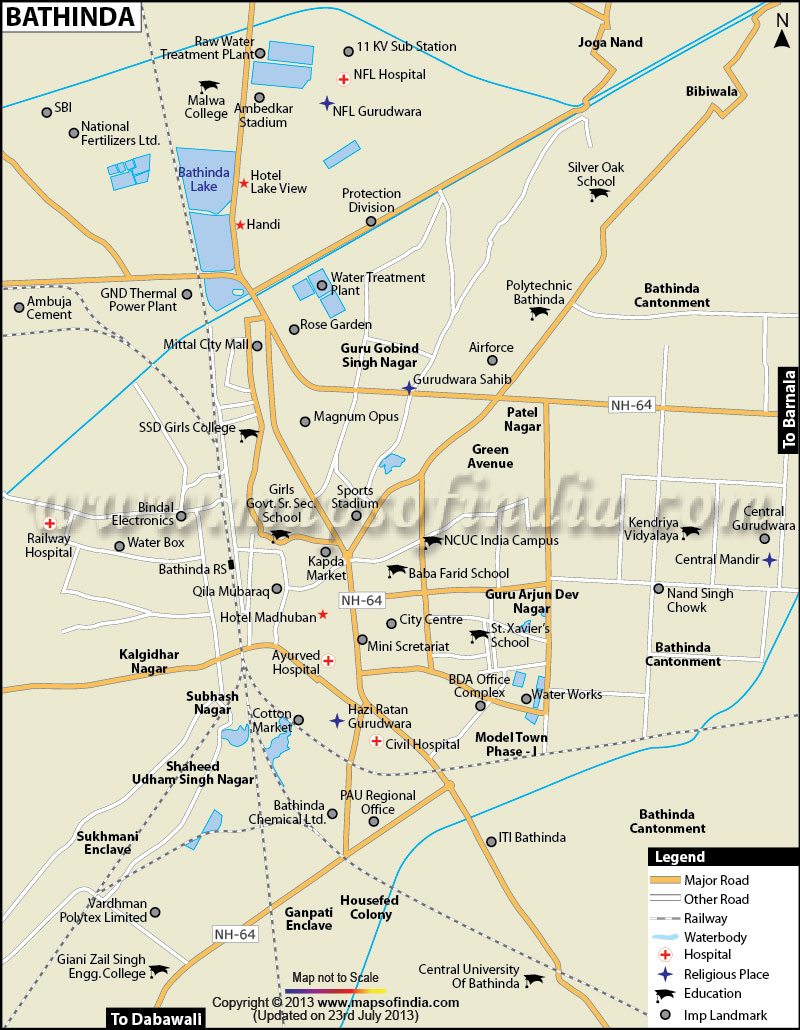
As per the 2011 Census, the population of Bathinda is 285,813 and the average literacy rate of the city is 82.84 %. The geographical coordinates of Bathinda are 30.20°N 74.95°E. The city has an average elevation of 660 ft.
The climate of Bathinda is semi arid with high difference between summers and winters. Summers are generally hot and winters are cold with low temperatures. Dust-laden winds are often observed in summers and the vegetation is quite scanty in the region.
The city of Bathinda is surrounded by twelve small and medium towns, making it a hub of industrial activities in the region. The Bathinda cantonment is alleged to be the Asia's largest and has one of the biggest cotton and food-grain markets in the country.
The government has proposed a massive development programme to set up a special economic zone (SEZ) for textile, Bathinda Airport, an international cricket stadium and academy, a flying school and an air-conditioned bus stand. Shopping malls and top end hotels are also coming up in the city.
Traveling to Bathinda is easy as the city is well connected through rail and road. The nearest airport to Bathinda is in Chandigarh. From here buses or cabs can be hired to reach the city. The railhead in Bathinda is one of the largest railway junctions in the country. Government and private buses are also easily available to reach Bathinda from nearby cities and states.
Last Updated on : February 19, 2026
| Buy this Map |
