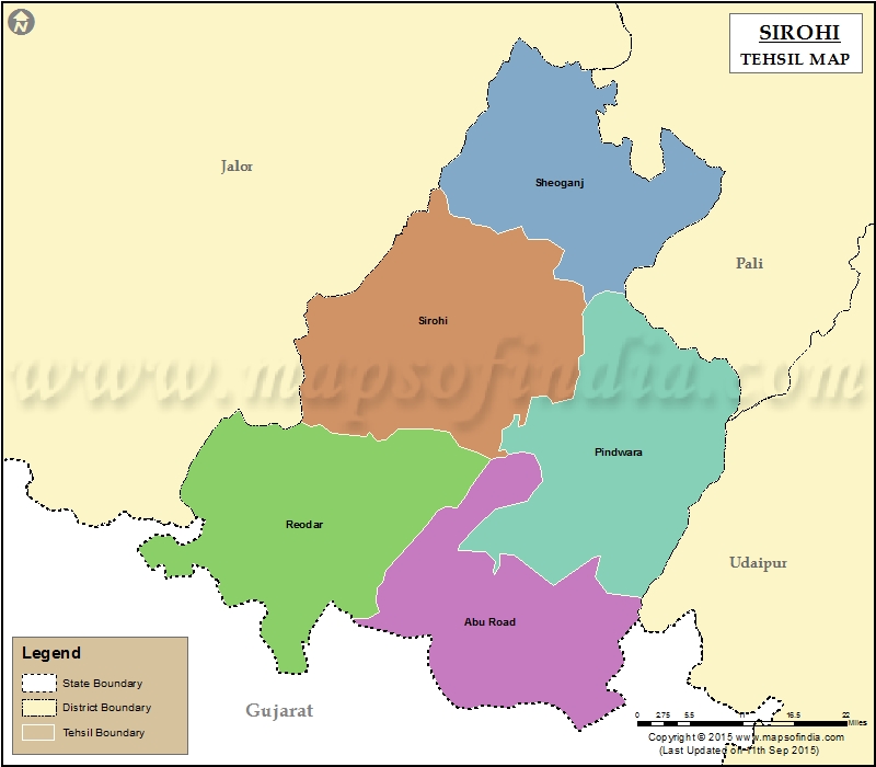
List of Tehsils in Sirohi District | ||
|---|---|---|
| Tehsil/Taluk Name | Total (Rural + Urban) Population (2001) in Number | Pin Code |
| Abu Road | 184,610 | 307026 |
| Pindwara | 205,568 | 307022 |
| Reodar | 175,344 | 307514 |
| Sheoganj | 124,452 | 307027 |
| Sirohi | 161,133 | 307001 |
Last Updated on : January 14, 2026
