Location Map of Andaman and Nicobar Earthquake


 Andaman and Nicobar Earthquake

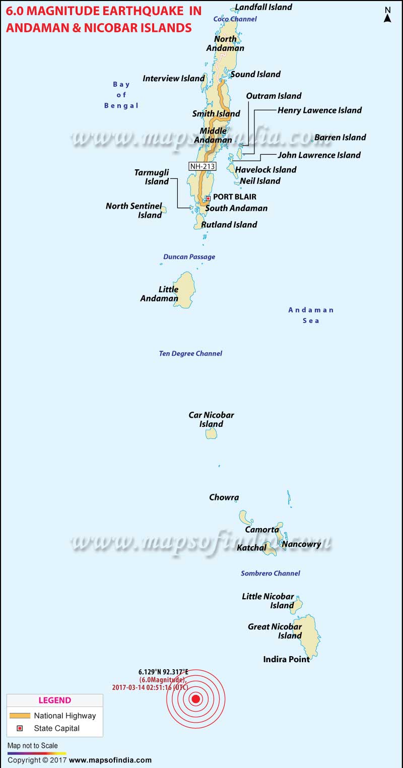
6 M Earthquake Hits Andaman & Nicobar Islands


A strong earthquake of 6 magnitude struck Andaman & Nicobar islands at 8.21 am onTuesday.

With a depth of 10km, the epicentre of the quake was in the Nicobar islands region.

There was no report of any loss of life or property.

Another earthquake of 3.6 magnitude occurred at 5.48 am at Kathua in Jammu and Kashmir.


Which States Share Boundary with China?India, in total, shares land borders with 6 sovereign countries. China is one of those. Below are the Indian states which share borders with the country. 1. Jammu and Kashmir This northern state of India is mostly located in the Himalayan mountains. It shares a… Read More...
Which States Share Boundaries with Pakistan? There are four states that share a border with Pakistan, namely, Jammu and Kashmir, Punjab, Rajasthan, and Gujarat. The India Pakistan Border is quite intriguing. Since India has installed 1,50,000 flood lights on… Read More...
Which Places in India Still Largely Speak Sanskrit?Sanskrit is considered as Dev Bhasha, the language of Gods. It has a history of around 3500 years. It used to be a primary language of ancient India. Its earliest form Vedic Sanskrit, was prevalent from 1500 500 BCE. However, it is fading… Read More...


EU GDPR Update:
MapsofIndia has updated its Terms and Privacy Policy to give Users more transparency into the data this Website collects, how it is processed and the controls Users have on their personal data. Users are requested to review the revised Privacy Policy before using the website services, as any further use of the website will be considered as User's consent to MapsofIndia Privacy Policy and Terms.

We follow editorialcalls.org for border and boundary demarcations