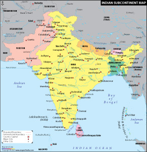
Extending from the Himalayan mountain ranges in the north to the Indian Ocean's tropical fringes in the south, the Indian subcontinent is recognized for its diversity and intriguing features all across the globe. The Indian subcontinent can essentially be described as a tectonic plate. Carved out of surrounding rocks, the subcontinent looks mesmerizing on the map in its diamond shape with multiple states and some neighbouring nations like Pakistan, China, and Sri Lanka to name a few. You can also see other countries that are neighbours of India on the Indian Subcontinent Map.
Today, it can be said that the Indian subcontinent is in a better position in terms of the social, political, and economic status it enjoys in comparison to the other economies of the world. It has been able to carve its niche not only in the tourism sector but also in the education, employment, and manufacturing sectors.
To know about the geographical features of the Indian subcontinent which covers more than 700,000 villages and cities, you can refer to the Indian Subcontinent Map.
Let's have a look at the neighbouring countries of India:
Pakistan - India and Pakistan, two independent countries born when the Indian subcontinent got freedom from British rule. Two countries were carved out of the geographical territories consisting of erstwhile British India, while several princely states and some Portuguese and French colonies were also added to India in the following years. At the time of independence, Pakistan was divided in to two territories, one on the north-west of India and the other, thousands of kilometers far apart, on the east of India. The two territories were not only geographically, but culturally apart too. In 1971 a civil war occurred between the two, following that Bangladesh was formed. West Pakistan lying in the northwest of India became the Republic of Pakistan and East Pakistan became Bangladesh. The Indian states of Jammu and Kashmir, Gujarat, Rajasthan, and Punjab share their borders with Pakistan. Pakistan is a South Asian country with a coastline along the Arabian Sea and the Gulf of Oman. The total area of the country is 7,96,095 sq km. The head of the state is the ceremonial head of the country. Islam is the state religion according to the constitution of Pakistan.
China - China lies to the north of India and shares its borders with the Indian states like Jammu and Kashmir, Himachal Pradesh, Sikkim, Arunachal Pradesh, and Uttarakhand. It spans over an area of 95,96,960 sq km and is the world's most populous country. Currently, China is one of the fastest-growing economies in the world. The President of China is the head of the state and the Premier of China is the head of the government. The capital of China is Beijing.
Nepal - In the northeast of India, lies Nepal, which is a country located in the Himalayas. Nepal is not a very large country in terms of its size and spans over an area of 1,47,181 sq km. Out of the world's 10 tallest peaks, eight are located in Nepal including the world's highest point Mount Everest. Agriculture is the mainstay of the economy of Nepal; even the majority of the industries here are involved in the processing of agricultural products. Tourism is one of the most significant features of the country. The government is a federal parliamentary republic. The capital of Nepal is Kathmandu. While Hinduism is practiced by 81% of the Population followed by 9% of Buddhism, and also has 4.4% of population which practices Islam.
Bhutan - The Kingdom of Bhutan shares a border with the Indian states of Arunachal Pradesh, Sikkim, Assam, and West Bengal. It is spread over an area of 38,394 sq km. The capital of Bhutan is Thimphu. The population of the country predominantly practices Buddhism followed by Hinduism. The country has a parliamentary form of government and hence is a constitutional monarchy. Besides the monarch, it has a prime minister who holds the executive powers of the nation. Hydropower, agriculture, forestry, and tourism are major contributors to the economy of Bhutan. Buddhism is considered to be the state religion as per the constitution. According to the International Religious Freedom report, 75% of the population follows Drukpa Kayu or Nyingma school of Buddhism followed by 22% of Hindus in the country.
Burma (Myanmar) - The Republic of the Union of Myanmar is situated in East Asia with a coastline along the Bay of Bengal. The Indian states of Nagaland, Mizoram, Arunachal Pradesh, and Manipur share their borders with Burma. The country is spread over an area of 6,76,578 sq km and its present capital is Naypyidaw.. A high percentage of the population practice Buddhism. Burma is governed as a presidential republic with a bicameral legislature. The head of the state is the president of the country. The country is predominantly Buddhist with almost 88% of the population being Theravada Buddhists, 6% Christians, and with 4% of the population being Muslim.
Afghanistan - Afghanistan is another neighbouring country of India located in Central Asia. It has many other countries in its neighbourhood including China, Iran, Pakistan, Tajikistan, Turkmenistan and Uzbekistan. The country has an area of 6,52,230 sq km. Islam is the predominant religion in the country and agriculture is the mainstay of its economy. The manufacturing of cotton textile, woollens, woven carpets and handicrafts are the main industrial activities in the country.
Sri Lanka - The Democratic Socialist Republic of Sri Lanka lies near the southern area of India and is separated by Palk Strait. The commercial capital of the country is Colombo; however, Sri Jayewardenepura Kotte is its legislative capital. The president is the chief of state and the head of government in Sri Lanka. It is home to many ethnic groups, religions and languages. With a large number of places of interest, Sri Lanka is a pleasant tourist destination in the world. Theravada is the known to be the official religion in the country with 70% of the Population as Buddhist followed by 12% Hindus, 9.7% Muslim, and 7.4% Christians in the country
Maldives - An island nation, Maldives is located in the south-southwest of India. It is situated in the Indian Ocean-Arabian Sea area and consists of a double chain of 26 atolls. With an area of 298 sq km only, Maldives consists of more than a thousand coral islands. The capital of Maldives is Male and Islam is the predominant religion in the country. It is a presidential republic and the president is the head of the state and of the government. Dhivehi is the official language of the country. According to the Maldives constitution, Islam is the official state religion.
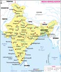 India Bangladesh Map |
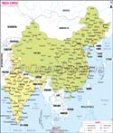 India China Map |
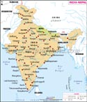 India Nepal Map |
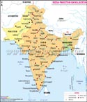 India Pakistan Bangladesh Map |
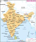 India Srilanka Map |
Neighbouring Countries Maps
