The surface of the Earth is made up of tectonic plates which are slowly but continuously in motion. When they move against each other the pressure builds up until it is released at a point called the epicentre. The resulting stress is transmitted in the form of seismic waves, or what is commonly called an earthquake. As the surface of the Earth buckles and bends great devastation can be caused to lives and property in the area. One such catastrophic event took place on 30th September, 1993, in Latur in Maharashtra state of Western India.
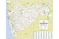
Early in the morning of 30th September, at 3.56 am a massive earthquake took place in Central India. The epicentre of the earthquake was in Killari in Latur district of Maharashtra. The impact was felt most in Latur and Osmanabad districts. The sleeping villagers of Latur and nearby areas had no warning and many of them were crushed to death under the debris of their houses which collapsed as a result of the quake. More than 20,000 people were killed and about 30,000 were injured. Many of the injured had fractures or crushed limbs as a result of being trapped under heavy stones or beams from the walls and roofs of their houses. The death toll included many women and children.
The intensity of earthquakes are measured on the Richter Scale where (where 2.0 or less is a minor quake while 7.0 and above is classified as a major quake). The Latur earthquake was recorded as measuring 6.4 on the Richter Scale. Since the area was densely populated, the toll of those killed and injured was very high. About 35 villages were completely devastated, as all the houses were destroyed in the quake. Another 730 villages were damaged as a result of the tremor.
The civil administration, the Central Reserve Police Force (CRPF) and the armed forces were pressed into disaster relief operations to rescue those trapped under the debris and provide the survivors with basic necessities. The Red Cross, the state health department and local hospitals were pressed into service to evacuate the injured and provide immediate medical help and rehabilitation. The most vulnerable, including young children, the elderly, women and the differently abled were given priority treatment. Basic necessities such as food, clean drinking water, clothing, blankets and tents for the survivors were organized and dispatched from central collection points. Villagers who had survived but had lost their homes were provided compensation and temporary accommodation. NGOs and social service organizations also played a big role in the relief efforts and helped survivors rebuild some semblance of their normal lives as soon as possible.
As the debris was cleared, the question of how to respectfully dispose off the large number of dead bodies also emerged. This needed to be carried out soon in order to prevent the spread of infectious diseases in the area. The option of community burial of the dead was put to use and people of all faiths were buried in mass graves. Disinfectant agents were used in the area to prevent any outbreak of disease. A large number of livestock were also killed as a result of the quake or died shortly thereafter. Their bodies too were disposed off in a similar manner, keeping in mind the health of the community.
As the damage was assessed and reconstruction requirements understood, donor agencies such as the World Bank offered assistance and funding for the reconstruction projects. The central and state governments with the help of NGOs and donor agencies carried out a reconstruction programme. Along with houses, essential infrastructure such as local schools and health centres were also extensively damaged. The new buildings that were constructed incorporated earthquake proof engineering techniques and structural design elements that would prevent them from collapsing in the the event of a future quake. The authorities viewed the reconstruction as an opportunity to introduce positive health practices to the community. The new houses that were constructed had sanitation facilities, running water and electricity, which the older mud-brick houses did not possess.
Along with rebuilding infrastructure, the local government and NGOs helped the villagers rebuild their lives. They were provided training in disaster management so they were better prepared for any natural calamity in the future. Many also received occupational training since they could not carry out their previous occupations as a result of injuries sustained in the earthquake. Adult Educational assistance and food distribution centres were also provided for the inhabitants of Latur. Community buildings that fostered a greater sense of a cohesive community, such as a gram Panchayat, a temple, a women's cooperative centre, a childcare centre, and an animal shelter were newly constructed in Latur.
The National Disaster Management Authority (NDMA) was set up as a consequence of the Latur earthquake. The central government recognized the need for a single nodal agency, which could provide a quick response and coordinate relief efforts in the event of a natural calamity or disaster.
The NDMA has since provided prompt relief and saved the lives of countless Indians during natural disasters such as the recent flashfloods in Uttarakhand in mid-2013. The centralized database of the NDMA provides important information in the case of a disaster and can also be used in forecasting and planning ahead in order to be prepared for when nature's fury might strike again.
Also on this day:
1996: The South Indian state of Tamil Nadu changed the name of its capital city from Madras to Chennai.