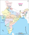
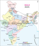
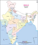
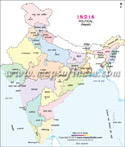
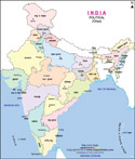
The India Map depicts the political boundaries of the states and union territories as well as the neighbouring With the Google Earth data you would get a detailed view of the states, union territories, and cities of India. Click on any state, union territory, or city that you wish to explore and get a complete map of the same along with locations of its subdivisions. The street map also shows the water bodies, the highways, the national parks, and the wildlife sanctuaries in accordance with their locations.
You can zoom in and zoom out to get a more detailed or simple view of a particular location. By moving the cursor, you can also move the map in different directions. On the left hand side below the map, there is a small box that gives you an option to switch to different modes. By clicking on the box, you can either have a satellite view of the map or the street view. On the top left corner, there is a link - 'View larger map'. Click on this link and a larger map of the city or the state will open. You can also get directions on the map by putting your start-to-end locations. You can also look up for nearby important places, such as hotels, restaurants, and so on, on this map.
India Maps in Different Languages
 India Map in Assamese |
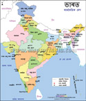
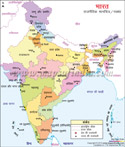
 India Map in Bengali |
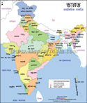
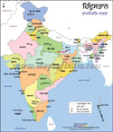
 India Map in Hindi |
 India Map in Kannada |
 India Map in Malayalam |
 India Map in Marathi |
 India Map in Nepali |
 India Map in Oriya |
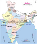
 India Map in Punjabi |
 India Map in Tamil |
 India Map in Telugu |
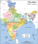 India Map in Urdu |
Last Updated on: April 17, 2026
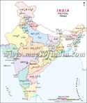
India General Maps