1 April in History


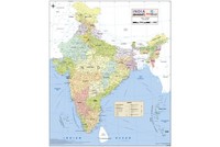
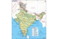
Orissa, a state of Oriya speakers, was established as a province of British India on 1 April 1936. The English name Orissa was changed to Odisha on 4 November 2011. Odisha’s history is at least 5,000 years old. The Kalinga War of the 3rd century BC, which made emperor Ashoka embrace non-violence and adopt the teachings of Buddha, was fought in... Read More →
S.M. Joshi was a brilliant student during his academic years and displayed an outstanding oratory skill while participating at various contests. All his regular article contributions reflected his literary excellence to the fullest. Being inclined towards politics from the very beginning, S.M. Joshi participated at various Gujarat festivals along with the Tilak processions. He also entered the Indian independence movement... Read More →
Browse by
Month
Date

FAQs and Answers on Indian History and Geography
Which States Share Boundary with China? India, in total, shares land borders with 6 sovereign countries. China is one of those. Below are the Indian states which share borders with the country. 1. Jammu and Kashmir This northern state of India is mostly located in the Himalayan mountains. It shares a… Read More...
Which States Share Boundaries with Pakistan? There are four states that share a border with Pakistan, namely, Jammu and Kashmir, Punjab, Rajasthan, and Gujarat. The India Pakistan Border is quite intriguing. Since India has installed 1,50,000 flood lights on… Read More...
Which Places in India Still Largely Speak Sanskrit? Sanskrit is considered as Dev Bhasha, the language of Gods. It has a history of around 3500 years. It used to be a primary language of ancient India. Its earliest form Vedic Sanskrit, was prevalent from 1500 500 BCE. However, it is fading… Read More...


EU GDPR Update:
MapsofIndia has updated its Terms and Privacy Policy to give Users more transparency into the data this Website collects, how it is processed and the controls Users have on their personal data. Users are requested to review the revised Privacy Policy before using the website services, as any further use of the website will be considered as User's consent to MapsofIndia Privacy Policy and Terms.

We follow editorialcalls.org for border and boundary demarcations