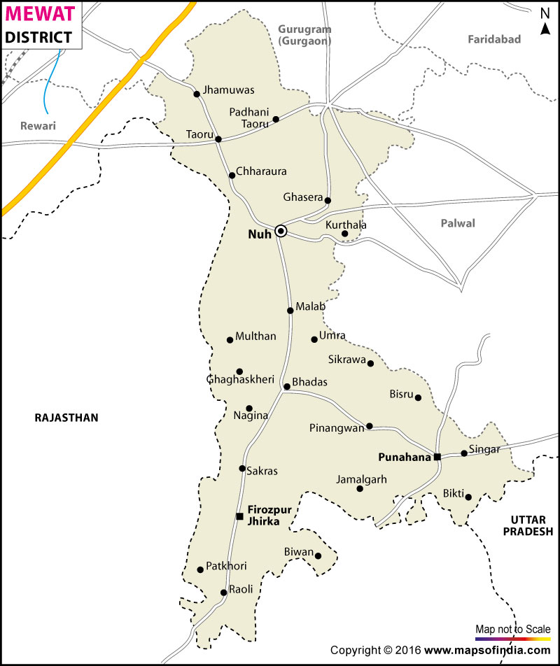
The Mewat district has an area of 1,499 sq km and has a population of 1,089,406 as per the 2011 census with a population growth of 37.94 percent and a population density of 729 people per sq. km. The main occupation of Mewat is agriculture and related agro-based activities along with animal husbandry as the secondary source of income. Mewat is also called the Land of the Meos. They are tribal inhabitants who are mainly agriculturalist.
| Facts of Mewat District | |
|---|---|
| State | Haryana |
| District | Mewat |
| District HQ | Nuh |
| Population (2011) | 1089263 |
| Growth | 37.93% |
| Sex Ratio | 907 |
| Literacy | 54.08 |
| Area (km2) | 1765 |
| Density (/km2) | 729 |
| Tehsils | Ferozepur Jhirka, Nuh, Punahana, Taoru |
| Lok Sabha Constituencies | Gurgaon |
| Assembly Constituencies | Nuh, Ferozepur Jhirka, Punhana |
| Languages | Hindi, Haryanvi, Mewati |
| Rivers | Mewat |
| Lat-Long | 28.008952,77.062797 |
| Travel Destinations | Fort Kotla, Indor Fort, Shaking Minarets, Nallad, Chui Mai Pond etc. |
| Government Colleges/Universities | Govt. College for Women (Salaheri Nuh), Government College (Tauru), Govt. College (Nagina) etc. |
Last Updated on : January 14, 2026
