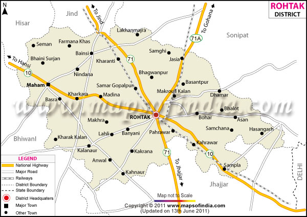
Known as the political capital of
Haryana, the Rohtak district lies in the south-east of the state. With Rohtak town as the district headquarter, it has a total area of 1668.47 square kilometers and a population of approximately 9,40,000.
The district has an agrarian economy with 51.89% of the working population are engaged in growing crops like wheat, gram, sugarcane and bajra.
Rohtak district is a historical place with many historical sites, sculptures and buildings. No wonder, the tourists will love the area.
| Facts of Rohtak District |
|---|
| State | Haryana |
| District | Rohtak |
| District HQ | Rohtak |
| Population (2011) | 1061204 |
| Growth | 12.88% |
| Sex Ratio | 867 |
| Literacy | 80.22 |
| Area (km2) | 1668 |
| Density (/km2) | 607 |
| Tehsils | Maham, Rohtak, Sampla |
| Lok Sabha Constituencies | Rohtak |
| Assembly Constituencies | Mehem, Garhi Sampla-Kiloi, Rohtak, Kalanaur (SC) |
| Languages | Hindi, Haryanvi |
| Rivers | ---- |
| Lat-Long | 28.873539,76.502495 |
| Travel Destinations | Banni Khera Farm, Tilyar Lake, Jama Masjid, Pirzada Masjid, Rajputs Ancient Monuments etc. |
| Government Colleges/Universities | Govt College (Mokhra), Govt. College for Women (Lakhan Majra), Govt. College for women (Sampla), Govt. College for Women (rohtak), Govt. College (Jassia), Govt. College (Sampla), Govt. College (Meham), Pt. NRS Govt. College etc. |
