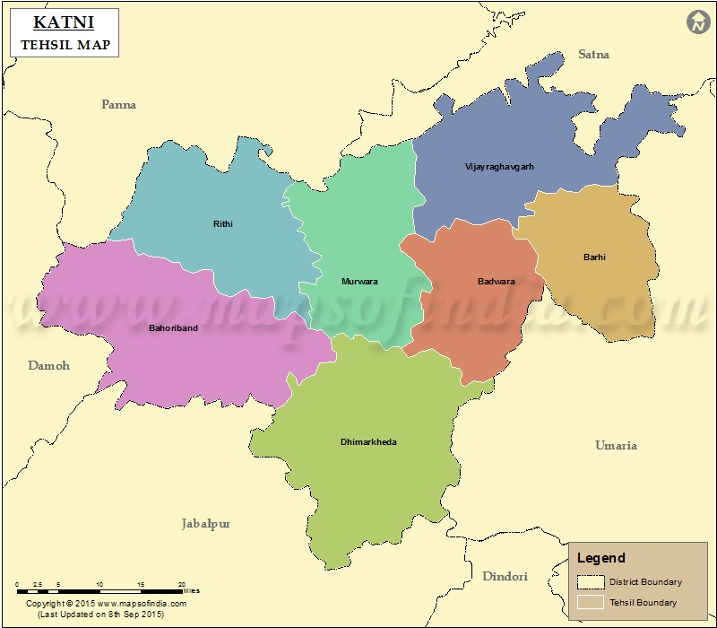
List of Taluk in Katni District | ||
|---|---|---|
| Tehsil/Taluk Name | Total (Rural + Urban) Population (2001) in Number | Pin Code |
| Badwara | N.A | 483773 |
| Bahoriband | 163,496 | 483330 |
| Barhi | N.A | 483770 |
| Dhimarkheda | 152,005 | 483332 |
| Murwara | 570,011 | 483332 |
| Rithi | N.A | 483990 |
| Vijayraghavgarh | 178,655 | 483775 |
Last Updated on : January 14, 2026
