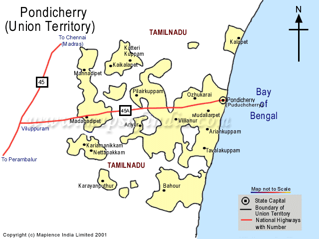
ROAD NETWORK MAP OF PUDUCHERRY POCKET - PONDICHERRY
|
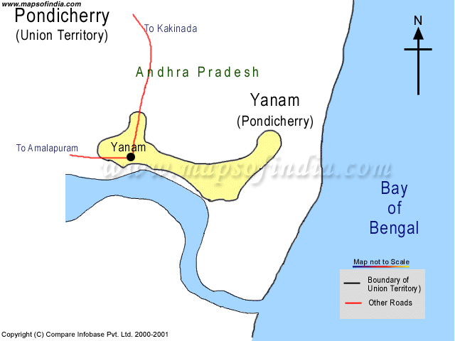
Yanam, territory of Pondicherry, shares it's border with Andhra Pradesh depicting a very good of it's road network with other local places though it neither have any major roads nor the National Highway.
|
|
| * Map showing the Road Network of the Puducherry District. |
ROAD NETWORK MAP OF KARAIKAL POCKET - PONDICHERRY
|
Karaikal also share it's border with Tamilnadu and it is also a territory of Pondicherry. Its local places are- Kottucherry, Nedungadu, Tirunallur, Neravys, Tirumalairayan Pattinam.
|
|
| * Map showing the Road Network of the KARAIKAL District. |
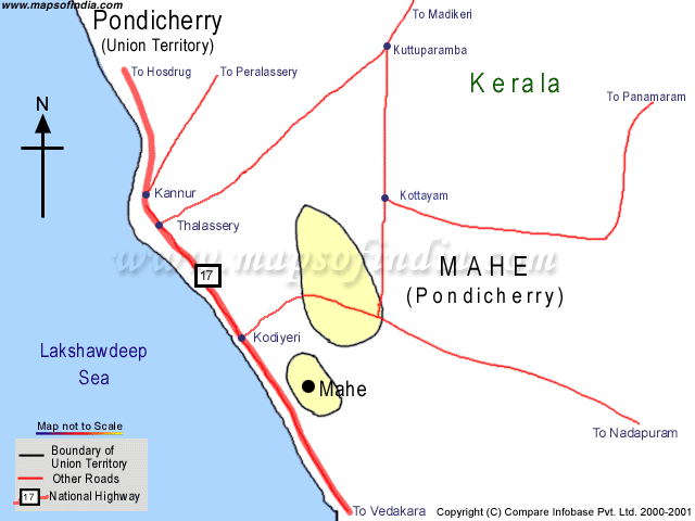
ROAD NETWORK MAP OF MAHE POCKET - PONDICHERRY
|
Mahe, another territory of pondicherry, share it's border with Kerala. It doesn't have any major roads but the other roads show there well connection with all other local places through NH-17.
|
|
| * Map showing the Road Network of the Mahe District. |
ROAD NETWORK MAP OF YANAM POCKET - PONDICHERRY
|
|
|
| * Map showing the Road Network of the Mahe District. |
Disclaimer : All efforts have been made to make this image accurate. However Mapping Digiworld Pvt Ltd. and its directors do not own any responsibility for the correctness or authenticity of the same.
|
Last Updated on : April 17, 2026