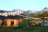
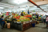
Sikkim's economy is mainly agrarian. It produces rice, cardamom, oranges, apples, and tea. It is also a mineral-rich state and has mines of copper, dolomite, limestone, graphite, mica, iron, and coal. It also has vast tourism potential. There are many hotels and guest houses to cater to the flourishing tourism industry. Apart from the contribution from tourism, the service sector also boasts of its real estate.
The languages majorly spoken in Sikkim are Nepalese, Sikkimese, Lepcha and English.
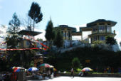
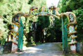
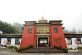
Over the years, Sikkim has become one of the states in India that is highly frequented by tourists. Some of the places that tourists should not miss out on visiting are Pemayangtse Monastery, Kanchendzonga National Park, Nathu La Pass, Tsango Lake or Changu Lake, Himalayan Zoological Park, Rumtek Monastery, Namchi, Khecheopalri Lake, and Phodong Monastery.
Major Towns and Cities of Sikkim
- Gangtok
- Gyalshing
- Jorethang
- Mangan
- Namchi
- Nayabazar
- Rangpo
- Rhenak
- Singtam
Hotels in Sikkim
Since tourists visit this state every year, Sikkim offers a list of hotels where you must stay. The scenic beauty you will be able to witness from the hotels is something you should see. Below is the list of some of the hotels.
- Summit Nam Nang Courtyard & Spa
- Summit Sobralia Resort & Spa
- Club Mahindra Gangtok, Royal Demazong
- The Golden Crest
- Summit Ttakshang Residency Hotel & Spa
- Norbu Ghang Resort
- WelcomHeritage Denzong Regency
- The Elgin Mount Pandim, Pelling
Best Time to Visit Sikkim
The average temperature in Sikkim is 28-degree centigrade. The best time that you can visit Sikkim is from March to June or from September to December. If you want to avoid getting stuck due to rains and landslides in the state, skip the rainy months.
How to Reach Sikkim
By Air:
distance of 124 km. You can also avail of the option of the helicopter to reach Gangtok, the capital of Sikkim. However, it depends on weather conditions.he nearest airport to this state is in Bagdogra, West Bengal, which is at a TBy Rail:
distance of 124 km. You can also avail of the option of the helicopter to reach Gangtok, the capital of Sikkim. However, it depends on weather conditions.he nearest airport to this state is in Bagdogra, West Bengal, which is at a TThe nearest railway station to Sikkim is in Siliguri, West Bengal. To catch the trains, you will have to travel a distance of (188 Km) from Gangtok.By Road:
Private and public vehicles are the best and easiest options to reach this beautiful state, which are available all through the day as well as night.Sikkim State Information (as per sikkim map) | |
|---|---|
| Capital | Gangtok |
| Date of formation | 16. May. 1975 |
| Governor | Shri Om Prakash Mathur |
| Chief Minister | Prem Singh Tamang |
| Tourist attractions | Tusklakhang, Namgyal, Deer Park, Orchid Sanctuary, Khabelstok |
| Festivals | Kanchendzonga, Lossong |
| Major dance and music forms | Khanchendzonga, Kali Topi Hat |
| Arts and crafts | Thangkas or religious scroll paintings depict scenes from Buddha's life; sand mandala; hand-knotted carpets. |
| Languages | English.Nepali, Sikkimese, Lepcha, and so on |
| Size | 7,096 sq. km |
| Population (Census 2011) | 607688 |
| Rivers | Teesta, Rangit |
| Forests and wildlife sanctuaries | Kanchendzonga NP, Fambong La WS |
| State animal | Red panda |
| State bird | Blood pheasant |
| State tree | Rhododendron |
| State flower | Noble dendrobium |
| Major crops | Maize, paddy, wheat, barley |
| Factoids | The highly endangered red panda is found in Sikkim. |
| Sikkim has around 200 monasteries or Gompas where red-robed lamas chant to drums, horns and trumpets. | |
| No. of District | 4 |
MOI.AB.28.01.17
Last Updated on : June 24, 2026