
Introduction
Champawat is a very peaceful district which is located in a remote corner of the hill state of Uttarakhand in India. Many people refer to it as the secret gem of Kumaon area for the lack of crowd at the other tourist spots it has to offer. At a high altitude it also gives you great views of the snow capped Himalayan peaks on a clear day.
History
The history of Champawat is a rich tapestry which plays out in the mountains of Uttarakhand. In the past this town was the preeminent in the area which it held as its capital for the Chand Dynasty. That dynasty which took to rule around the 10th century made Champawat a great center for art and politics. For many years the royal court here determined the fate of the Kumaon hills.
The Chand Dynasty kings were great builders which they put to use in stone architecture. They invited the best crafters to carve out beautiful temples from dark rock. The preeminent example is the Baleshwar Temple which is a symbol of their power. Today as you look at the fine details in the stone you can see how much the ancient rulers valued beauty and religion.
In the late 1700s the district’s history took a turn. In came the Gorkha forces from Nepal which took over the land. They were a small group but what they lacked in numbers they made up in bravery and also they brought in large scale changes to the local laws. Also they had a short rule which in intensity was very great. Later after a large scale war in 1815 the British took over the region. The British officers were very drawn to the mountain cool air of Champawat and they built many of the bungalows which we see today.
In the early 20th century we see the case of the “Champawat Tiger” which is a famous element of local history. A tigress at that time became very dangerous to the village populations. That led to the intervention of Jim Corbett, the famous hunter and writer. He tracked the tiger through the district’s dense forests. His books which chronicled these events made the wild terrain of Champawat known to readers world over.
For many years after independence India did what is today the Champawat which was a part of the Almora and Pithoragarh districts. But the town was growing and it was time for it to have its own administration which would in turn look after the mountain roads and schools. In 1997 the government went ahead and made it a separate district. This in turn put the local people in a better position to get what they needed from the government and transformed the town into a modern center for the hills.
Today in Champawat as you walk the streets it is as if you are turning the pages of a living history book. You see the ancient stone temples of the kings, the wooden structures from the Gorkha era, and the former British buildings. It is a place which honors its past as it steps into the future. The tales of the Chand kings are still related by the elders which in turn preserves the spirit of the old capital.
Culture
The culture of Champawat is a presentation of what it means to live in the mountains. It is a simple, honest way of life very much in tune with the gods and green hills. Here we have the Kumaoni people who welcome each as one of their families. They live by the season, in which joy is found in the simple things like a shared cup of tea or a local song.
In many communities what is very much a treasure of the local culture is a folk art which we know as Aipan. This is a form of ritual painting which mainly women practice which they do on the floors and walls of their homes. They use a natural red color called "Geru” for the base and white rice powder to create geometric designs. These pieces beyond just serving a decorative purpose are put out to invite in good luck and the blessings of the gods which is very much a part of the wedding and festival rituals.
Religion plays a central role in life in Champawat. We see that every hill has a small temple and every village has a local protector god. The people have very deep faith which is what keeps them going through the cold winters. In the case of the Bagwal festival we see great celebrations. At that time people come out in large numbers to sing, to pray, and to take part in traditional games which have been passed down for generations.
Music and dance are the ways people tell their stories. In the district the Choliya Dance is a famous performance. Men put on ancient warrior attires which are very colorful and move to the beat of large drums and trumpets. They carry swords and shields which they move in a way that looks like a royal battle from the king’s time. This dance brings to mind the brave history of the Kumaon region.
In Champawat the food is very healthy which is a result of using local produce. We see great love for Bhatt ki Dal and dishes which use Mandua flour. Also very popular is the “Singori” sweet which is a milk based confection wrapped in a frChampawatnt leaf. In the mountains we have a slow and easy go at sharing a meal which is a part of the day, as people sit together and chat about what went on in the fields or at the market that day.
The culture of the people also is put on display through what they wear. Women in the area wear the “Pichora” which is a traditional yellow and red stole worn out during holy events. It is a symbol which identifies a woman as a wife and is very respected. This mix of colorful clothes, rhythmic dances, and ancient art is what makes the culture of Champawat so alive. It is a place which is true to its roots even as the world around them changes.
Language
Language in Champawat which is a reflection of the simple and calm hill people. It is Hindi which is the primary language of the area’s offices, schools and markets. Most visitors find that they can talk easily with the local people as Hindi is spoken very clearly and politely in Champawat.
Apart from Hindi, in Champawat many people speak Kumaoni which is the local language of the Kumaon region. Kumaoni is used at home especially by elders and village folks. This language which also carries forward local stories, songs and traditional sayings has been passed down through the generations.
In the villages of Champawat district, children grow up hearing the two dialects Hindi and Kumaoni. At home, they are exposed to Kumaoni while at school Hindi is used. Thus which language they use goes along with what environment that they are in but overall it allows people to hold on to their culture and also do well with the modern languages.
English is also taught in Champawat's schools. Young students study basic English words and sentences. Also English is used in education which does not extend to everyday life or local markets.
Geography
Champawat’s geography is a mix of high mountains, dense valleys, and vast green forests. It is in the east of Uttarakhand at an altitude which ensures the air is ever so fresh and cool. This area is part of Kumaon Himalayas which also gives it a great deal of that which is almost endless rolling hills. It is a wild and at the same time a very peaceful rugged terrain.
In each zone of the district which has a different altitude the environment changes. At lower altitudes the weather is warm and there is a dense growth of Sal trees. As you go up into the mountains the landscape transforms totally. You will see that you are surrounded by Tall Pine and Deodar trees. These evergreen trees make the hillsides very lush at all times of the year, not just when it is raining.
In Champawat the soil is very much of the rocky variety which is a characteristic of mountain ranges. But the local people have turned this to their benefit by way of Terrace Farms which we may think of as giant green steps that they have built into the hillsides. Farmers there grow in these steps ginger, potatoes, and finger millet. It is a spectacular sight to see the hillsides which are filled in with that which is very organized and green.
The climate is a major player in our local geography. We have very pleasant summers which in turn sees many visitors come to get away from the heat of the plains. As for winter, the higher areas of the district including Abbott Mount see to it that we get a good cover of snow. This change in seasons brings about a different look to the landscape every few months from the bright green of monsoon to the dusty gold of autumn.
Water is all over in what we see of Champawat’s geography. We have the large Sharda River which is a feature but in addition many natural springs which we call Naulas that come out of the rocks. These springs give out clean, cold water to the villages. Also the hills put out many beautiful waterfalls which are within the deep forests. This mix of high mountains, running rivers and dense forests makes the geography of Champawat very unique.
| Facts of Champawat District | |
|---|---|
| State | Uttarakhand |
| District | Champawat |
| Area (km2) | 1781 |
| Currency | Indian Rupee (INR) |
| Religion | Mostly Hinduism, Islam |
| Language | Hindi, Kumaoni |
FAQs
Q1: Is Champawat famous for anything specific?
Yes, the Baleshwar Temple and the history of being the Chand kings’ capital are what the place is known for. Also it won fame world over through the stories of Jim Corbett which were about the Champawat Tiger.
Q2: Can from here I see the Himalayan peaks?
Absolutely. On bright days spots at Abbott Mount and Kranteshwar Mahadev present you with great views of the Himalayan range which is very much in the distance. Also the air is very clean which in turn makes the peaks appear very near.
Q3: What do I put on my plate that is the traditional food?
Try out Bhatt ki Dal (black soybeans) and Mandua Roti (millet bread). For sweets do not miss Singori, a milk based treat in a fragrant leaf.
Q4: Which places should I see nearby?
You should check out Lohaghat which is a nearby hill station and Advaita Ashrama at Mayavati. Also at Pancheshwar the river front is very nice for people who prefer quiet places and fishing.
Q3: Do people speak English in Champawat?
Most people use Kumaoni and Hindi, in which we have also seen many young residents and shopkeepers do speak some basic English. You won’t have great trouble in getting your basic communication across.
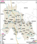
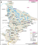
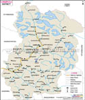
| Major Districts of Uttarakhand |
 |
 |
 |
 |
| Uttarkashi District Map | Dehradun District Map | Nainital District Map | Tehri Garhwal District Map |
 |
 |
 |
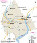 |
| Almora District Map | Pithoragarh District Map | Chamoli District Map | Haridwar District Map |
| other districts of Uttarakhand >> | |||
Last Updated on : May 08, 2026
| Buy this Map |