
Introduction
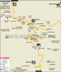
Nainital is a very popular hill station in India which is in the state of Uttarakhand. It is what they call the City of Lakes where we have a large pear shaped lake which is very pretty in the sun. It is a place which offers you fresh mountain air and tall green trees which cover the hillsides.
History
The history of Nainital is a blend of sacred myths and tales of colonial exploration. Before the roads were built the local people knew this place as a holy site. In the ancient Hindu legends it is said the lake was formed when the eye of Goddess Sati fell here as Lord Shiva was passing by. That is why the town is named “Nainital” Naini means eye and Tal means lake.
For many years the lake was unknown to the rest of the world which only the local herders and priests knew of. Dense forests and high mountains kept it a secret until 1841. Into that year a British sugar merchant by the name of P. Barron who was traveling the Kumaon hills reports to have come upon the beautiful blue lake. He was so taken by its beauty that he decided to build a home there and bring others to see it.
During the time of the British Raj this town became a social center for the elite. They developed the Mall Road and the Boat Club for their evening promenades and parties. Nainital was the spot for high level officials to get away from the hot weather of the Indian plains. Even after the British left in 1947 these old buildings and the European flavor of the town remained which gives it a very unique character.
In the present time Nainital has transformed from a private resort for the elite to a favorite of all Indian families. It became a hub for education and tourism in the hills. The town has managed to keep alive its past charm which is present in the old Governor’s House and the Victorian style street lamps. Today people visit not only for the water but to experience the history which breathes in every stone and tree around the lake.
Nainital’s history is unique in that it tells the tale of a sacred forest pond which became a world famous hill station. It is a story of faith, chance discovery, and careful development. Though today we have many new hotels, the tales of the Chand kings and the British explorers are still related by the elders.
Culture
Nainital’s culture is a blend of mountain heritage and old world style. The Local community which is known as Kumaonis are known for their simple way of life and warm disposition. As a large tourist destination the culture also has incorporated elements from the rest of India and British rule. What you see is a very welcoming atmosphere in which everyone feels at home whether you are a resident or a guest.
In the most artistic element of our culture we have Aipan which is a traditional folk art in which women use white rice paste to paint beautiful motifs on a red background. You will find these designs at entrances of homes and within temples during festivals and weddings. It’s not just decoration, rather a means to invite good fortune and prosperity into the home.
Music and dance play a large role in the everyday live of the hills. At local fairs which we call Mela you may see the Choliya Dance. In that performance men put on the costumes of ancient warriors and as they move to the sound of large drums they wave their swords and shields. It is very exciting to see, which also brings to mind the great history of the Kumaon region and its royal soldiers.
We see that people enjoy dishes which use local grains and lentils, like “Bhatt ki Dal” and “Kafuli” which are also very health conscious. Also for dessert we have Bal Mithai which is a must try, it is a brown chocolate type of sweet made from roasted milk and covered in white sugar.
Faith is a central element of the culture and the Naina Devi Temple is the spiritual core of the town. All year round there are large numbers of people who come to pray and to toll the temple bells at the Naina Devi Temple. The sound of those bells mixed with the lake’s water which surrounds the area creates a very special peace in Nainital. Also the local people have great respect for the lake which they see as a sacred gift.
Even today we see traditional silver jewelry and colorful head scarves worn at special events which are few and far between. The culture is that of a past which is very much alive and present in the present time which we embrace. It is a place where in the markets you will hear ancient folk songs and in each person’s heart the spirit of the hills lives on.
Language
In Nainital the language is a blend which presents its past as a mountain retreat and a popular tourist destination. The town’s spirit speaks Kumaoni which is the native language of the hill people. It is a soft musical language which has been handed down through song and story for hundreds of years. You will often catch the locals speaking Kumaoni at the tea stalls or in the quiet village streets.
While Kumauni is at the core, Hindi is the primary language used for everyday business. In that we are a tourist destination which sees people from all over India, Hindi serves as that connecting thread which brings us together. Shop owners, boatmen and hotel staff do very well in Hindi to put tourists at ease. Also it is in the official capacity and in schools that you see the preponderance of Hindi which in turn makes it the language you will hear the most of on Mall Road.
In the time of the British which saw the founding of many of Nainital’s renowned boarding schools, English took root there. Many local speakers do very well in it and you’ll see that most signs and menus are in Hindi as well as English. That makes it a cakewalk for international travelers to get around and explore the town. It is a place where three languages coexist very well.
In the bustling markets you’ll hear a mixed fun group of all these languages. People may start a sentence in Kumaoni and finish it in English or Hindi. This “melting pot” of languages is a show of how friendly and welcoming the culture of Nainital is.
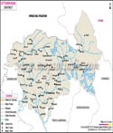
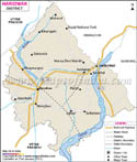
Geography
Nainital is a very beautiful hill station in Uttarakhand. It is in the Kumaon range of the Himalayas. The town’s average elevation is 2,000 meters above sea level. Also it is because of its height that Nainital has a cool climate through out most of the year.
In Nainital the famous Naini Lake is at the center. This is a pear shaped natural lake which is surrounded by green hills. Out of the town which extends to the town’s periphery the lake is at the heart of it. The lake brings to the geography of Nainital a charm and freshness.
High mountains encircle Nainital on almost all sides. The known peaks are Snow View, Naina Peak and Tiffin Top. These hills also present a great view of the Himalayas. Many visitors to Nainital report that they came just to see these scenic spots.
Forests cover major share of Nainital district. We see pine, oak and deodar in great number in this area. These forests provide Nainital with clean air and a peaceful setting. Birds and small animals live in the woodlands which surround Nainital.
In Nainital which has fertile soil for small scale farming we see people cultivate vegetables and fruits on hill slopes which they farm using terraces. In some areas of Nainital district apples, plums and peaches also do well. In Nainital farming is at the mercy of rain and local water resources. Farmers in Nainital base their production on rainfall and local water resources.
In Nainital roads wind through hills and over valleys. By road you get to see beautiful forests and mountains. Although in some areas the roads are narrow they connect Nainital to other parts of Uttarakhand.
In terms of location that is what which puts Nainital on the map as a popular hill station. Lake, hills, forests and cool climate together make Nainital a distinct place in Uttarakhand. Natural beauty is the core of Nainital’s charm.
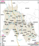
| Facts of Nainital District | |
|---|---|
| State | Uttarakhand |
| District | Nainital |
| Area (km2) | 3853 |
| Currency | Indian Rupee (INR) |
| Religion | Mostly Hinduism |
| Language | Hindi, Kumaoni |
FAQs
Q1: Which is the best time to visit Nainital for holiday?
The best time is in March to June which has cool and perfect weather for boating. As for those who love the snow, it is in December and January you should visit for the beautiful white landscape.
Q2: Can I see the high Himalayan peaks from that town?
Yes, at Snow View Point and also if you trek up to Naina Peak you can see them. On a fine day, we have reported that you can see the large ice covered peaks of Nanda Devi which look very beautiful.
Q3: What to try from the local cuisine in Nainital?
You should try the Bal Mithai, a local brown sweet that we dust with small white sugar balls. As for main meals, order “Aloo ke Gutke” which is a traditional Kumaoni spicy potato dish served with green chutney.
Last Updated on : May 08, 2026