
Introduction
The district has its administrative headquarters in the city of Haridwar that serves as a spiritual capital and also a developing city. The district belongs to Garhwal division and borders such districts as Dehradun, Pauri Garhwal and Saharanpur. Its geographic position as a gateway to mountainous Uttarakhand and flat-country north India, has traditionally placed it as a significant point of contact among the diverse cultures, trade routes, and religion.
The area is of great value in the Hindu religion. It is ranked among the seven most holy pilgrimage towns in India and every year it receives millions of pilgrims. The followers go there to take ritual baths in the Ganges as well as religious rites that had been performed for many centuries. The main event related to the district is the Kumbh Mela, a religious assembly of enormous size that is held regularly, and gathers pilgrims not only from India but also from other countries.
Besides the religious significance it has also turned out to be an industrial and educational hub in the past decades in the district. Development of industrial zones and education establishments in the region has helped in the economic development without losing the spiritual nature of the area. Small-scale industries, tourism, and agriculture are also beneficial to the local economy.
History
The history of Haridwar district is completely connected with the ancient religious customs and the overall history of the Indian subcontinent. Ancient Hindu writings (such as the Puranas and the Mahabharata) have stated that the region is a significant place to practice spiritual activities and pay pilgrimage to. It is believed that through traditionally held beliefs, sages and ascetics came to meditate along the shores of the holy Ganges.
Archaeology has proven that the area had settlements since ancient times. It was positioned along some of the major trade and pilgrimage paths, thus emerging as a center of exchange of travelers, merchants, and religious scholars. The pilgrims who came to visit the shrines located higher up in the Himalayan continued to pass by the region on their way to the mountains.
The region, in the early historical times, had several kingdoms to the North that dominated the Gangetic plains. It later on gained a connection with religious centers and temples which were of significant interest to pilgrims of the subcontinent. Among the best-known religious places in the area, Har Ki Pauri is an illustrious bathing pier, thought to indicate where Ganges meets the plains.
In the medieval period, there was also the impact of different local authorities or the conquests of larger empires, which controlled northern India. Even though the political power changed with the change of the dynasties, the religious significance of the region only increased. The pilgrimage activities were not stopped and temples and monasteries were being opened to host the visiting pilgrims.
The Mughal Empire also ruled over part of the sixteenth and seventeenth centuries. Even though the Mughal rulers controlled much of northern India, and maintained religious tolerance in cities without interfering much. Therefore, pilgrimage customs were not broken.
The region was colonized by the British colonial government in the nineteenth century as it was expanding its empire in India. During the British occupation, there was an introduction of administrative reforms and development of infrastructure. Relationships were also enhanced by building roads and railways to ease accessibility to the district by pilgrims and travelers.
In 1947 with the gaining of independence of India the region was included in the state of Uttar Pradesh. When the new state of Uttarakhand was established in the year 2000, the district was incorporated in it. It has since further evolved to be a religious destination as well as industrial and tourist attraction center.
Culture
Haridwar district is a major site of pilgrimage to Hinduism and this cultural life is strongly influenced by this fact. The social and cultural basis of the district is dominated by religious traditions, rites of passage and celebrations. Key to this is the fact that there are hundreds of temples, ashrams, and ghats that create an environment in which spirituality is a part of everyday life.
Evening Ganga Aarti ceremony at the Har Ki Pauri is one of the most popular cultural practices exercised in the district. Priests also come during this ritual, and they pray to the Ganges with the help of lamps, flowers, and incense, and at the same time, people who are devoted to it come to the riverbanks and take part in the ceremony. The view of the thousands of lamps drifting along the river over the sight radiates a spiritual ambiance that appeals to people who come to the area worldwide.
The other significant feature of this district culturally is pilgrimage festivals. Kumbh Mela is one of the largest religious congregations on earth which is periodically held in the district along with other religious cities in India. On this occasion, millions of pilgrims come to bathe in the Ganges on a ritualistic basis because they believe that the sacred waters will purify them of their sins as well as provide them spiritual merit.
Besides great festivals, there are smaller religious festivals that take place all year round. Ceremonies are performed in temples to different Hindu gods whereas ashrams are spiritual cleansing centers, where spiritual talks, meditations, and cultural events are held. The fact that spiritual teachers and religious institutions exist in the district helps in making the district a place of spiritual learning and practice.
There are also other aspects of cultural life such as music, devotional singing and storytelling. Kirtans and bhajans are very commonly sung in ashrams and temples and can be heard reverberating across the city and beyond. These musical cultures served to have religious doctrines maintained and unify the communities.
Language
The language in the Haridwar district is symbolic of the language diversity in the North of India. The language is mainly Hindi which is spoken in administration, education and daily communication. Since the district receives pilgrims and guests, who may be located at the other side of the country, Hindi is a unifying language, which helps people from various regions to communicate with each other.
Besides Hindi, a number of regional dialects are also used in the rural regions of the area. Garhwali is the language that is linked with Garhwal in the Uttarakhand region, it is widely spoken by the people of the area. It has unique words, accentual sounds which are hinged to the cultural traditions of the Himalayan territory.
The presence of Urdu in the district is also there, specifically part of the communities as well as in culture and literature. Urdu poetry and literature has had an impact in various regions of northern India and the language is still valued in the religious and the cultural contexts.
There is an increasing use of English in education, tourism and business. Numerous learning institutions are available in the district, which provide teaching in English and the services that are related to tourism usually make use of the English language when communicating with visitors who come from various parts of the world.
Due to the fact that the district is popular among pilgrims that represent all parts of India, one can hear lots of other languages in markets and temples. There are religious festivals during which visitors who have common languages like Bengali, Gujarati, Tamil and other regional languages visit the district often.
Geography
One of the most defining features of the Haridwar district is the geographical location of this area. The district is situated in the junction of the Himalayan foothills and the plains of the vast India that are present to the north. This is a transitional site making the area have a diverse climate that has rivers, forests, hills, and arable farmland.
The largest geographical aspect of the district is Ganges River that passes across the territory after descending from the Himalayas. The river is not just a source of important water in agriculture and day to day activities, but also a religious symbol in Hindu religion. The various ghats and temples constructed in the banks will serve the purpose of accommodating the pilgrims in performing ritual bathing and religious rituals.
The Shivalik hills used to determine the northern side of the district, which gives a natural passage between the mountain and the plains. These hills have forests with diverse species of animals and plants. There are sections of the district that are situated close to the protected natural habitat like Rajaji National Park that is characterized by wildlife as well as beautiful landscapes.
The district climate is considered to be subtropical. Summers are hot, and the temperatures can easily go above 35°C, whereas winter is relatively cool and friendly. Rainfalls are very heavy and the monsoon period covers the period between June and September and it recharges the rivers and ground water sources.
Transport networks link the district to the large cities in north India. The city of Haridwar is connected to other cities and cities like Delhi and Dehradun through railway lines and highways. These links allow pilgrims, tourists and goods to pass through the region easily.
Its active centuries-long evolution is determined by the fact that the district is of the union of sacred rivers and fertile plains, forested hills, and a strategic location. Geography still determines the economic process and the way of settlement, and the culture of life in the area
FAQs
Q1: What is so remarkable about the district at the time among tourists and pilgrims?
The area is known to have strong religious meaning in the Hindu religion. Pilgrims come to bathe in the Ganges and to have the much renowned evening prayer service at Har Ki Pauri. There is also the large Kumbh Mela which is one of the largest religious get-togethers in the globe and is held in the district.
Q2: When is the most convenient time to pay a visit to the district?
The period is most appropriate during October and March when the climate is cool and comfortable to tour around. Tourists are able to visit temples, ghats, and local hills without the extreme heat experienced in summer.
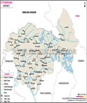
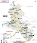
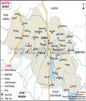
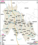
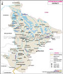
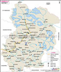
| Major Districts of Uttarakhand |
 |
 |
 |
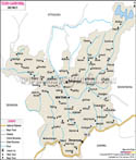 |
| Uttarkashi District Map | Dehradun District Map | Nainital District Map | Tehri Garhwal District Map |
 |
 |
 |
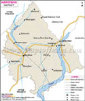 |
| Almora District Map | Pithoragarh District Map | Chamoli District Map | Haridwar District Map |
| other districts of Uttarakhand >> | |||
Last Updated on : May 08, 2026
| Buy this Map |