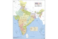
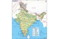
On 17th August 1947 the Radcliffe Line was declared as the boundary between India and Pakistan, following the Partition of India. The line is named after Sir Cyril Radcliffe who was commissioned to equitably divide 4,50,000 km sq of territory with 88 million people.
The idea behind the Radcliffe Line was to create a boundary which would divide India along religious demographics, under which Muslim majority provinces would become part of the new nation of Pakistan and Hindu and Sikh majority provinces would remain in India.
The Indian Independence Act 1947 of the Parliament of the United Kingdom which came into force on 15th July 1947, stated that India would be free from British rule on 15th August 1947, exactly a month from then. The act also agreed on the Partition of the provinces of British India into the two new nations of the Union of India and the Dominion of Pakistan (which would further be divided into the Islamic Republic of Pakistan and the People’s Republic of Bangladesh). Pakistan was intended to be a homeland for Indian Muslims and India with a Hindu majority was to be a secular nation.
Before Partition, 40% of India was covered by princely states which were not British possessions and hence were not part of British India. Hence, the British could neither give them independence, nor partition them. The rulers of these states were therefore, fully independent and had to choose which of the two nations they wanted to join (or if they wanted to remain independent). However, all the rulers swiftly decided to join India or Pakistan, though only a small number did not.
Since the Partition of India was done on the basis of religious demographics, Muslim majority regions in the north of India were to become part of Pakistan. Baluchistan and Sindh (which had a clear Muslim majority) automatically became part of Pakistan. The challenge however, lay in the two provinces of Punjab (55.7% Muslims) and Bengal (54.4% Muslims) which did not have an overpowering majority. Eventually, the Western part of Punjab became part of West Pakistan and the Eastern part became part of India (Eastern Punjab was later divided into three other Indian states). The state of Bengal was also partitioned into East Bengal (which became part of Pakistan) and West Bengal, which remained in India. After Independence, the North West Frontier Province (located near Afghanistan) voted with a decision to join Pakistan.
Since the population of Punjab was scattered, it was difficult to draw a line which would clearly divide Hindus, Muslims and Sikhs. Similarly, no line drawn was favoured by the Muslim League headed by Jinnah, nor the Congress headed by Nehru and Sardar Patel. Hence, it was decided that what was required was a well drawn line which would reduce the separation of farmers from their fields, while also minimizing the number of people who would have to relocate, hence reducing the feeling of alienation, which a new place brings to people.
A rough border of sorts had already been drawn by Lord Wavell, the Viceroy of India, before he was replaced by Lord Mountbatten in February 1947. In June 1947, Britain commissioned Sir Cyril Radcliffe to head the two Boundary Commissions (one for Punjab and the other for Bengal), to determine which territories will be assigned to which nation. The Boundary Commission was asked to demarcate areas in Punjab based on religious majority. While defining the boundary, Radcliffe also took into consideration “natural boundaries, communications, watercourses and irrigation systems”, while paying heed to socio-political affairs. Each Boundary Commission had four representatives, two from the Congress and two from the Muslim League and given the tension between the both, the decision regarding the boundary ultimately lay with Radcliffe.
Radcliffe arrived in India on 8th July 1947 and was given five weeks to work on the border. Upon meeting with Mountbatten, Radcliffe travelled to Lahore and Kolkata to meet his Boundary Commission members, who were primarily Jawaharlal Nehru representing the Congress and Muhammad Ali Jinnah representing the Muslim League. Both parties were keen that the boundary be finalised by 15th August 1947, in time for the British to leave India. As requested by both Nehru and Jinnah, Radcliffe completed the boundary line a few days before Independence, but due to some political reasons the Radcilffe Line was only formally revealed on 17th August 1947, two days after Independence.
Also on This Day:
1780: Philip Francis and Warren Hastings fought a gun duel. Francis was shot, but survived. Hastings escaped unhurt.
1909: Indian revolutionary, Madan Lal Dhingra was hanged in Pentonville prison for Wyllie and Lalkaka murders.
1947: After the Independence of India, the first contingent of British troops sailed for home.