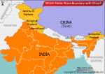
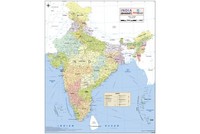
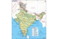
The beautiful north-eastern mountainous state of Nagaland came into being on December 1, 1963. A complicated (and at times contested) series of events over 150 years culminated in Nagaland becoming the 16th state of the Indian union.
Much of the area that is currently Nagaland and Assam came under Burmese rule in 1816. Ten years later the British East India Company took over Assam and started steadily expanding its control over the Naga Hills. Since the Nagas, as the tribes of Nagaland are collectively known, had little recorded history, knowledge about them before the British era is limited.
According to some accounts, the Nagas belong to the Indo-Mongoloid group, and migrated from the east. References to tribes that could possible include the Nagas appear in Vedic and other ancient texts such as the Yajurveda, hundreds of years before Christ, and the people are referred to as ‘Kiratas’. When the Ahoms (who would rule for six centuries and give Assam its name) arrived in the area in the 13th century, the Nagas were already masters of the hills.
Traditionally, the Nagas are Animists. According to the belief systems of Naga Animism, while there is one supreme god who is on the side of humans, there are several evil spirits that bring bad luck and misfortune such as illnesses. The Naga tribes speak several languages and there are differences in their customs and attire as well. For a millennia they lived in relative isolation that ended partly with the coming of British missionaries.
The Nagas resisted initial British attempts at controlling their territories.
In 1866, however, the British set up a district headquarters at Samaguting (near Dimapur), which was shifted to Kohima in 1878. While large parts of Naga territories were now administered by the British, some tribes in the east remained ‘free’. The British tried to follow a policy of ‘least interference’ when it came to the Nagas’ unique community life and customs.
In the 1870s, the British brought out the Bengal-Eastern Frontier Regulation, under which people from the plains (except Christian missionaries) were disallowed from entering Naga areas. By the end of the 19th century, Naga areas were politically a part of Assam. Nearly all Naga tribes converted to Christianity. Currently, over 90% of the population of Nagaland is Christian, most of them Baptists.
One effect, perhaps unexpected, of the tribes’ conversion to Christianity was that inter-tribal rivalry decreased and the Nagas became more united. A significant phase in their political consolidation occurred during World War 1 when hundreds of Nagas from various tribes were sent to France to work as aides on the allied front. This group on its return to India organised themselves along modern, political lines, something alien to traditional Naga culture. A ‘Naga Club’ was formed at Kohima that brought together some government officials and important Naga chiefs and provided a common platform for various tribes.
After 1935, following recommendations of the Simon Commission, the Naga Hills, declared as an ‘Excluded Area’, continued to be administered by the Government of Assam.
World War 2 would prove to be a dramatic time for the Nagas, with Japan bringing the war into the heart of what is now Nagaland. Fought in phases between April 4 and June 22, 1944, the Battle of Kohima started with Japanese attempts to capture Kohima ridge, followed by a counterattack by British and Indian forces. Though Japanese troops abandoned the ridge, they continued their siege of the Kohima–Imphal road, which finally ended on June 22. In 2013, the British victory over Japan at the Battle of Kohima was chosen as Britain’s greatest battle.
After India became independent, the Naga areas continued to be a part of Assam province. Some Naga nationalist groups stepped up their demand for a political entity comprising several Naga-populated areas. The Naga National Council was at the forefront of such campaigns. With the situation turning violent, the central government decided to send in the Army in 1955. Eventually, talks between the central government and Naga tribes led to the formation of the Naga Hills Tuensang Area (NHTA), comprising the Naga Hills of Assam and the Tuensang frontier. The NHTA was made into a union territory but there was more unrest in the area.
In April 1962, the Nagaland Security Regulation, 1962, for the suppression of subversive activities, maintenance of essential supplies and services and control of military requirements was passed. In August 1962, a bill was moved in the Indian Parliament for creating a state of Nagaland. Indian President Sarvepalli Radhakrishnan inaugurated the state of Nagaland at Kohima on December 1, 1963.
The state has 11 districts — Kohima, Mokokchung, Wokha, Phek, Tuensang, Zunheboto, Kiphire, Mon, Dimapur, Longleng and Peren. According to the 2011 census, Nagaland’s population is around 20 lakh. Nagaland has 16 major tribes — Ao, Chakhesang, Angami, Dimasa Kachari, Chang, Konyak, Kuki, Lotha, Pochury, Rengma, Sangtam, Sumi, Zeliang, Yimchunger, Phom and Khiamniungan.
Though Nagaland became an Indian state, bringing normalcy to the area has not been easy. Reflecting on the problems in Nagaland and the Indian state’s various interventions, the political commentator and journalist Bharat Bhushan wrote in 2002 in The Telegraph: “[T]he willingness of the government of India to look beyond Article 370 in Kashmir has also created a context in which it may enter the process of political negotiations with the Nagas with wider options…It remains to be seen how creatively New Delhi can balance the need for maintaining the unity and integrity of the Indian nation with the sensitivities of the states which claim that the integration of Naga areas threatens their integrity.”
Also on this day:
1954 — Medha Patkar, social activist, was born
1965 — Border Security Force was established
1980 — Mohammad Kaif, Indian cricketer, was born
1990 — Vijaya Lakshmi Pandit, Indian diplomat and politician, passed away