On 1st September 1947 the Indian Standard Time (IST) was introduced as the official time for the whole country.
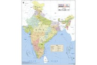
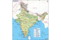
The Indian Standard Time is observed throughout India, with a time offset of UTC+5:30. This means that India is five and a half hours ahead of Greenwich Mean Time. Unlike other countries, India does not observe Daylight Saving Time. Indian Standard Time is computed on the basis of 82.5 degrees East longitude from a clock tower in Mirzapur near Allahabad, as it near the corresponding longitude reference line.
Earlier in the 4th century CE, an astronomical treatise “Surya Siddhanta” had mentioned about Standard Time in India. Assuming to which, the earth is spherical. The book outlined that the Prime Meridian passed through Avanti (ancient name for the city of Ujjain) at 23°11′N 75°45′E and Rohitaka (ancient name for Rohtak) at 28°54′N 76°38′E. The book also elaborates that Rohatika and Avanti are situated on a line which passes through the Equator (76° E) and the North Pole.
A sidereal day in ancient India began with sunrise at the Prime Meridian in Ujjain and then was divided into smaller time units. Despite these early advancements standard time was not used other than in astrology. In ancient India, kingdoms used Hindu calenders to keep their own local time. An early example of this is the Jantar Mantar constructed by Maharaja Sawai Jai Singh in 1733 in Jaipur which has large sundials (up to 90 feet high) which were used to accurately calculate local time.
The Madras Observatory was established by the British East India Company in 1792 primarily because of the efforts of Michael Topping, a sailor and astronomer. In 1802, the first official astronomer of the British East India Company, John Goldingham established the longitude of Chennai as 13°5′24″N, 80°18′30″E, which was five hours and thirty minutes ahead of Greenwich Mean Time. This was the first time that a current time zone had been used. Following this, as opposed to earlier when a day would begin at sunrise, a day now began at midnight.
Despite this, most towns and cities continued using their own local times until the introduction of the railways in the 1850’s. This was when it became crucial to have a unified time zone. Being the headquarters of the most important presidencies of British India, Mumbai and Kolkata time assumed importance and began to be adopted by nearby provinces and princely states.
In the 19th century, the railways began to synchronize their clocks through a time signal which would be sent by the head office at a specific time every day. The International Meridian Conference in Washington DC in 1884 established uniform time zones for across the world. Accordingly, India would have two time zones; Kolkata using the 90th East Meridian and Mumbai the 75th East Meridian. Kolkata time was set 5 hours, 30 minutes and 21 seconds in advance of the Greenwich Mean Time and Mumbai time was 4 hours, 51 minutes ahead of Greenwich Mean Time.
By the late 1880’s the railways had begun to use the Madras Time (which had come to be known as Railway Time) as an intermediate between the two time zones. Another time zone, the Port Blair Time Zone was established, which was 49 minutes and 51 seconds ahead to the Madras Time.
It was not until 1905 that British India adopted standardized time zones. The meridian passing east of Allahabad was picked as the central meridian for India. This came into force on 1st January 1906, though Kolkata and Mumbai maintained their own time zone until 1948 and 1955, respectively.
After Independence, on 1st September 1947, the Indian Government declared the Indian Standard Time as the official time for the entire country (except Kolkata and Mumbai which were to maintain their own time zones for some time to come). The Central Observatory was moved from Chennai to Mirzapur so that it would be closer to the UTC+5:30. Though India does not observe Daylight Saving Time, it was observed briefly during the Sino-Indian war in 1962 and the Indo-Pakistani wars in 1965 and 1971 respectively, so that energy consumption by civilians would be reduced.
Also on This Day:
1858: Court of Directors of the East India Company held its last meeting in the East India House in London.
1942: Indian National Army was founded by Rash Behari Bose.
1956: Pakistani forces crossed the ceasefire line in Kashmir.