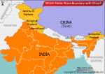
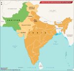
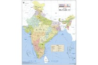
Nestled in the lap of the great Himalayan range, Himachal Pradesh, India’s 18th state, came into being on 25 January 1971. Bordering the Indian states of Jammu & Kashmir, Punjab, Haryana and Uttarakhand and the Tibet Autonomous Region, Himachal Pradesh has an area of 55,670 square kilometres and a population of around 7 million (2011 census).
The history of the region that now constitutes Himachal Pradesh goes back to more than 2,000 years before Christ. Ancient tribes such as the Koilis, Dagis and Khasas lived here in pre-historic times. Much later several local chieftains developed their areas of influence in the region. Some of these rulers included Rajputs. Though many of these small kingdoms were captured by the Delhi Sultanate, they maintained a substantial degree of independence in their internal affairs.
After the 15th century they came under the overall control of the Mughals. In the late 18th and early 19th centuries, the Gurkhas of Nepal captured Sirmour and Shimla, but were unable to take over Kangra fort, which was under the Sikh ruler Maharaja Ranjit Singh.
In 1817 the Maharaja of Patiala, who had aided the British in the Anglo-Nepalese War (1814–16), was rewarded with land around the present-day Shimla. Two years later Lieutenant Ross, a key British official in charge of the hill states, built a cottage in Shimla. Another official, Charles Kennedy, built the town’s first proper house.
Shimla’s cool climate attracted British officers oppressed by the Indian summer and it became a preferred holiday destination for them. In 1863, John Lawrence, the then Viceroy of India, shifted the ‘summer capital’ of British India to Shimla. The Kalka-Shimla rail line was built in 1906.
During the 1857 revolt the hills were quiet, seemingly unaffected by the turmoil in the plains. The hill rulers helped the British in their World War I campaign.
After Independence, several small princely states in the hills were integrated and the Chief Commissioner’s Province of H.P. was established.
In 1959 the Himachal town of Dharamshala became recognised on the world map after the most famous Tibetan exile, the Dalai Lama, and his supporters settled in the upper reaches of the town called McLeodGanj. In 1960 the Tibetan “government-in-exile” was established. Besides being the official residence of His Holiness the Dalai Lama, McLeodGanj is home to many Buddhist monasteries. It is a spiritual centre for Tibetans from around the world and in recent decades has emerged as a popular tourist destination as well.
Given the distinct identity of the hill regions, there was a natural progression towards forming a separate state after 1947. With the enactment of the Punjab Reorganisation Act, 1966, several areas such as Shimla, Kangra, Lahul & Spiti, and Una became part of Himachal Pradesh. The State of Himachal Pradesh Act was passed on 18 December 1970, and the new state was born on 25 January 1971.
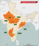
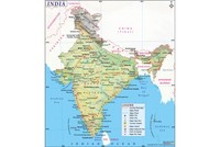
Himachal Pradesh has 12 districts — Shimla, Solan, Hamirpur, Mandi, Bilaspur, Kangra, Chamba, Lahaul & Spiti, Una, Kinnaur, Sirmaur and Kullu. The city of Shimla in the Shimla district is the state capital.
The state has emerged as a major tourist destination both for Indian and foreign travellers. Besides Shimla and Dharamshala, the popular tourist places include Kullu, Manali, Kangra, Mandi, Chamba, Chail, Kasauli and Dalhousie. Named after a British governor general and perched on five hills in western Himachal, Dalhousie has beautiful trees like pines, deodars and oaks, and some of the oldest churches in the area. The hill station also offers stunning views of the Chamba Valley and Dhauladhar Range.
Located at end of a valley on the National Highway that goes to Leh, and arguably the most popular destination in Himachal, Manali is defined by the striking views of snow-capped peaks, the Beas River, and thousands of young couples who make it their honeymoon-destination. Kullu, the ‘Valley of Gods’, located by the Beas in the lower Himalayas, is famous for its temples, festivals, handicrafts and apples.
Tourism and rapid development have, however, put the state at a crossroads. Many tourist destinations were for centuries quiet hamlets with an unhurried way of life. One has to now travel beyond the tourist circuit to discover that side of Himachal.
Still, Himachal Pradesh remains a peaceful state with low crime-rate and good social indicators. The future of this beautiful Himalayan state will depend on an ecologically sensitive tourism and a philosophy of development that heeds the real needs of its people.
Also on this day:
1824 — Michael Madhusudan Dutt, Bengali poet and dramatist, was born
1862 — Ramabai Ranade, social worker and pioneering women’s rights activist, was born
1958 — Kavita Subramaniam, Indian film playback singer, was born
1988 — Cheteshwar Pujara, Indian cricketer, was born