Last Updated : March 31, 2026
Places to Visit in Patna
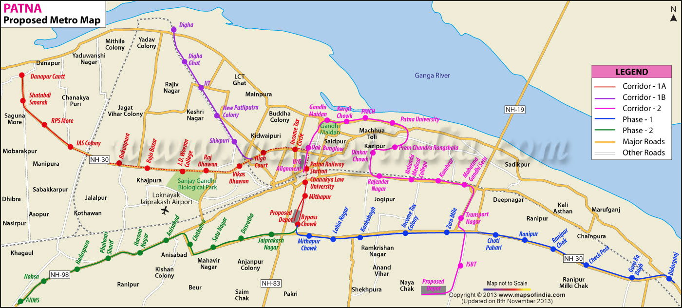
Patna Metro Map |
*Map showing the proposed Patna metro routes.
Disclaimer: All efforts have been made to make this image accurate. However Mapping Digiworld Pvt Ltd and its directors do not own any responsibility for the correctness or authenticity of the same.
In 2011, Planning Commission of India under UPA Government approved the plan for a rapid transit system in Patna. Patna Metro Rail Corporation, a PPP entity, will look after the operations and functioning of the Patna Metro system. According to the proposed plans, the metro services will be available to the commuters in two corridors, and work will begin as public-private-partnership entity. The CM of Bihar Nitish Kumar is hopeful of beginning the project as soon as possible, with the state government submitting detailed project report (DPR) according to the new guidelines issued by the Central Government. The Phase-I of proposed Patna Metro will cover 31 km distance from Mithapur Bus Stand to Saguna Mor via Bailey Road and Patna Junction, while the second phase will connect Patna Junction to bus stand at Bairiya via Ashok Rajpath, Gandhi Maidan and Rajendra Nagar.
Last Updated : March 31, 2026 Places to Visit in Patna
|