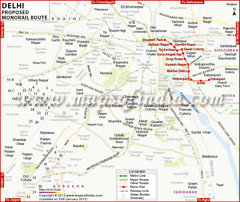
Delhi Monorail Route Map


Route Map of Delhi Monorail

separator Click here for Customized Maps arrow custom map
Route Map of Delhi Monorail
Email Buy Now 
*The Map Showing the Proposed Route of Delhi MonoRail. Disclaimer


The Delhi government has proposed to launch a mono rail or light rail system in Delhi by the year 2021. This rail system will be integrated with the Delhi Metro and the DTC bus network. Operational corridors for this mono rail system have been identified and the responsibility of implementing this light rail plan lies with the DIMTS Ltd.

There are three proposed lines and phase 1 phase one will include the following routes:
  • Rohini Sector 21 to Red Fort via Wazir Pur - Shakti Nagar - Anand Parbat - Ajmeri Gate - Delhi Gate (Delhi). The length of this line would be 28.5 km.

  • From Kalyanpuri to Pul Mithai via Scope Minar - Geeta Colony - Shanti Van - Red Fort - Old Delhi Railway Station. The length of this line would be 15.5 km.

  • From Gulabi Bagh to Delhi University via Shakti Nagar - Kamla Nagar - Guru Teg Bahadur Road. The length of this line would be 3.8 km.
There are other lines for the monorail that are in the pipeline too, such as:
  • Badarpur to Mehrauli

  • Qutub Minar to Dwarka (via Vasant Kunj and IGI airport)

  • Saket to IG Stadium, via Siri Fort, South Extension, JLN Stadium and New Delhi Railway Station.
This is a low cost, eco friendly rail system which will help ease traffic congestion, reduce pollution and also ensure pedestrian safety.


Last Updated on : 1 March 2013