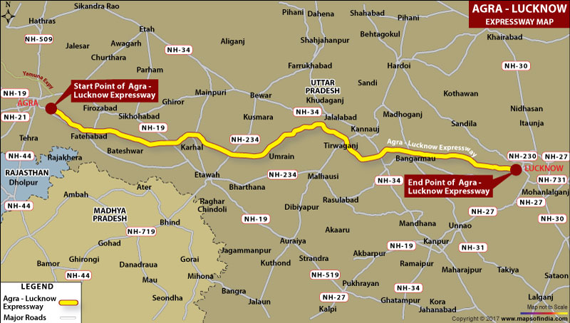
Implemented under Engineering Procurement and Construction (EPC) mode, Agra to Lucknow Access Controlled Expressway (Greenfield) Project has been implemented with the strategy that it not only helps the travelers reach any of the destinations among the two on time, or even lesser time than the usual, but will also open opportunities for Industrial as well Urban development.
It is a 302 km long Expressway which connects many districts of Uttar Pradesh such as Agra, Firozabad, Mainpuri, Etawah, Auraiya, Kannauj, Kanpur Nagar, Unnao, Hardoi and Lucknow. It connects the state capital as well as the national capital. Currently a 6-lane, it can be expanded up to 8-lanes. Drivers can maintain speed of 120 kms per hour. It starts at the the Agra inner Ring Road and ends on SH-40, outskirts of Lucknow.
Last Updated on : January 20, 2026
