
Originally, Pune was called as Punawadi and became a town since 847 AD. The city also turned as an important political centre in 1730. It also was a cantonment town after the British India took over this city in 1817. It was also the Bombay Presidency's 'monsoon capital' until India's independence.
Today, this city is well-known for its educational prosperity and facilities. The city is rich in cultural activities which include classical music, theatre, spirituality, literature and sports. These spectacular activities and various opportunities for job attract many people and students from not only India, but also abroad. Pune has also been ranked as the 'Gamma- Global City'.
Pune Roads
Pune has excellent road connectivity to various cities and states in the country. Pune has both private and public transport available for the commuters. To reach Pune from other cities, one can prefer the national highways or the state highways. National Highway 4 (NH 4) connects to Mumbai, Kolhapur and Bangalore. NH 9 connects to Hyderabad, and NH 50 connects to the grape-city Nashik. The state highways connect Pune to Aurangabad, Ahmednagar and Alandi.
Two intra-city highways - National Highway 4's part Katraj-Dehu Road Bypass and old Pune-Mumbai Highway - serve Pune. NH 50 that connects Nashik City and Pune will be part of Nashik-Pune-Mumbai, which is popularly called as the golden triangle.
India's first Expressway, Mumbai-Pune Expressway, can be clearly seen from the hill-station Khandala. This is the first six-lane high-speed expressway in India, which was constructed in 2002. It is because of this expressway that Mumbai-Pune travel time has reduced to almost two hours. To manage heavy traffic, a ring road is also being planned.
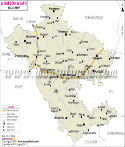
href="https://www.mapsofindia.com/maps/maharashtra/roads/buldhana.htm">Buldhana