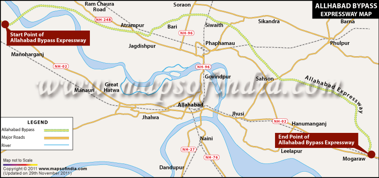
The 85 kilometer long, four- lane dual carriageway expressway is the longest bypass in the country. It was inaugurated in 2009 and built by the National Highway Authority of India. The World Bank has funded the project.
The NH 2, which is the historic Grand Trunk Road built by the Shershah Suri connects Delhi to Kolkata in West Bengal and passes through the states of Haryana, Uttar Pradesh, Jharkhand and Bihar. It is one of the longest and the busiest highway in the country.
The NH 2 passes through Allahabad city in UP and is one of the most crowded roads at this junction with only two lanes. The Allahabad bypass starts at Kokhraj on the NH 2 and ends at Handia, running north of Allahabad city. The traffic from the industrial town of Kanpur to the major tourist town and religious pilgrim point Varanasi does not have to pass through the crowded NH 2 at Allahabad and can instead take the bypass thus reducing travelling time and avoiding traffic blocks. While coming from Varanasi the bypass is 93 kilometers away and while coming from Kanpur the bypass is at 149 kilometers from the city exit.
The bypass, built on an embankment along agricultural land passes through a scenic route different from that of the NH 2. Apart from the reduced travelling time, it also makes for an enjoyable road travel on a gently curving road.
Last Updated on : January 20, 2026
