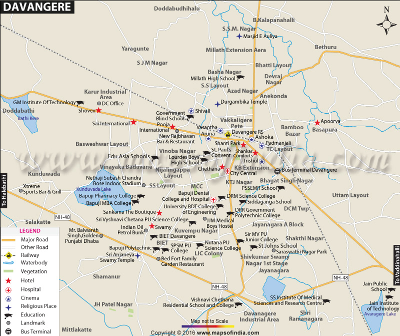
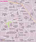
Davangere is geographically located at 14° 31' N and 75° 58' E and is about 602 m above the sea level. It is situated in the Maidan region of the Deccan Plateau and is surrounded by other districts such as Shimoga, Chitradurga, Haveri and others. It lies on the national highway (NH-4), which is a part of the network of the Golden Quadrilateral. The population of the city is 4,34,971 as per the 2011 Census and it spans over an area of 68.63 sq km.
It is famous for the delectable Karnataka dishes and culinary traditions and Benne Dose, which is a traditional dosa that originated in Davangere. The city has a mix of south and north Karnataka cuisines. 'Guladiki unndi' is a unique sweet dish that is only available in Davangere. It is also a major trading centre of Karnataka. With the presence of numerous cotton mills, it is also referred to as the "Manchester of Karnataka". Due to substantial connectivity to the rail and road networks, it gets ample opportunities for trade. Crops like cotton, rice and sugarcane are also traded in Davangere.
There are many higher educational institutions in the city; most of which are run by Bapuji Educational Association and other similar institutions. There are number of colleges that offer courses in the field of humanities, science and commerce. Besides these, there are two dental colleges, two medical colleges, three engineering colleges, one fashion designing college and one ayurveda college in this region. It also houses some cricket and football clubs that offer sports training to students.
Davangere is well-connected to Mumbai, Bengaluru, Chennai, Pune and Goa via NH-4. The buses by the Karnataka State Road Transport Corporation (KSRTC) connect it to Chennai and Bengaluru. Davangere Railway Station falls under the Southern Western Railway Zone. The nearest airport to the city is Hubli Airport, which is at a distance of about 143 km.
There are many places of interests for the tourists in Davangere. Some of such places are as follows:
- Lingeshwara Temple
- Bathi Gudda
- Durgambika Temple
- Subramanya Temple
- Shri Ram Mandir and Navagraha Temple
- Kondajji
- Anekonda
- Punyasthala
- Shanthi Sagara
WBST240315
WBVDA
Last Updated on : January 14, 2026
| Find Distance from Davangere to other Indian Cities | |||
