
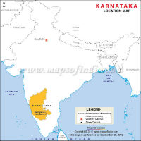
Karnataka Location Map

Karnataka Map

Karnataka Travel Map
About Karnataka
Karnataka is one of the well-known states in South West India. Originally, it was known as State of Mysore but was renamed Karnataka in the year 1973. Bangalore is the largest city, and also the capital of this state. The state is surrounded by Laccadive Sea or Lakshadweep Sea and Arabian Sea in the west, Maharashtra in the northern side, Goa in the north-west side and Andhra Pradesh and Telangana in the eastern side. It is also surrounded by Kerala in south-west and Tamil Nadu, in the south-east side. Karnataka is the 6th largest state in India by population. The state has 30 districts. Kannada is the official and extensively spoken language of this state. Other languages that are spoken in this state are Konkani, Tulu and Hindi.
According to the 2018 Census, the population of the state is 6.87 Crore. It is a popular destination in the southern part of India among the tourists. The main religion in this state is Hindu. In addition, there are also other religions that constitute the population. It includes Muslims, Christians, Jains and Tibetan Buddhists. The two river systems in this state are Krishna on the north and Kaveri in the south. Several etymologies are suggested for naming this state. However, the state derives its name from the two words Karu and Naru that means 'elevated land'.
Facts on Karnataka | |
|---|---|
| Official Website | www.karnataka.gov.in |
| Date of Formation | Nov 1, 1956 |
| Area | 191,791/km2 |
| Density | 319/km2 |
| Population (2011) | 61,095,297 |
| Males Population (2011) | 30,966,657 |
| Females Population (2011) | 30,128,640 |
| No. of District | 30 |
| Capital | Bengaluru |
| Rivers | Arkavati, Sharavati, Malaprabha, Hemavati |
| Forests & National Park | Bandipur NP, Nagarhole NP, Mudumalai NP |
| Languages | Kannada, Tulu, Hindi, Bengali, Mahl |
| Neighbours State | Maharashtra, Goa, Kerala, Andhra Pradesh, Telangana, Tamil Nadu |
| State Animal | Elephant |
| State Bird | Indian Roller |
| State Tree | Sandal |
| State Flower | Lotus |
| Net State Domestic Product (2011) | 60946 |
| Literacy Rate (2011) | 75.36% |
| Females per 1000 males | 968 |
| Assembly constituency | 224 |
| Parliamentary constituency | 28 |
History
The history of the state dates back to the hand-axe Paleolithic culture that is proved by the discoveries of cleavers and hand axes in this region. The evidence of Megalithic and Neolithic culture was also found in Karnataka. The gold that was found in Harappa was imported from the mines in this state. It encouraged scholars and researchers to assume contacts between Indus Valley civilization and ancient Karnataka. Before 3rd century BCE, a large part of this state was a part of Nanda Empire. After that, it became a part of the Mauryan Empire. The rule of Satavahana for 4 centuries followed that allowed them in controlling the bigger areas of this state. After the failure of Satavahana, the growth of native kingdoms like Western Gangas and Kadambas followed that marked the emergence of the political entity of this region. Mayurasharma founded Kadamba Dynasty having the capital in Banavasi. In the year 1565, Karnataka and various parts of South India has experienced a geopolitical shift. After India attained independence, Jayachamarajendra Wodeyar, who was a Maharaja, allowed the accession of his kingdom to India. Mysore became the state of India in the year 1950. The industrial visionaries like Mokshagundam Visvesvarayya play a crucial role in the growth and development of the industrial and manufacturing base of Karnataka. Read More ...
Geography
Karnataka has 3 main geographical zones. It includes the Karavali coastal region, the hilly region of Malenadu covering Western Ghats and Bayaluseeme region covering plains of the Deccan plateau. The major part of this state lies in Bayaluseeme region. The highest and peak point in this state is the Mullayanagiri hills that are located in Chickmagalur district. It has a height of 6,392 feet or 1,929 meters. The significant rivers in this state are Kaveri, Krishna, Sharavathi, Malaprabha and Tungabhadra. Karnataka comprises of 4 main kinds of geographical formations. It includes Archean complex that is made of granitic gneisses and Dharwad schists, Proterozoic sedimentary non-fossiliferous formations of Bhima and Kaladgi series, Deccan intertrappean and trappean deposits, and tertiary and alluvial deposits. Read More ...
Tourism
Due to its long history and varied geography, Karnataka is host to various places of interest that can be viewed by a tourist. You will be able to witness an extensive range of ancient and old sculptured temples, attractive hill ranges, modern cities, endless beaches and unexplored forests. In fact, the state has been considered as one of the popular destinations in India for tourism. In terms of the protected monuments on a national scale, Karnataka holds the second place in India only behind Uttar Pradesh. The various districts of Western Ghats, along with the southern regions of this state, have eco-tourism locations that are quite popular. Some of the locations are Kudremukh, Agumbe and Madikeri.Read More ...
Administration and Government
Karnataka, like the other states in India, has the parliamentary government with 2 constitutionally elected houses. One is the Legislative Council, and the other one is the Legislative Assembly. Legislative Assembly includes 224 members, and they are elected for a period of 5 years. On the other hand, the Legislative Council is considered as the permanent body with 75 members. 25 members retire after every 2 years. The Karnataka government is controlled and led by Chief Minister. The Chief Minister is selected by the governing members of the Legislative Assembly. He or she, together with the assembly of ministers, takes the initiative of the various legislative agenda. In addition, the Chief Minister also takes the main executive decisions. The Governor is the formal and the constitutional head of state. The Governor is chosen for a period of five years by the Indian President on the recommendation of the Union Government.Read More ...
Education
According to the latest census, the literacy rate of Karnataka is 75.60%. The percentages of male and female literates are 82.85% and 68.13% respectively. You will be able to get the premier research and educational institutions that are present across India like IIS, IIM, NIT Karnataka and National Law School. The number of primary schools in Karnataka is nearly 54,529. The state also has 8.495 million students and 252,875 teachers. There are 3 types of schools/colleges in Karnataka. It includes the private aided, private unaided and government-run schools. In the private aided schools, the government provides financial aid. On the other hand, financial aid is not provided in the private unaided schools.Read More ...
Economy
In the fiscal year 2012-13, the Gross State Domestic Product (GSDP) is at about Rs12.69 trillion.
Agriculture is the main occupation in Karnataka which is heavily dependent on the southwest monsoon. As per the 2001 census, it has floated 56 per cent of the workforce of Karnataka. The three main agricultural seasons such as Kharif (April to September), Rabi (October to December), and Summer (January to March). Read More ...
Demographics
As per the 2011 census, the population of this state was 61,095,297. The number of male and female population is 30,966,657 and 30,128,640 respectively. It indicated an increase of around 17% as compared to the 2001 census. The density of the population is 319 per sq km. In addition, the percentage of the population that lives in the urban areas is 34%. The rate of literacy is 75.36%. The percentage of male and female literates is 82.47% and 68.08% respectively. The percentage of Hindu population is 83%. Muslim, Christian, Jains and Buddhists, are the other religions of this state.
Culture
You can get the diverse religious and linguistic ethnicities in this state. In addition, the long histories that are associated with this state have contributed enormously to the different cultural legacy of this state. In addition to Kannadigas, the state is also home to Kodavas, Konkanis and Tuluvas. Tibetan Buddhists, along with the tribes like Yeravas, Siddhis, Todas and Soligas constitute a small number of populations of this state. The traditional arts and folks cover the total gamut of drama, dance, music, etc. Yakshagana and coastal Karnataka are the main theatrical types of this state. The modern theatre culture of this state is vibrant.Read More ...
Food
Karnataka comprises of different regions and hence different traditions. At one hand where North Karnataka is popular for its vegetarian food, coastal region on the other hand offers some lip-smacking seafood. If you want to indulge in meat curries and Mangalorean cuisines, Kodagu region is the place to be. However here is a general list of Karnataka dishes which are a must taste; Mysore Masala Dosa, Mysore Pak, Chow Chow Bhath, Ragi Mudde and Sopinna Saru, Korri Gassi, Obbattu or Holige, Kane Rava Fry, Bisi Bele bath, Maddur Vada etc.
Languages
Kannada is the official and extensively spoken language of this state. The major part of the population speaks this language, and it is also considered as a classical language in India. A vital role is played by Kannada in the foundation of Karnataka. A significant role is played by the linguistic demographics for defining the state in the year 1956. Konkani, Kodava and Tulu, are the other native languages of this state that has a history associated with it. Urdu is the widely spoken language by the Muslim population. The languages that are less spoken are Sankethi and Beary bashe. Tulu is mainly spoken in various coastal districts and regions of Dakshina Kannada and Udupi.
Transport
The air transport facility of this state is a growing sector. The various airports in this state are located in Mangalore, Bangalore, Belgaum, Hubli, Bellary, Hampi and Mysore. In addition, the international flights also operate from Mangalore and Bangalore airports. The major airlines like Kingfisher Red and King Fisher Airlines are based in the city of Bangalore. The length of the rail network of this state is 3,089 km. The South West zone was created in the year 2003, and its headquarter is located in Hubli. At present, various parts of Karnataka come under the Southern and South Western railways.
Last Updated on: June 11, 2026