Kannur often known as 'the crown of Kerala' because of its natural treasures, is edged by the Western Ghats in the east and Kozhikode and Wayanad districts in the south, the Lakshadweep Sea in the west and Kasargod in the north.
With the Lakshadweep Sea in the west, the Western Ghats in the east, and the Kozhikode and Wayanad districts in the south, Kannur is bounded by a wealth of natural beauty. It lies at a distance of 310km Kannur City Map |
|
||||||||||
 | ||||||||||
|
| *Kannur city map showing major roads, hotels, hospitals and other places of interest. |
| Major Cities of Kerala |
 |
 |
 |
 |
| Thiruvananthapuram City Map | Kumarakom City Map | Ernakulam City Map | Palakkad City Map |
 |
 |
 |
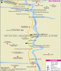 |
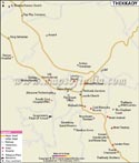
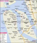
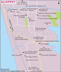
| Thekkady City Map | Kochi City Map | Alleppey City Map | Munnar City Map |
| other cities of Kerala >> |
Kochi and 92km from Kozhikode.
The name Kannur is believed to have been derived from the name of Hindu deity - Kannan( Lord Krishna ) and Ur (place), thus signifying the 'Place of God- Krishna.' Some people also opine that the term Kannur is inferred from Kanathur, an ancient village of Kerala.
Kannur is a land associated with abundant myths and legends and you can still hear many ancient tales of the past from the locales. Kannur was cited as NAURA in the illustrious Greek work of great antiquity- 'The Periplus of the Erythraean Sea'.
It was that place from where King Solomon collected timber for erecting the famed Temple of Jerusalem. It was this heaven-like place of astounding beauty to which Jawaharlal Nehru referred to as the 'Garden of India'. This place is the melting pot of many cultures, religions and traditions and the state of Kerala owes its cultural, political and industrial heritage to Kannur.
Places of Interest
Fort St Angelo
This laterite fort was built by the Portguese in 1505 and was seized by the British in 1790, who made it their military station after reconstructing it. This fort is situated in the west of Burnassery Cantonment on the Lakshadweep Sea and offers an imposing view of the fascinating alcove of Moplah and the sea. This majestic triangular shaped fort is made of laterite. The fortess is now a property of the Archaeological Department of the Government of India.
Shrines
Sundareswara Temple
This temple was built in 1908 and is dedicated to the Lord of Destruction- Lord Shiva.Apart from Shiva Lingam; the temple also houses idols of Lord Ganesha (God of Wisdom and Prosperity) and Subramonia. The annual temple fair is held in the month of Meenam(March-April).
Mavilakavu Temple
This old Mavilakavu Temple lies at a distance of 5 miles from Kannur. The five day temple festival during the month of Medam, is very appealing because of the exhibition of the pompous rituals and customs. Another interesting aspect is the Ati or Thallu performance wherein there is an exchange of blows between different groups who gather at paddy fields outside the temple.
Urpazhachivaku Temple
This is another nearby temple that exhibits exquisite carvings on wood depicting the Ramayana (an ancient Hindu epic) and Krishnaleela( the playful antics of Lord Krishna). The main deity of this temple is Shankaranarayana, other deities like Bhagavathi and Vettakorumakan are also placed here.
The most distinct practice in this temple is the Vellattam , the daily ceremonial dancing.
Shri Muthappan Temple
This temple is located at Parassinikadavu, on the banks of Valapattanam River and the temple is dedicated to the unusual deity who is the lover of fried fish and toddy.
The Old Juma Masjid is another important mosque in the town. St. John's Church, the renowned Church also exists in Kannur.
Beaches
Payyambalam (Beach)
This enormous beach lies about2 km from Kannur and offers a perfect spot for a picnic. The monolithic carving of a mother with her child at the entrance and the laterite headlands jutting out in the sea impresses the beholder. The unsullied sand on the beach and the surge of the rolling waves entrance the visitors of Kerala.
Ezhimala (Beach)
This idyllic beach is the most isolated of all beaches and has a hill close by with an elevation of 286 M. A Naval Academy is being built up here. Other beautiful nearby beaches are Muzhapilangad Beach (15km from Kannur) and Meenkunnu Beach (12km from Kannur).
Other Attractions
Many folk art and dance forms originated Kannur. Kannur boast of its extraordinary, primordial ritualistic folk art - 'Theyyam', that is endemic to the North Malabar region. Kavadiyattam was also nurtured by the performing artists from Kannur.
About 40 Kalaries- fields of martial art-are dispersed around the district and most of the circus artists dwell here. There are also a plethora of Ayurveda, Naturopathy and yoga centres in the Kannur city which will heal and rejuvenate your senses and soul. Learn the Rajyoga, a range of exercises meant to heighten mind control at the Parivrajakacarya Yoga Vedanta Mission, Thottada and Sadanada Puri in Kannur.
Also don't miss out the mud-and-water-therapy at the Mahatma Nature Cure Centre, at Taliparamba in Kannur.
Kannur is internationally famous for its superior handloom fabric. You can shop for the spices and cashew nuts that are also produced in plenty. Thus Kannur has a plenty of reasons to be included in the must visit places in your itinerary.
Connectivity
Air
The nearest airport is at Karipur, Kozhikode about 120 km away. Mangalore airport is 170 km away
Rail
Kannur railway station is located at the Mangalore- Shornore Sector.
Road
N H 17 passes through Kannur.
Another Kerala-Karnataka route from Kannur is the Thalassery- Virajpetta route. KSRTC buses ply to all parts of the state and to Mangalore and Bangalore in Karnataka from Kannur.
Last Updated on : May 11, 2026