
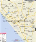
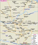
Geographically, the city is located at 10° 31' N / 76° 12' E. Thrissur is known as the 'cultural capital of Kerala'. It is renowned for the celebrations of the festival of Pooram. It is a centre of learning for some of the renowned performing arts and the Indian knowledge systems like the Ayurveda. Throughout history, the city has preached cultural, spiritual and religious learnings. There are many pilgrim sites in Thrissur that also depict its cultural values.
The city is known for its art and culture due to the varied heritage and cultural establishments. The classic example of the architectural style of Kerala is the Vadakkumnathan Temple, which is known for its pieces of art and murals. The celebrations of Pooram at the temple give moments of immense joy and spectacular sight to any viewer. There are many other temples, churches and mosques in the city that portray the culture of the city and draw a large number of visitors. Some of such places are Thiruvambadi Sri Krishna Temple, Paramekkavu Bagavathi Temple, Guruvayur Temple, Our Lady of Dolours - Syro-Malabar Catholic Basilica, ST. Antony's Syro-Malabar Catholic Forane Church and Cheraman Juma Masjid to name a few. Thrissur is known as a major financial and commercial hub in Kerala. It is believed that during the reign of King Sakthan Thampuran, he invited some Syrian Christian families to settle in the region and start their businesses. After this, the region began to flourish in Kerala as one of the business centres. At present, the city is the major centre for gold manufacturing in the state. There are a large number of manufacturing units in the city for gold ornaments. It also houses many other industries such as timber industry, beedi and rice manufacturing units, coir and coir product manufacturing units, cotton spinning and weaving units. The city is also emerging as one of the main centres for Ayurvedic drug-manufacturing units in India. There are about 150 such units in the city that also include some major Ayurvedic drug-manufacturing units.
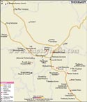
How to Reach?
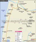
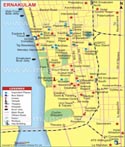
The city also enjoys the advantage of being connected through different modes of transport. National Highway 47 links it to the North-South Corridor National Highway System. Inter-state, inter-city and district buses owned by Kerala State Road Transport Corporation (KSRTC) ply in the city connecting it to other places. There are four railway stations in the city that connect it to other cities and states of the country through the railway networks. Cochin International Airport is the nearest airport to Thrissur, which is at a distance of about 55 km.
WBST020415
WBVDA
Last Updated on : May 11, 2026